
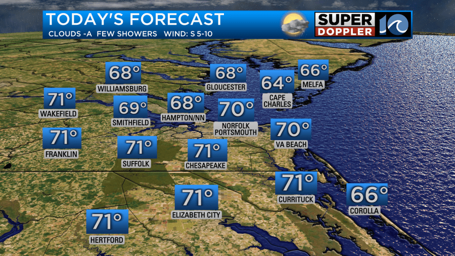
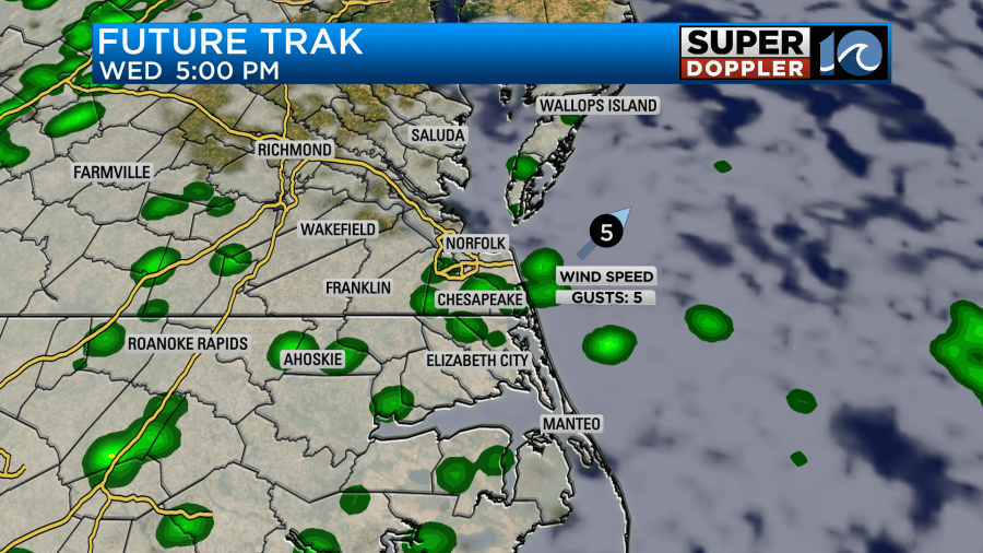
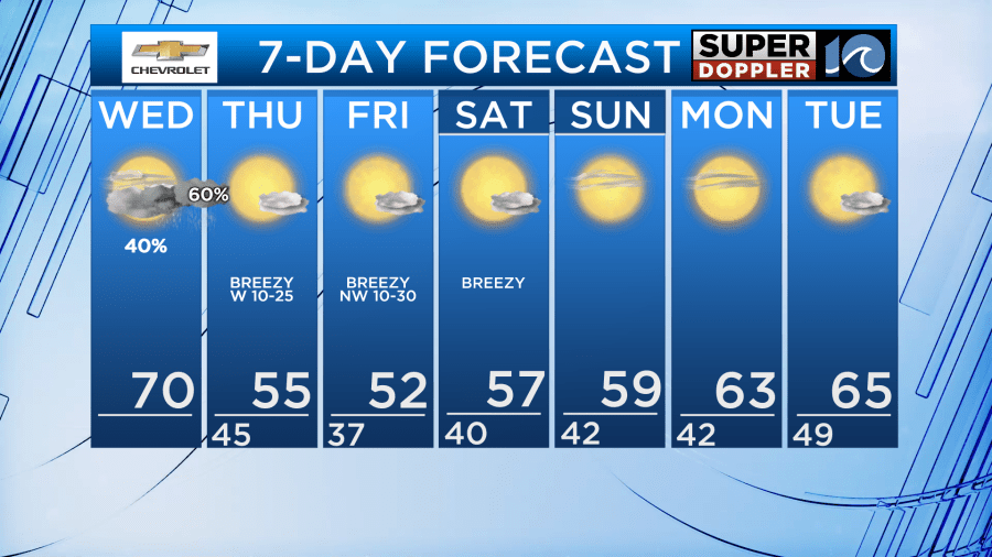
A cold front will approach the area today- leading to a few scattered showers during the day and a better chance for rain once the sun sets. With a south wind, temperatures will still be in the 60s and 70s Wednesday. We will see a south breeze at 5-10 mph.
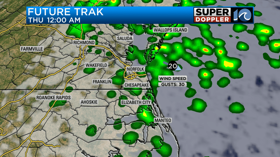
As we head into the overnight, rain chances will increase. A few isolated rumbles of thunder can’t be ruled out, as well as a big gust of wind as the front comes through. Wind gusts could exceed 35 mph as the front arrives around midnight to 2 AM Thursday. This might wake you up!
The strongest part of the wind will die off quickly during the morning on Thursday, but it will still be breezy overall especially in the afternoon. Similar winds expected Friday.
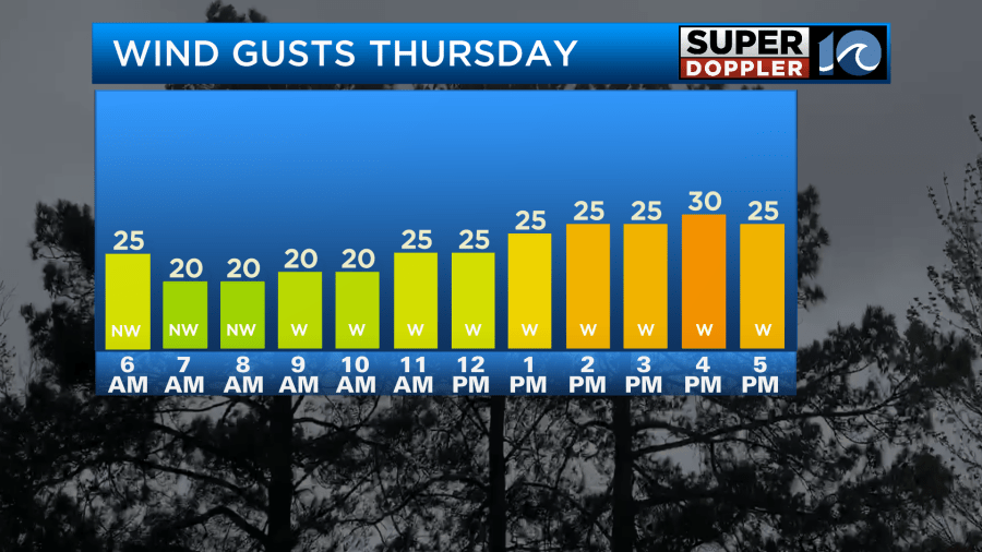
Temps much cooler for Thursday with temperatures in the 50s. Same thing for Friday and into the weekend. We’ll see a good amount of sunshine with breezy conditions. With a persistant west/nw wind, we could also see some soundside flooding in the Outer Banks through Saturday morning.
Hope you have a great Wednesday!
Meteorologist Ricky Matthews
Follow Ricky on Facebook and Twitter


