
I used to work with an anchor in Huntsville, Alabama that often said “if a picture says a thousand words then this image speaks volumes”. Thanks Greg! Take a look at this picture from this morning:
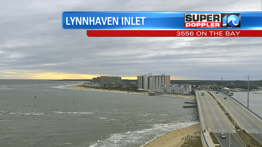
There were lots of clouds. It was windy, chilly. There were some spotty showers as well. It kind of felt like Fall. A cold front was slowly dropping to the south.
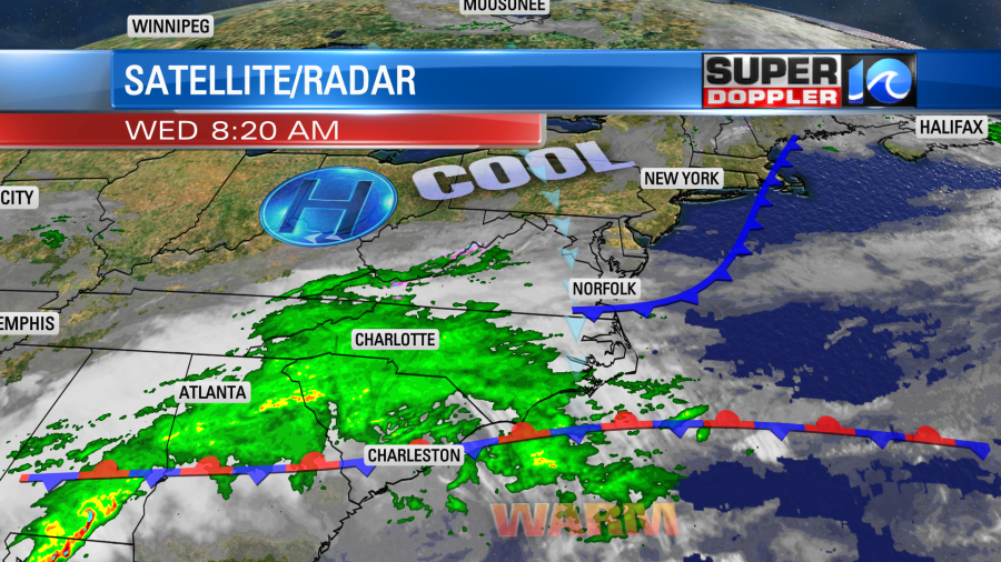
The front will keep drifting south through the day. It should pull down some drier air, but there will still be a lot of moisture to the south. Moisture is trying to push back up over the cooler airmass (overunning). So there will be some showers in our area. The highest chance for rain will be over northeast North Carolina with isolated to scattered showers over Hampton Roads.
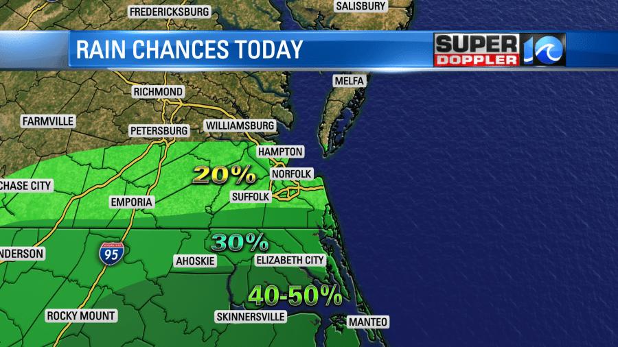
This will be from the late morning until the late afternoon. It is going to stay cloudy and chilly through the day. High temps will only rise to the upper 50s to low 60s. The average high for this time of year is 76 degrees. North/northeast winds won’t help. They will run at 10-15mph with some gusts to 20mph near the shore.
We’ll all dry out this evening with some clearing overnight. Low temps will drop down to the 40s and 50s. Then tomorrow the front will drop a little more to the south. We’ll have drier air overall. Plus, high pressure will scoot a bit closer to the area. This will allow for partly cloudy skies to break out. High temps will be able to warm up to the upper 60s to near 70 despite a light wind out of the northeast.
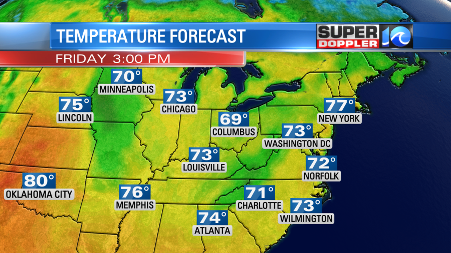
Then we’ll have nice weather Friday through the weekend. We’ll be partly cloudy with high temps returning to the 70s.
I’ve actually had a few people say that they still need rain. Mostly in Virginia Beach. If that pertains to you, then I believe our next best chance for rain will be on Monday. Stay tuned for updates!
Meteorologist: Jeremy Wheeler


