Yesterday we had a huge mess in the region. We had rain, wind, sleet, snow, flooding, and even tidal flooding. There were even some strong thunderstorms in the morning over North Carolina. The snow tapered off in the evening. Then we had cold/dry air pour into the region. It did snow in Hampton Roads, but, as expected, a lot of it melted. However, there were some accumulations north of the metro where colder air arrived sooner.
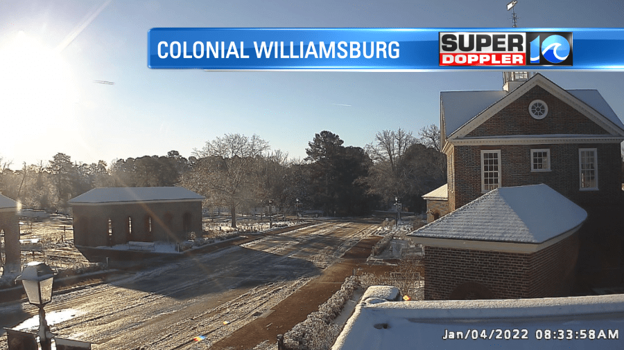
The snow was much thicker north of Williamsburg towards the Richmond Area.
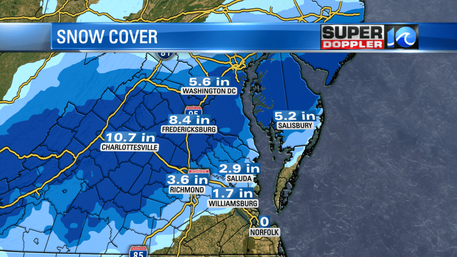
It got so bad between Richmond and Washington D.C. that it pretty much shut down parts of I-95. Many people had been stuck on the roads for more than 12 hours.
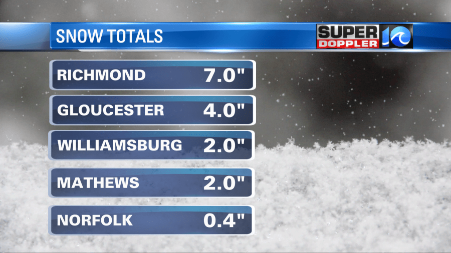
Here were some of the snow local totals. It wasn’t nearly as bad here:
It snowed at my house for about 3 hours (I’m on the Southside), but it all melted except for a light coating on some of the grass. Winds were howling at times. Many of the strong gusts caused power outages. Winds peaked at about 45mph for most, but in Virginia Beach it reached up to 59mph at one point.
Today the weather will be much calmer. The storm system that created the mess is far out to sea. A strong cold front has dropped to our south. High pressure is building in from the west.
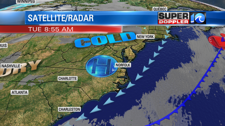
The wind won’t be nearly as strong as yesterday. It will run at 8-12mph out of the northeast. However, that will keep high temps down in the lower 40s. We’ll have full sunshine. So if you can get out of the breeze and into the sun, then that might warm you up a bit.
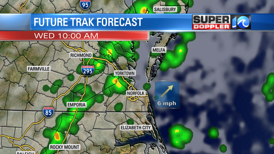
Tomorrow the high will quickly roll offshore. This will allow the winds to turn out of the south. Warmer and more humid air will try to push northward. As that happens there will likely be some overrunning. As the milder air pushes up over the cooler air at the surface it will squeeze out the moisture. So we’ll have a few sprinkles or isolated showers tomorrow morning. There could be a couple of sleet pellets early. Then we’ll have some scattered rain showers form the mid morning through the early afternoon.
High temps will be in the 50s. We’ll be dry and cool on Thursday with highs in the mid 50s. A strong cold front will move into the region Thursday night into Friday morning. This could create a wintry mix for the area with some snow to the north. For now I’ll show you what the European computer model looks like for Friday morning.
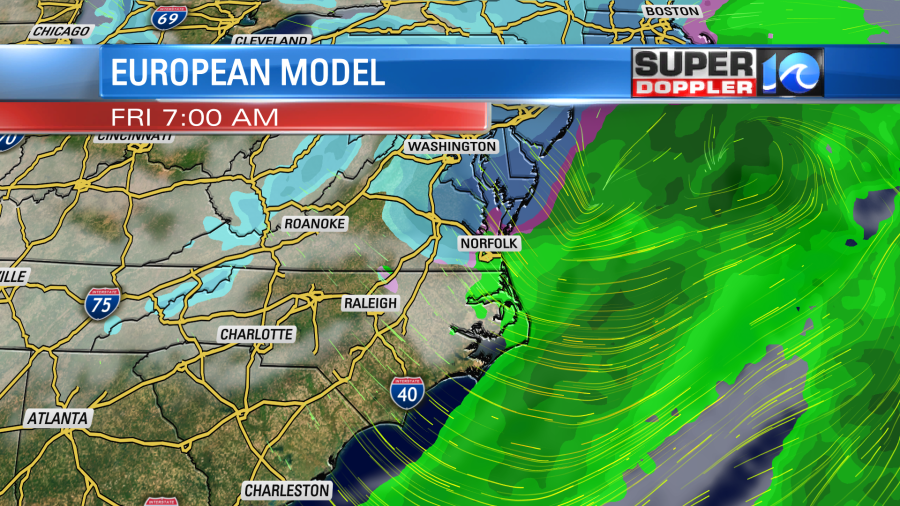
The GFS model has the mix and snow a little farther south. It’s still a bit early to forecast this system. So I’ll have a bigger update in tomorrow’s weather blog. Stay tuned!
Meteorologist: Jeremy Wheeler


