The storms were pretty rough yesterday afternoon, but there was plenty of warning ahead of time. We had a slight risk posted for the bulk of area all day. We had a huge amount of instability that built through the mid afternoon. Temps were in the 90s with dew points in the mid 70s. So the CAPE (amount of energy for lift in the atmosphere) was up to 4500 J/Kg. 2,000 if fairly high. So when a weak mid-level trough moved over this feature, it created a line of heavy showers and strong thunderstorms.
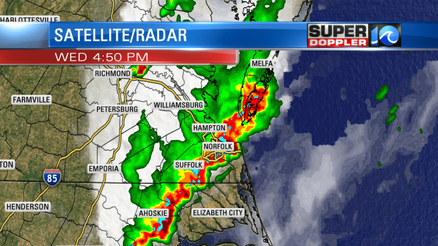
There was also a small amount of wind shear. So that helps to keep storms elevated, and that created some hail. There were also scattered wind damage reports along with strong wind gusts.
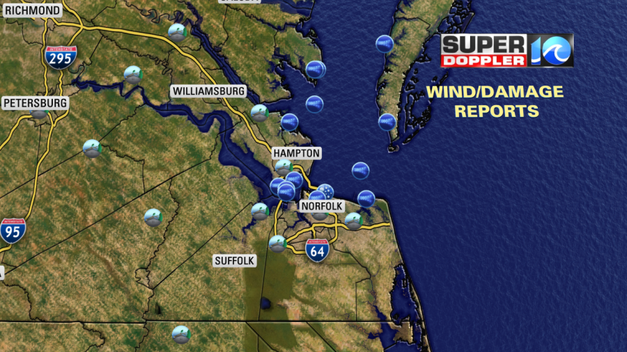
There were several reports of lightning striking objects on the ground. One tree was split as lightning struck it. One strike even hit a building. There were also many reports of flooding. The ball park at Harbor Park had flooded out.
Rain totals varied quite a bit in the region. Here were a few reports from the National Weather Service:
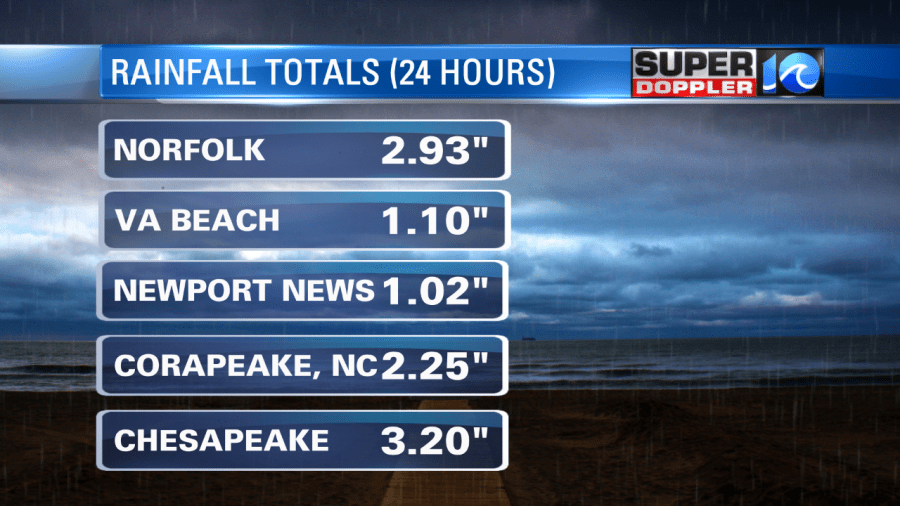
Downtown Norfolk had about 3″ of rain. My weather watcher, AJ on the lower Eastern Shore, had a little under a half an inch. There may have been some unofficial reports that were higher.
These features were all out ahead of a cool front. That front is actually moving into the region today. It is falling apart though. So that’s why it’s semi-transparent on the map.
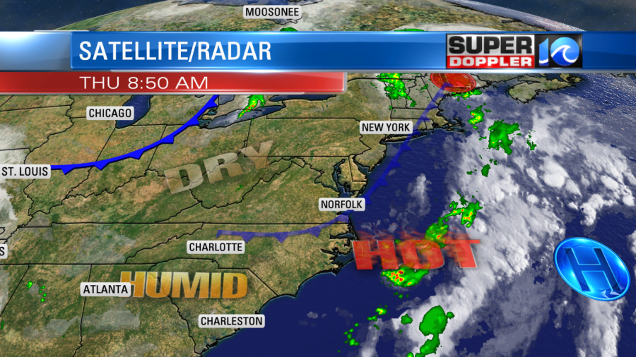
Since this front is falling apart, we’ll still be pretty hot and humid today. High temps will be near 90. The heat index will be in the mid 90s. It will only be slightly drier than yesterday. (the heat index yesterday was closer to 100 before the storms arrived). Winds will be light and out of the northwest. However, today we’ll only have some isolated showers or storms in the region this afternoon. It will be nothing at all like yesterday. Tomorrow we’ll be partly cloudy. Temps and humidity will be about the same. We’ll have some isolated showers and storms during the afternoon, but the rain may pick up towards the evening.
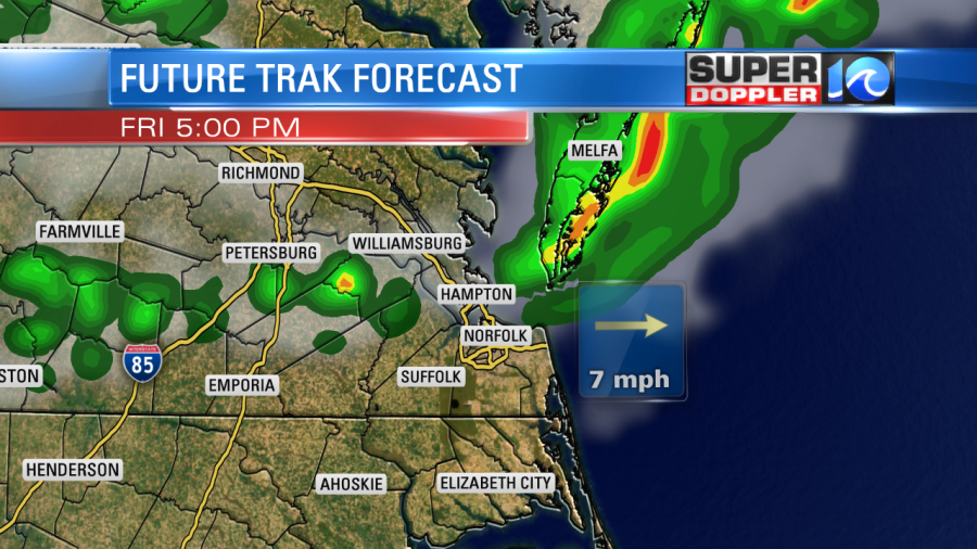
A second cool front will move into the area by about that time. This will usher in some cooler air for the weekend. High temps both Saturday and Sunday will be in the low-mid 80s. The humidity will drop with dew points down to the 60s. We’ll have partly cloudy skies with only a couple of stray showers.
We’ll start heating up next week with highs in the 90s for most days. Stay tuned for updates.
Meteorologist: Jeremy Wheeler


