This morning was looking great but feeling cold.
Temps started off mainly in the 20s with a few 30s. The trade-off was that there was hardly any wind. So the wind chills were the same as the temps. High pressure is off to our northeast. It is slowly moving away from our region, but it is large.
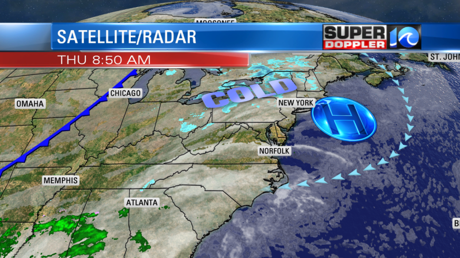
While the high pushes away, moisture is increasing in the upper levels. This will gradually increase the clouds through the day, but we’ll have enough sun to warm up the temps. High temps will reach the mid 50s. Unlike yesterday, the wind won’t be bad. It will only run out of the east/northeast at 5-10mph.
By this evening we’ll have enough moisture for some isolated showers, but the moisture will increase even more overnight. Rain showers will become widespread late.
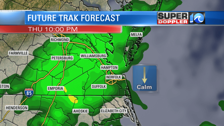
The main driver for the rain will be overrunning. Warmer/more humid air will push up over the cooler air at the surface. At least it won’t be as cold tonight. Lows will be in the low 40s. So no wintry weather is expected. Although a few sleet pellets may mix in with the rain. The showers will continue into tomorrow morning.

The rain showers will taper off during the afternoon as the overrunning shuts down. The breeze will pick up a little out of the northeast. It will run at 5-15mph. We won’t have any big weather systems nearby, but an area of low pressure will form south of the Carolinas.
By Saturday the low will move northeast. It will still be pretty far offshore. However, high pressure will re-build in to our northwest. This will create a pressure gradient over our region, and that will increase the northeast winds.
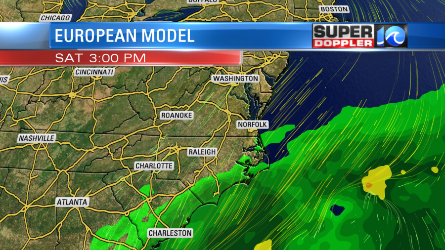
The European model has a broader low and a little farther to the southeast. The GFS has a sharper low, and a little closer to the region

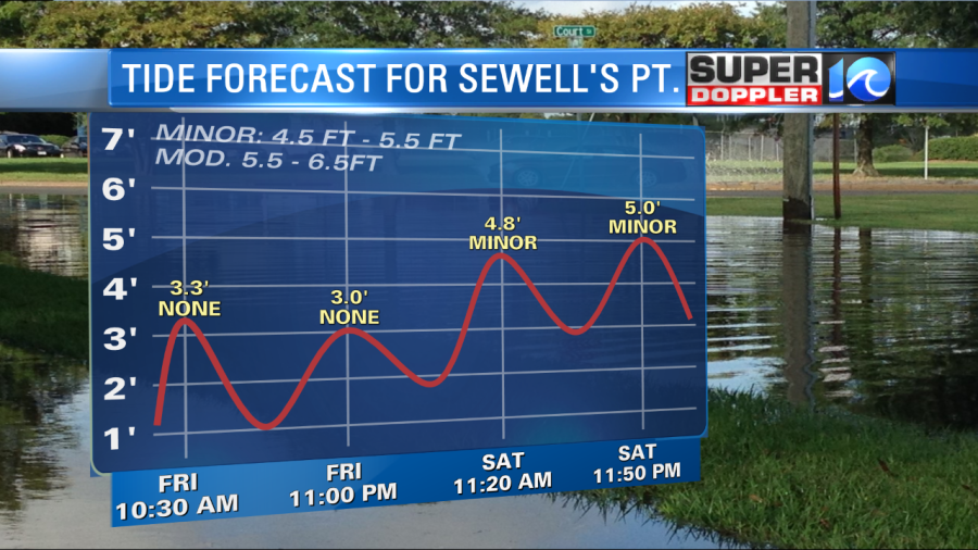
Both have some scattered showers, but not too many. Either way we will have gusty winds. We could have some gusts to 25mph over land with some gusts to over 45mph near the coast. Possibly a few gusts to 50mph over the Outer Banks. The tide on Saturday doesn’t look too bad. At this time it looks like it will be up to minor levels in Hampton Roads.
However, the wind will persist into Sunday as the low moves farther northeast and the high stays in place.

The wind probably won’t be as strong as on Saturday, and it will probably be more out of the north than northeast. However, the building tide could still push up to moderate levels. Possibly up to high-end moderate or even low-end major over the Outer Banks. The waves near the coast could be over 10 feet. This could lead to some beach erosion. It will also likely bring some overwash to the Outer Banks. Luckily there should only be some isolated showers on Sunday. All of this should move out by Monday. We’ll have quiet weather with mostly cloudy skies and highs in the 50s. Stay tuned for updates to the weekend forecast.
Meteorologist: Jeremy Wheeler


