We are coming off of a gloomy and chilly weekend. The sun barely popped out, and temps were mainly in the 40s. It was about as forecast. There was even a little sleet one day. Now we are starting off the week with lots of sunshine.
We’ll stay chilly today, but we’ll warm up for a few days before another shot of cold air on Friday.
A weak cold front was falling apart this morning as it dropped to the south. High pressure is edging closer from the north.
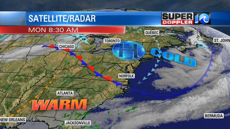
The front is basically reinforcing the cold air that was already in place. We’ll have a northeast wind with high temperatures in the mid 40s.
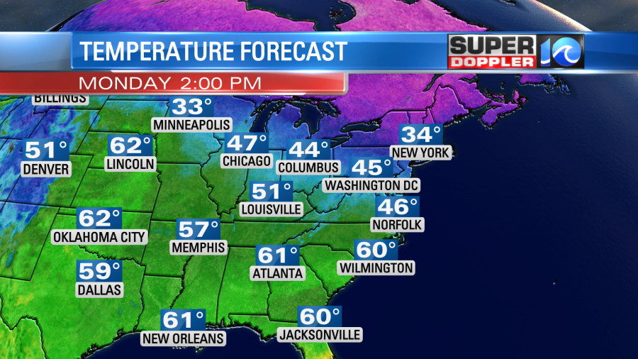
Tomorrow the stationary front will turn into a warm front and will lift north. We’ll have southerly winds in our region. We’ll also still have lots of sunshine. The bottom line….It’s going to be a nice day! High temps will run up into the upper 50s with low 60s inland/south. It should be nice and dry. Then more nice weather will follow. We’ll have fair skies with highs in the 60s both Wednesday and Thursday.
A cold front will drop in on Thursday. However, temps will only drop a little though. They will drop more on Friday as the front sinks a bit more to the south and stalls out. There might be some precip on Friday. Though the models are a bit split on that. Stay tuned for updates.
Meteorologist: Jeremy Wheeler