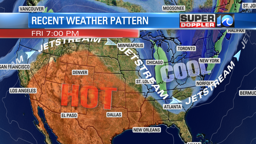
We are like zombies… sort of. The weather lately has been about the same every day with lots of heat, humidity, and some scattered afternoon thunderstorms. We are in the dog days of Summer. So folks are pretty used to it. However….Get ready for a big change in the weather pattern this week! We’ll be talking about some seasonably cool and dry air.
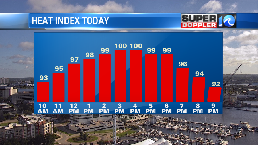
I don’t want to get too far ahead of myself. We still have about 3 more days of this heat. High temps today are aiming for the low-mid 90s. The heat index will be near 100.
High pressure is offshore with a very slow moving cold front over the Midwest.
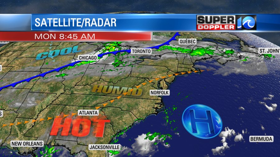
We’ll be partly cloudy this afternoon with some isolated showers and storms popping up. There will be a light southwest wind.
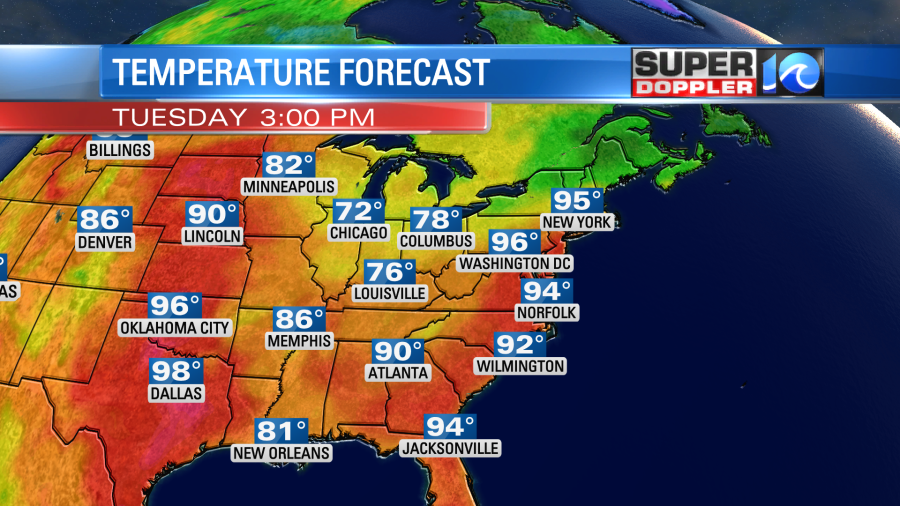
Tomorrow we’ll have similar weather, but high temps will likely bump up a bit. So we’ll run more into the mid 90s.
The heat index will be between 99 and 105 degrees. It is possible that we could have some heat advisories posted, but we’ll see.
By Wednesday 2 cold fronts will be approaching from the northwest. We won’t cool down yet as the fronts will still be to our northwest during the day. However, late in the day we’ll have some scattered showers and storms. High temp will be in the 90s, and the heat indices will be in the 100s.
Finally, things will change by Thursday. We’ll have lots of clouds with a good chance for rain. High temps will drop to the mid-upper 80s. The humidity will be dropping on Thursday, but it won’t get to low levels until next weekend.
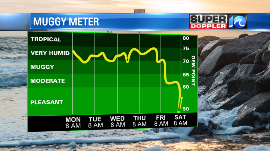
High temps might be close to 80 degrees for a couple of days next weekend. It will feel like a taste of early Fall. I’m sure we’ll warm up again following the brief break. The weather pattern will definitely change next weekend as the jetstream takes a big dip over the east coast.
Speaking of ch…ch…ch…Changes. Things may be starting to fire up in the tropics. There is a weak disturbance in the eastern Atlantic. It is near the Cabo Verde Islands. It is moving to the west/northwest.
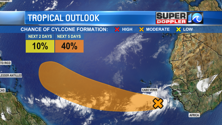
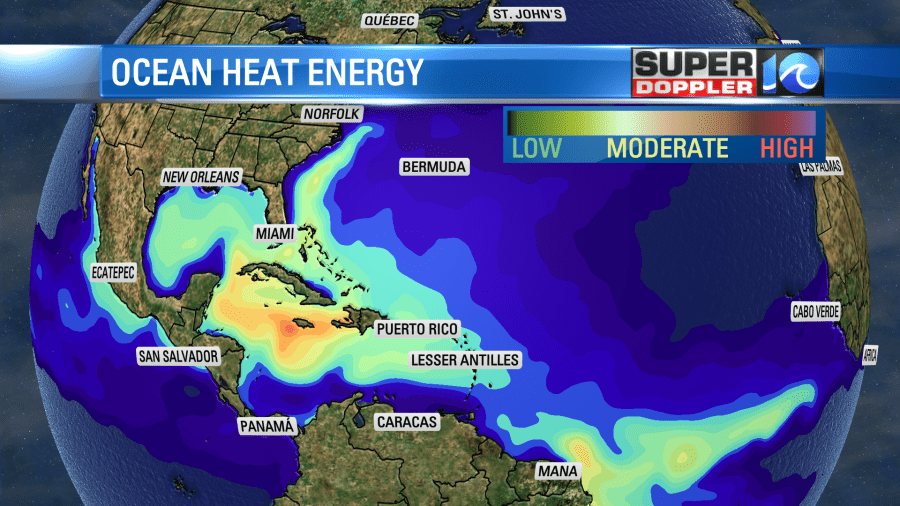
There is some pretty warm ocean water. However, there is not a lot of deep ocean heat content along its forecast path.
Also, there has been a pretty large Saharan Air Layer coming off of Africa lately. This a dry/dusty air mass that tends to suppress tropical system formation.
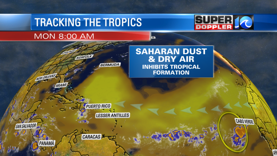
We’ll track this feature over the next few days no matter what it does, and bring you updates.
Meteorologist: Jeremy Wheeler


