Is it a careful what you wish for situation? We really needed/wanted some rain over the last few months. Then we had 2 long stretches of cool/wet weather this month.
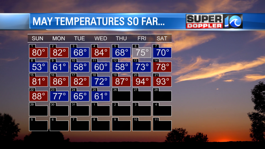
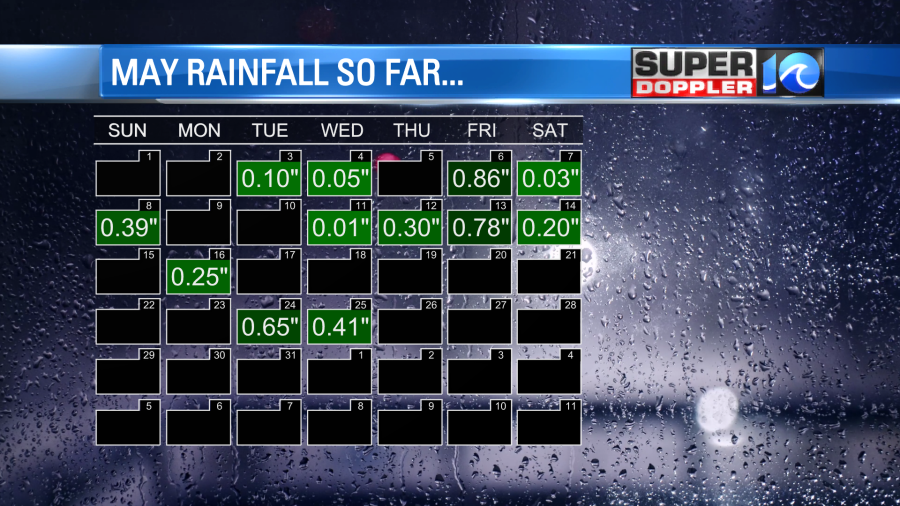
We have had 4.03″ for the month so far. This is about 0.91″ above average. We are up 1.64″ for the year. At least in Hampton Roads. I think we put a dent in the drought over northeast North Carolina, but the Drought Monitor doesn’t update until later today. Elizabeth City is about 0.4″ above average for the month, but it has been much drier southwest of there towards Bertie County.
Yesterday we had a lot of drizzle through the day (all day at my house), but it didn’t add up to much in the rain gauge. We had more clouds, drizzle, and fog again this morning.
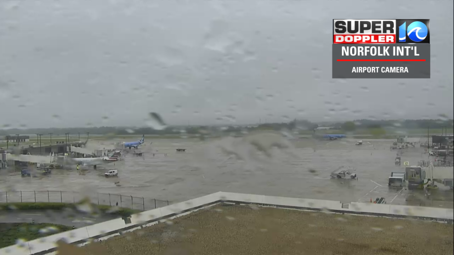
The area of low pressure that has been sitting offshore for the last couple of days is actually moving inland this morning. However, it is also falling apart at the same time.
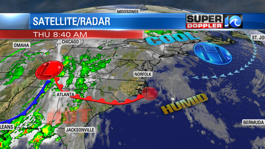
It will fall apart today, and the warm front will slowly move up from the south. Notice that there is a cold front and an area of low pressure off to the west over the Mississippi River Valley.
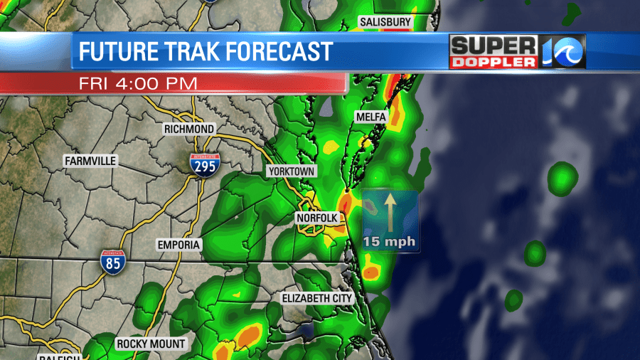
We’ll hold onto the clouds and drizzle through about midday. Then both should start to break up a bit. I’m hopeful that the models are right and that the sun will pop out this afternoon. This will depend on whether or not the low actually falls apart. Here is what Future Trak shows:
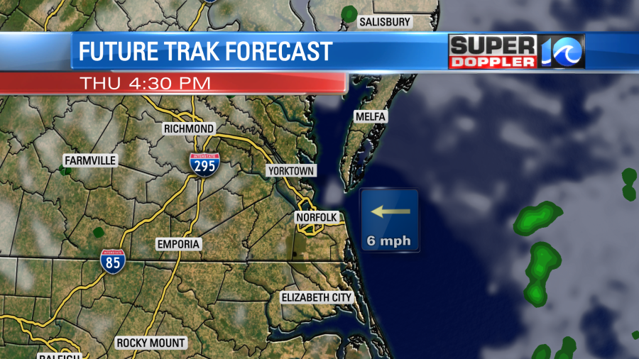
The temps should rise into the 70s this afternoon. For now I’m betting on the sun popping out. So I even think we could hit 80 in a few inland spots. We’ll have a light east wind.
Tomorrow we’ll start with some sunshine. Then the clouds will build through the day. We’ll heat up fast into the 80s by the early afternoon. Then a line of storms will roll into the region from the west.
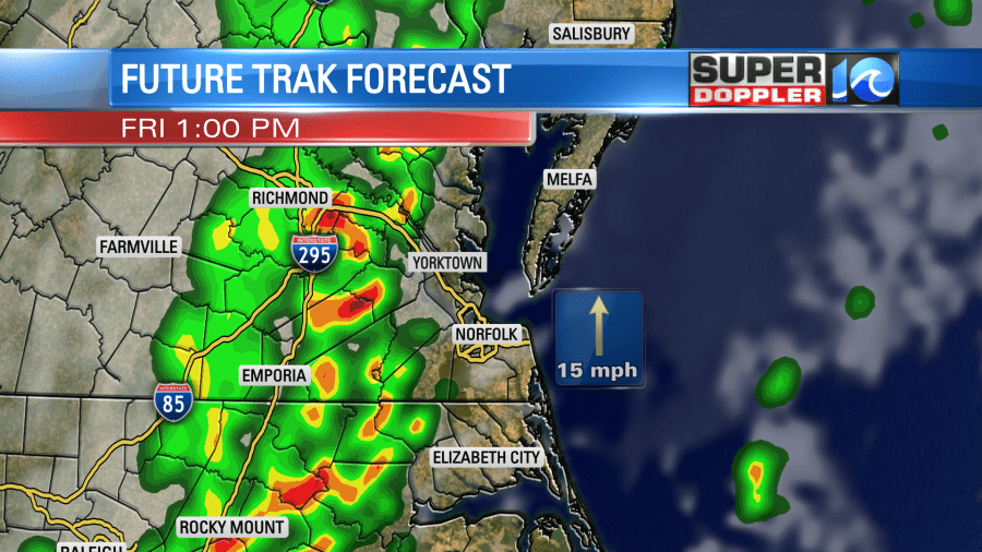
This will be ahead of the cold front which will move in around the end of the day. It will be a focus for some strong to severe storms which will continue into the early evening.
There is a slight risk for severe weather for a large portion of the region.
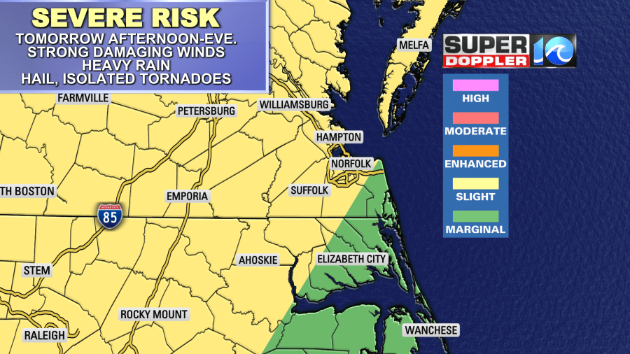
Strong damaging winds will be the main threat. The wind will already be out of the south gusting up to 25mph even before any storms arrive. When they do the winds could possibly gust to over 55mph. Rain will be briefly heavy. Hail will be possible. There may even be some isolated tornadoes in the region. Let’s hope not.
Temps will probably fall to the 60s by the late afternoon. The front will slowly slide east. It could still pop a few scattered showers Saturday morning behind it. Then we won’t cool down as much as we’ll dry out for the rest of the weekend. High pressure will build in Saturday afternoon through Monday. We’ll be mostly to partly sunny. High temps will be in the 80s. It should be nice out.
Meteorologist: Jeremy Wheeler
