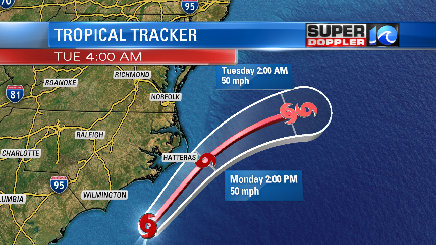
As of 5am Arthur was about 130 miles SSW of Cape Hatteras moving north/northeast. It is still on track to pass over or just to the east of the southern Outer Banks later today.

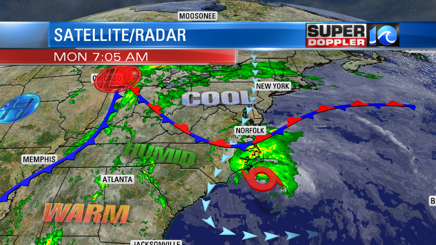
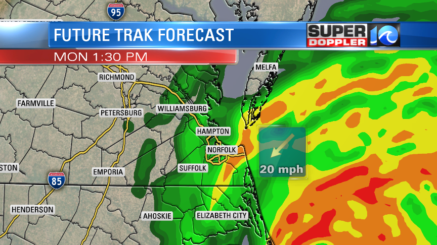
The system will then move away from our area later this afternoon into the evening. While the center of the storm will stay to our southeast, a lot of rain will be moving north of the system. This is because Arthur is interacting with some cooler air. We even have a stationary front sitting over our area.

I would make the argument that this system has become subtropical as much of the rain has spread out from the center, and there really isn’t too much banding near the center. Either way we are going to get wet, and it will be windy along the coast. Rain will increase through midday. Then it will taper off towards the later afternoon.

The wind will be out of the northeast. It will run at 10-20mph with gusts to 30mph. There will be some gusts to 40mph possible along the Virginia Beach oceanfront and on the Eastern Shore. Gusts will be up to 45-55mph over the Outer Banks.
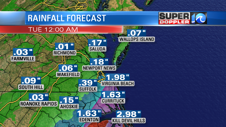
Rain will be heaviest to the southeast (closer to the storm). So we could see 2-3″ over the Outer Banks. 1-3″ inland northeast North Carolina. We’ll have 0.5″ to 1″ expected for most of southeast Virginia, but Virginia beach could see 1-2″.

Luckily tidal flooding should be minimal with this storm. However, there will be some overwash over the Outer Banks along highway 12.
I’ll have more updates through the morning. Stay tuned and be safe!
Meteorologist: Jeremy Wheeler


