We are in the middle of a blast of Arctic air today. We’ll have some of the coldest air in years entering the region. There is a strong cold front far to our south. High pressure is building in from the west.
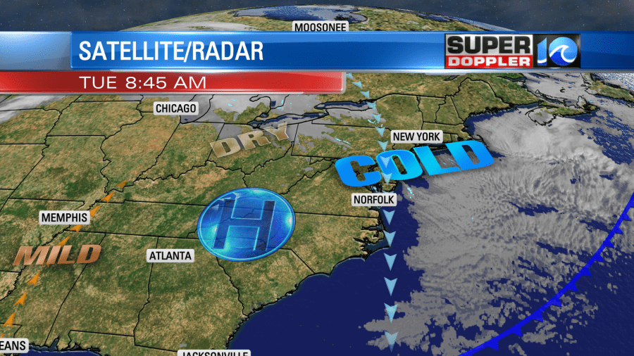
This is producing a steady north breeze, and that is pulling down the cold air out of the Great Lakes and Northeast. Winds will run at 5-15mph today with gusts up to 20mph. So this morning we started with temperatures in the 20s and wind chills in the teens. As we go through the day that won’t improve much.
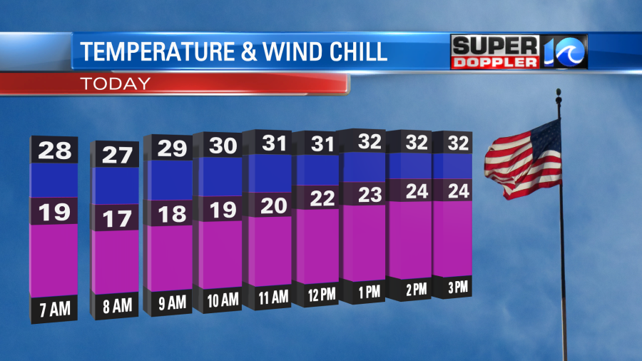
High temps will only rise to the low 30s. Wind chills will be in the 20s through the afternoon. High pressure will give us a lot of sunshine, but a few clouds may develop along the coast/shore.
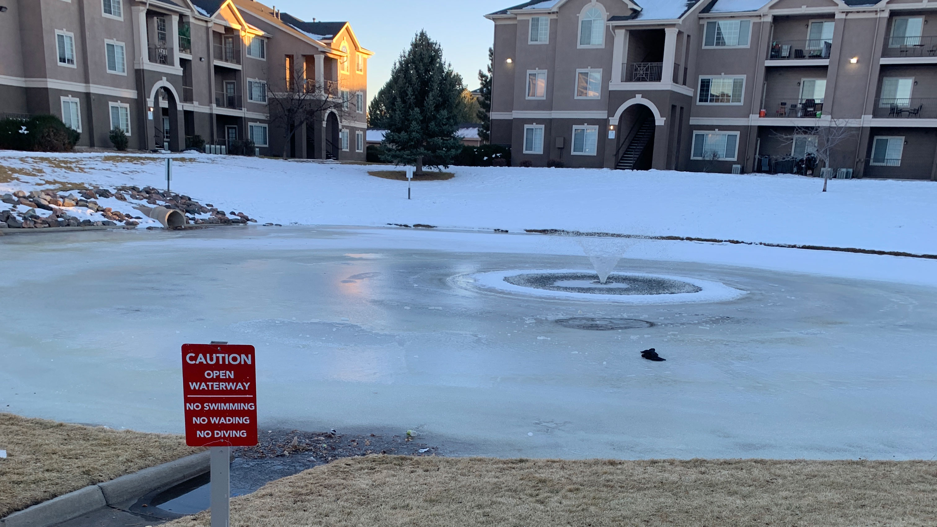
Tonight we’ll have clear skies and very cold temperatures. Winds will drop to light and variable. Also, the air is very dry. These ingredients will allow for the maximum cooling. So low temps will drop down to near 20 in the metro. There may be a few teens as well. We’ll likely drop to the teens inland. So now is the time to Winterize your home:
- Slow-drip the faucets overnight.
- Open cabinets under sinks
- Cover cracks under doors and around windows. Use towels, rags, foam, or possibly plastic film.
- Cover outdoor faucets. They do sell foam covers, but I typically cover mine with some plastic.
Tomorrow we’ll have a southwest breeze develop as the high pressure zone slides offshore. This will allow temps to bump up quite a bit. So we’ll aim for the upper 40s.
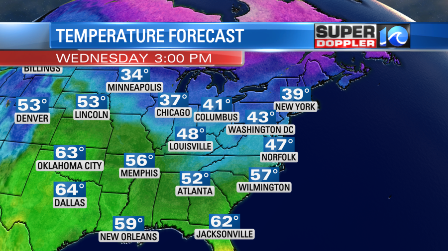
There will be a good amount warming today and tomorrow over the central U.S.
We’ll be partly cloudy with a slight chance for a showers on Thursday. High temps will be closer to 50 degrees. Then we’ll be in the 40s on Friday after a cold front drops to the south again. We might be in the upper 30s on Saturday. That high temperature is important as it will help to determine what happens on Sunday.
Sunday, Sunday, Sunday!!! So on Sunday an area of low pressure is forecast to form in the south/central U.S. It is forecast to move to the east late Sunday into Monday. The GFS model has the low running right through our area. This produces some rain, and then a mix of snow and rain between late Sunday into Monday morning.
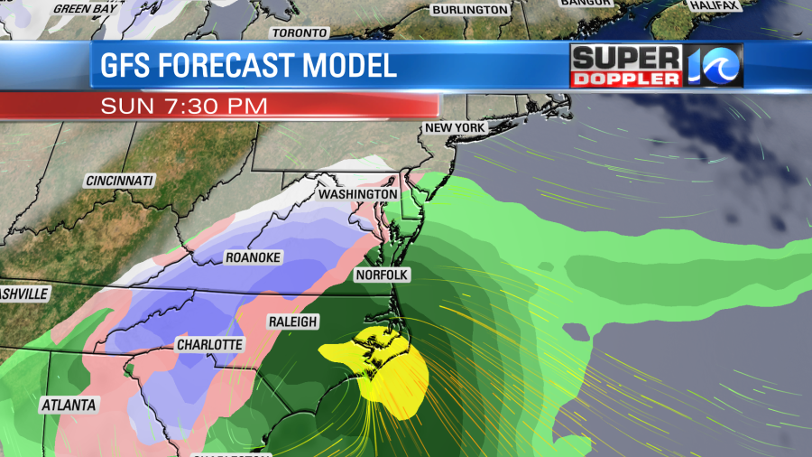
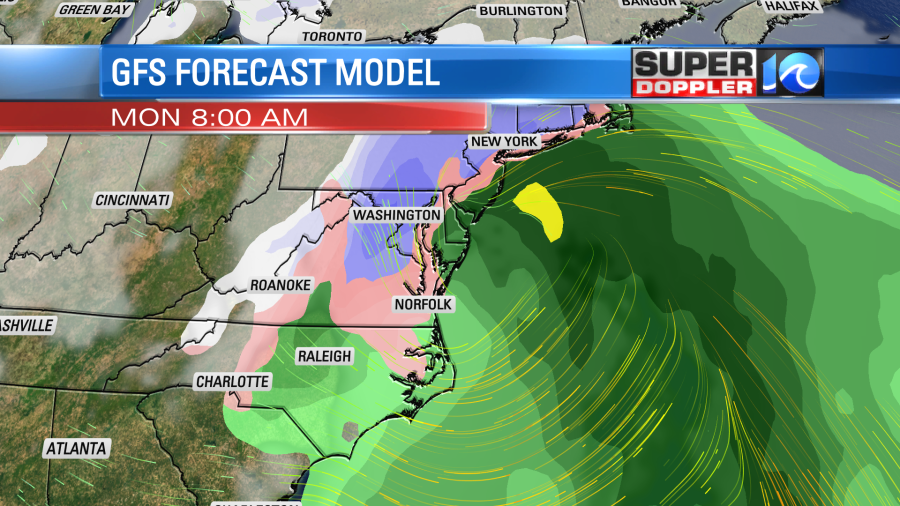
However, this has really flared up since yesterday’s model runs. It was a huge swing. Also, the European model is much more suppressed. (At least this morning’s version).
It pretty much keeps everything to our south through that time. It doesn’t have the low really forming until it gets pretty far offshore. The latest Canadian model kind of blends the 2 with most (but not all) of the precip to our south. However, some rain and snow makes it up here. So it’s too early to side with either model at this point. However, these should come into better agreement by tomorrow. It’s also out of range of the NAM model for a couple more days. So basically…check back for updates!
Meteorologist: Jeremy Wheeler
