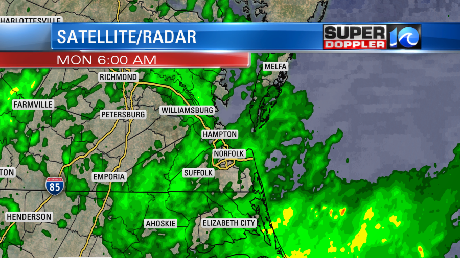
We just came off of a pretty decent weekend (in Hampton Roads). There were actually a good amount of rain showers over the Outer Banks and parts of northeast North Carolina. I doubt many there need rain at this point. However, there are some in the viewing area that do need some rain. Especially north of Hampton Roads. Well…you’ll likely get some this week. The next few days don’t look like a complete washout, but each day looks pretty wet.
We started today with scattered showers over the area. It was light, but there was pretty decent coverage.

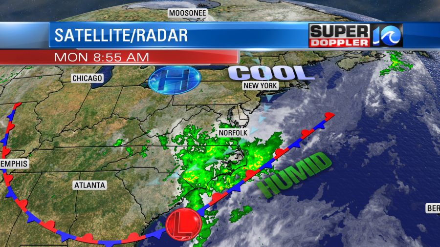
Showers will continue on and off today. I think it will mostly be light, but there will be some pockets of moderate showers mixing in. I don’t expect any thunderstorms. It will be too cool and stable for that. We don’t have any big weather features at the surface. High pressure is to our north. There is a stationary front and a weak area of low pressure to our south.

None of these features are directly responsible for the showers. Instead there is a cut-off low in the upper levels of the atmosphere (~15,000-30,000ft). This “Water Vapor” satellite imagery shows the water vapor in the upper levels. It is useful for identifying features that are closer to the jet stream level. In this case we have a cool and spinning pocket of upper level energy that is rotating down our way.

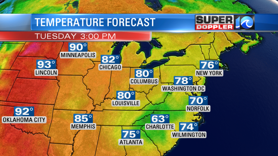
This feature is actually cut-off from the jet stream. So it will sit on top of us for the next few days. These typically don’t happen in June. It is unseasonable. Hopefully, it will weaken by the end of the week. Until then we’ll be cool, cloudy, and breezy today through Wednesday. High temps will only be in the upper 60s to low 70s. In fact tomorrow Minneapolis will be about 20 degrees warmer than Norfolk.

There will be a northeast wind at 10-15mph with gusts to 25mph today, tonight and tomorrow. There will be a persistent northeast breeze over the next few days, but luckily the moon phase is not conducive to naturally higher tides. We are in 3rd quarter. So I don’t think we’ll have anything more than nuisance tidal flooding.
The GFS model is showing rainfall totals of about 2-4 inches in Hampton Roads with 4-6 inches over northeast North Carolina. Keep in mind that this will be spread out over the next few days.

It has lesser amounts north of Hampton Roads. This is unfortunate as many in North Carolina don’t need any more rain for a while. Meanwhile, they do need it a little in parts of Hampton Roads, and they need it a lot more north Hampton Roads. We’ll see. Hopefully, it gets spread out a little more through that time. Also, hopefully the forecast for next weekend dries up a bit. Stay tuned.
Meteorologist: Jeremy Wheeler


