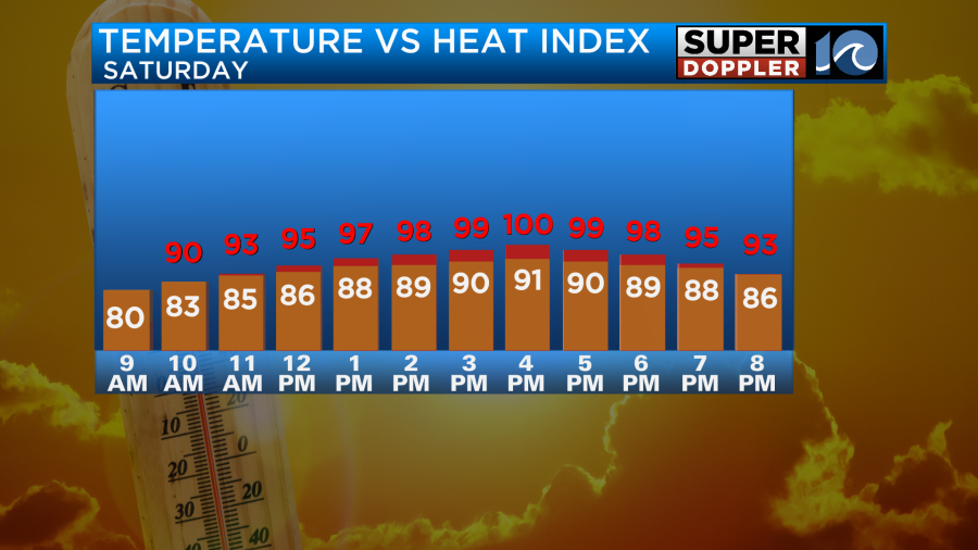
Heat and humidity builds this weekend with temperatures in the 90s through Saturday and Sunday. Heat index values will make temperatures feel about 100° on Saturday… and between 100°-105°+ on Sunday!
An isolated pop up shower or two is possible Saturday, but better rain chances arrive Sunday afternoon with an approaching cool front.
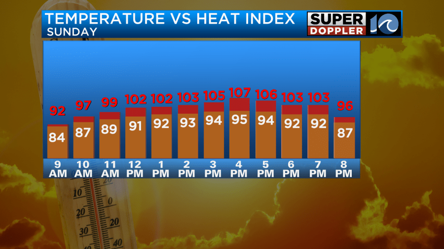
Sunday will be even hotter, with temperatrures in the mid 90s and heat index values over 105 at times during the afternoon.
STORMS SUNDAY AFTERNOON/EVENING
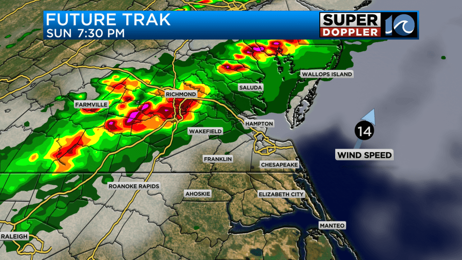
Expect scattered showers and thunderstorms to develop across the region Sunday later afternoon and evening. Some of these storms could be strong to severe, so be sure to stay weather aware. The main threat is damaging winds, but we can’t rule out small hail or even an isolated tornado. Heavy rain and lightning will also accompany the storms.
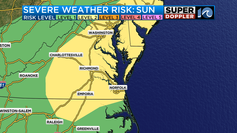
Most of our region is under a level 2 threat of severe weather for Sunday.
Storms will likely fire up in central VA earlier in the afternoon, then move SE as we head into the evening. Timing subject to change a bit, but looks like the most likely time will be late afternoon and into the evening.
Behind the cool front comes a big drop in the humidity on Monday and Tuesday next week with highs in the low 80s. More summer heat by the 4th of July!
TROPICAL UPDATE:
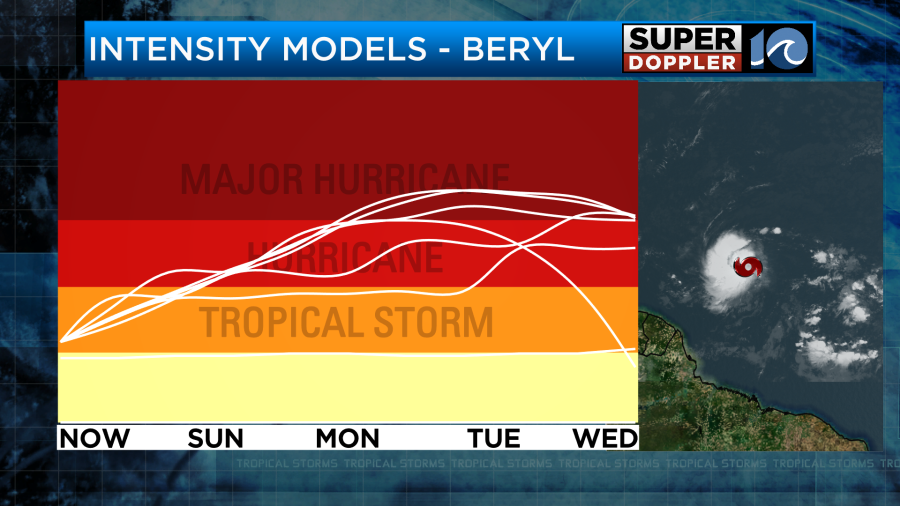
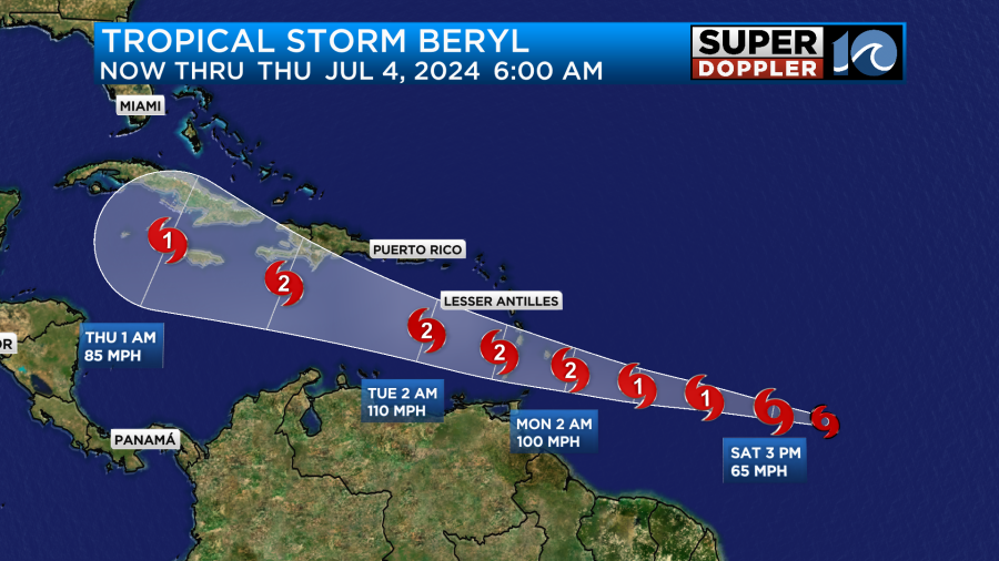
Tropical Storm Beryl has developed in the south central Atlantic. The system will move westward, impacting the Lesser Antilles and the Caribbean over the next next few days. The NHC expects this will become the first hurricane of the season, with the forecast calling for at least a category 2 hurricane. The NHC says this could be conservative, and the model data shows that too. I wouldn’t be shocked if it makes a run at a category 3 hurricane by early/mid week. This system is not expected to impact us, but we’ll track it.
Stay cool this weekend!
Meteorologist Ricky Matthews
Follow Ricky on Facebook and Twitter