
There will be a world of difference between yesterday’s weather and tomorrow’s conditions. Today we are in transition. High temps yesterday made it into the 60s and 70s during the afternoon. It was warm, humid, and breezy. There were some heavy duty thunderstorms in the late afternoon and early evening. Some of these put down about a half in up to three-quarters of an inch of rain.

When I got in this morning there was some light drizzle and temps were in the low 60s. Then reality hit. A strong cold front moved through between 5 and 7am. Temps then dropped down into the 40s and 50s. There were scattered rain showers along and north of the front. As the front dropped south of Elizabeth City the winds really revved up. Some of the gusts were to 35mph.
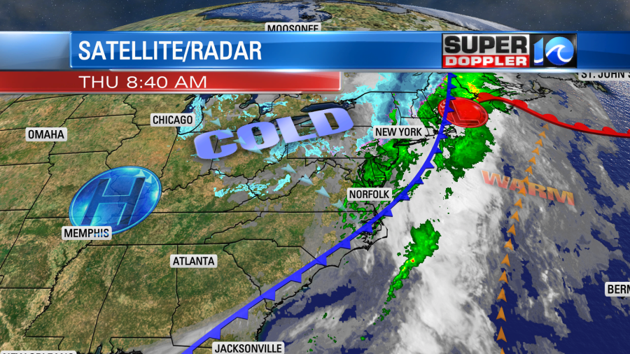
The wind won’t be that strong all day. However, they will run at 10-20mph with gusts up to 25mph this afternoon. The rain showers should taper off by the mid morning. Then we’ll have a mix of sun and clouds with spotty showers. If the sun does pop out then high temps should recover to the mid 50s. If it stays cloudy, then high temps will be closer to 50 degrees. Either way it will be much cooler than yesterday.
Tonight we’ll have partly cloudy skies. The breeze will still be up a bit, but it may be lighter in some inland locations. The air will really dry out. So there will likely be a frost or freeze in some of our inland locations. There are Freeze Warnings up for some inland areas tonight.
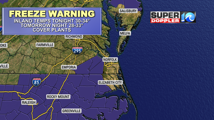
Now the National Weather Service may expand these warnings later today, and/or they may add some frost advisories. Here is the link to see what advisories are in effect: Cold/Freeze Alerts.
I say that because some of the models are calling for temps around the freezing mark outside of that area.
So now is the time to cover up your newly planted plants with mulch or a tarp (wait till the wind dies down, and make sure they are secure). A plastic bag will help a little. Also you can add a little temporary dirt. Don’t have mulch? Maybe you still have some leaves from the Fall/Winter in a corner of the yard. Put them over the plants. Also, bring in the potted plants.
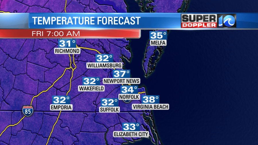
Tomorrow will be downright cold! High temps will only be in the upper 40s with partly cloudy skies. There will be a breeze out of the northwest at 10-15mph with a few higher gusts. Our model is calling for some bay-effect flurries in the morning.
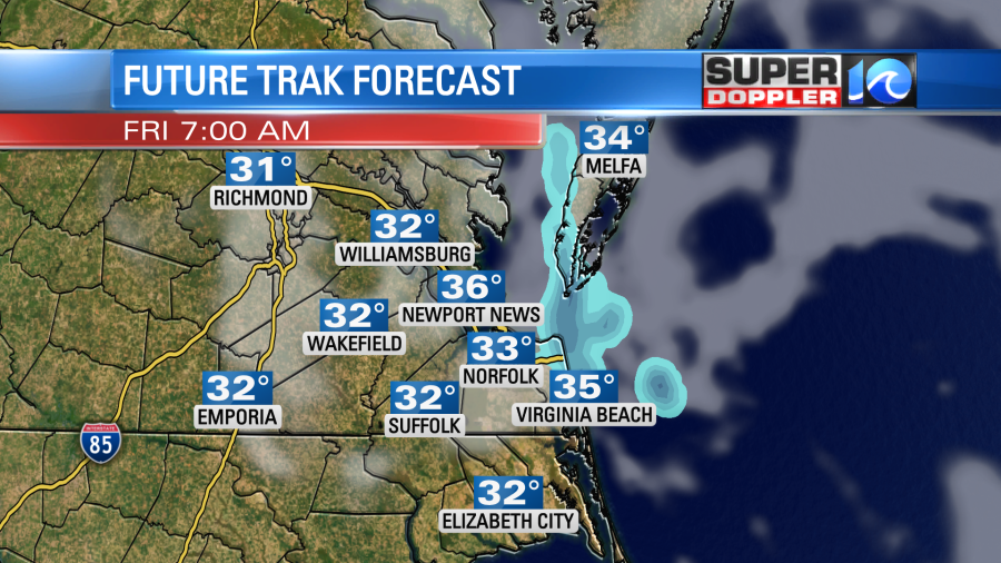
It’s not out of the question. However, the air will be very dry. The water temps are fairly mild. (upper 50s). So I think it will be tough for them to form. Maybe they will a few light coastal flurries. It’s also possible that it becomes more of a light mix. So we’ll see. It will all melt either way. Plus, it will be brief and over a small area.
The wind will die down tomorrow night. This could let the temperatures get even colder over the region Saturday morning. There could even be some upper 20s inland at that point. So if you don’t protect your plants today, then you may really want to do it tomorrow. We’ll be dry on Saturday during the day. High temps will get back into the 50s. Then Sunday looks great for Easter. We’ll be mostly sunny with highs in the mid 60s.
We’ll be covering more about that over the weekend. Have a good one!
Meteorologist: Jeremy Wheeler


