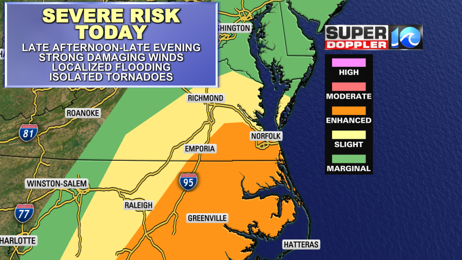
The title to today’s weather blog sounds like a cheesy Christmas movie. But it’s not fiction. We could see some pretty bad weather later today. We do have an enhanced risk for severe weather.
High pressure is moving offshore, and a warm front is moving up from the south. The front will pass to our north today. A strong cold front will stay to our west until this evening.

Temps were already in the 50s and 60s in our region this morning. Meanwhile temps were in the negatives over Minnesota.

High temperatures will rise all the way into the upper 60s and low 70s this afternoon. At the rate we are going, we may even get some mid 70s. This is way above average. Humidity will climb as well with dew points rising into the 60s. This is mainly due to the strong winds. Surface winds will increase out of the south today. The gusts will be up to 35-40mph this afternoon and evening.
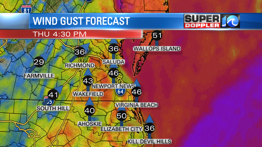
There may be a few gusts to 50mph near the shore. This has prompted a Wind Advisory from the National Weather Service.
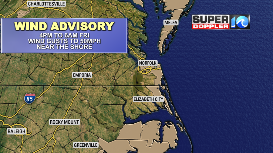
Unfortunately, this means that you need to secure your holiday decorations. You should probably even deflate the big blow-up characters as the wind could blow them down the street. At a minimum you should add an extra tether. Also secure your garbage cans. The wind may cause power outages this evening. Keep some candles and flashlights handy. Also, the wind-tide effect will happen. So the water will rise between the northern Albemarle Sound and southern Virginia Beach. Tomorrow the wind will be out of the west at 10-20mph with gusts to 25-30mph. This could create some minor flooding over the sound-side of the Outer Banks and possibly on the Bay-side of the Eastern Shore.
The bulk of the rain will stay to our west through the mid-afternoon. We’ll only have some isolated showers. Then a few showers and storms will move in. They will increase dramatically by the early evening.

These will likely turn into a line of storms between about 6pm and 9pm.

This will be the highest chance for storms and severe weather. A second line will move in around 11pm as the strong cold front arrives. This one will likely have less storms, but there will still be some heavy rain and strong wind. Then rain will slowly taper off overnight. There will be a few showers early tomorrow morning, but then we’ll dry out. There will be some sprinkles and flurries possible on Christmas Day as a strong upper level low drifts overhead. Temps will drop to the 40s tomorrow morning. They will either stay in the low 40s or even drop to the upper 30s during the afternoon. The wind will make it feel even colder.
The rain by itself could cause some localized flooding. We will get about 1.5 to 2.5 inches of rain.
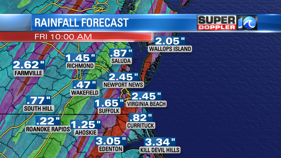
The ground is already saturated. So keep that in mind if you are driving/traveling this evening. Try to avoid it if you can. Many are already doing that due to the pandemic. Luckily Christmas day will have quieter weather, but will be colder and blustery. I’m hopeful to see some flurries tomorrow, but it’s not a guarantee. We’ll be cold and dry on Saturday with highs in the 40s and partly cloudy skies.
Have a merry but safe Christmas!
Meteorologist: Jeremy Wheeler