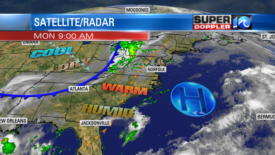
A Severe Thunderstorm Watch has been issued for Hampton Roads until 9pm Monday. Scattered downpours are still possible through sunset. Use caution this afternoon/evening and stay weather aware!
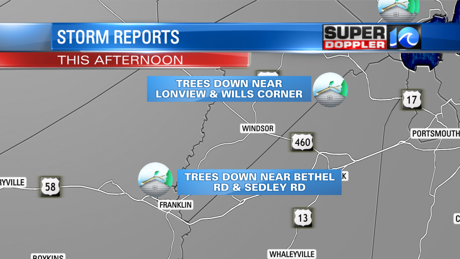
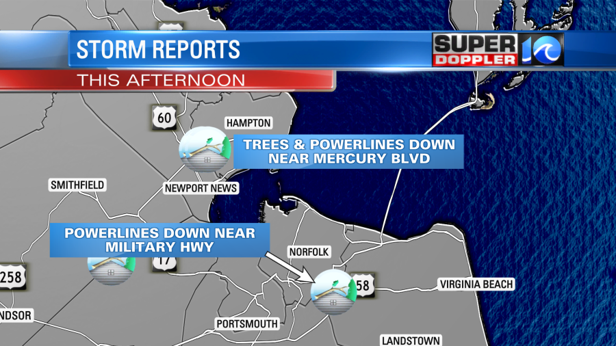
There have been reports of trees and powerlines down in parts of the region, use some caution on the roads this evening as crews may be out clearing things up.
Skies will clear out later tonight as the rain tapers off after midnight – this will set up a very nice day Tuesday, look for plenty of sunshine, highs near 80° and low humidity.
Meteorologist Steve Fundaro
___________________________________________________________________________________________________________________
Today we started off with lots of sunshine in the region. Temps were in the 60s with a light breeze. going through the day we’ll heat up to the mid-upper 80s. It will be warm and humid with dew points in the mid 60s. However, there will be a steady breeze out of the southwest at 8-12mph. So that will help a bit with how it feels. High pressure is offshore with a cold front to our west.
We’ll have partly cloudy skies through the early afternoon with only some isolated showers or storms around midday. During the mid-to-late afternoon there will be scattered showers and storms firing up. As the front approaches this evening there will be a broken line of showers and storms moving in.
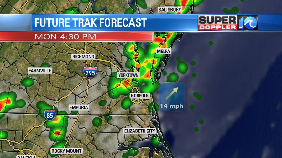
Some of the storms could be strong to severe between the late afternoon into the evening. Most of the region is in a slight risk for severe weather.
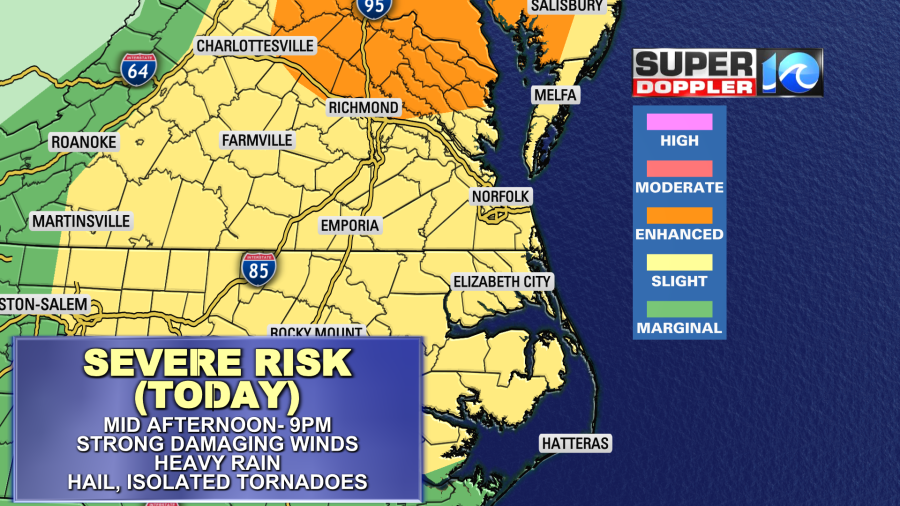
There is an enhanced risk on the Northern Neck and Middlesex County. Strong damaging winds and brief heavy downpours will be the main threats. However, there could also be some large hail this time. There may also be a couple of isolated tornadoes in the region. There will be a good amount of instability, and there will also be some wind shear this time. Storms will drop down to North Carolina by about 9pm. Then we’ll dry out after 10pm.
We could get a quarter to 3-quarters of an inch of rainfall over the area before it wraps up late tonight.
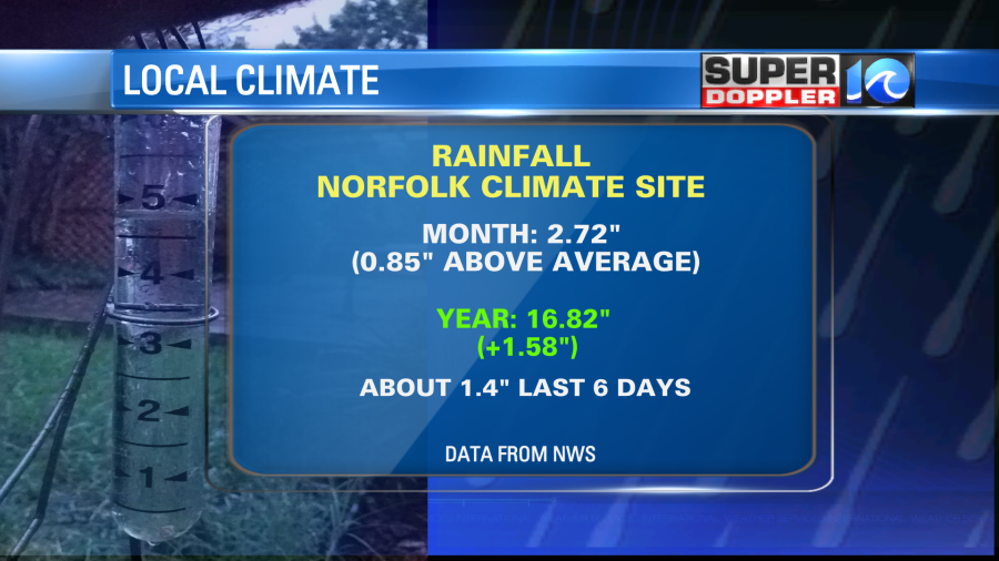
We did get caught up on rain in the short term. We now have 2.72″ of rain for the month in Norfolk. This is 0.85″ above average. 1.4″ of that was in the last 6 days. We are about 1.58″ above average for the year, but we are coming out of a pretty dry stretch.
The U.S. Drought Monitor will update on Thursday. So we’ll see how that gets changed with the recent rainfall.
In the meantime… Tomorrow we’ll have dry and warm weather behind the front. High temps will be in the low 80s.

We’ll have a lot of sunshine. It will be even nicer on Wednesday. High temps will be in the low 70s with dry conditions.
So we’ll get to enjoy 2 nice days of weather. As you can see from the maps though, they will still be very hot in the deep south and parts of the central U.S. Our heat will build back quickly Thursday into Friday. High temps will be in the 80s, and maybe even in the 90s by Friday. We’ll have some scattered showers and storms Thursday and Friday. I’ll talk about next weekend in tomorrow’s weather blog. I may also be talking about a possible tropical system in the Gulf of Mexico. Some of the long-range models keep showing something developing in the next 10-13 days. So we’ll see if it is anything.
Meteorologist: Jeremy Wheeler