We are coming off of a great weather weekend! It was mostly sunny both days with highs in the 70s. The dry air is what made the weather so enjoyable. We are going to continue with the nice weather today, but we are going to start warming up. A large area of high pressure is still in the region. However, it has drifted to the southeast a bit. This has allowed for the winds to turn out of the southwest.
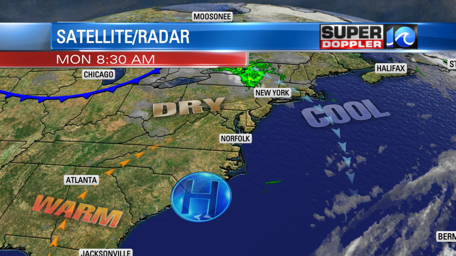
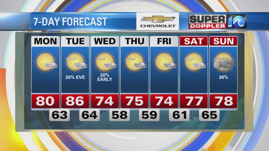
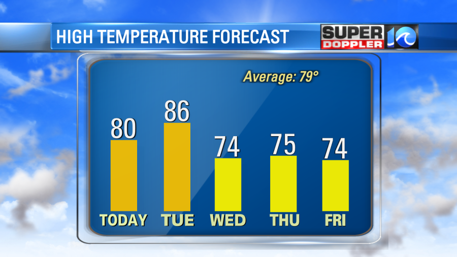
We started with temps mainly in the 50s this morning, but the southwest wind and the high amount of sunshine today will pump up the high temperatures to near 80 degrees this afternoon. Luckily it will stay dry today. Dew points will be in the 50s. Tomorrow we’ll warm up even more with highs in the mid-upper 80s. Humidity will rise a bit, but it won’t be too bad. We’ll have partly cloudy skies. The rain should stay away during the day, but some scattered rain showers will move in by tomorrow night.
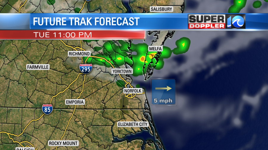
This will be along with a cold front. The front will sink to our south by Wednesday morning. So we’ll cool down again and dry out through the day. High temps will drop to the low-mid 70s. Then we’ll stay cool and dry for the rest of the week.
The tropics are still busy. As of this writing there was only one named storm (hurricane Sam). However, the remnants of Peter to our east could reform. Whether it does or not it should stay out to sea. Also, there are 2 tropical disturbances in the eastern Atlantic that are moving generally west. They both have a moderate to high chance of formation over the next few days.
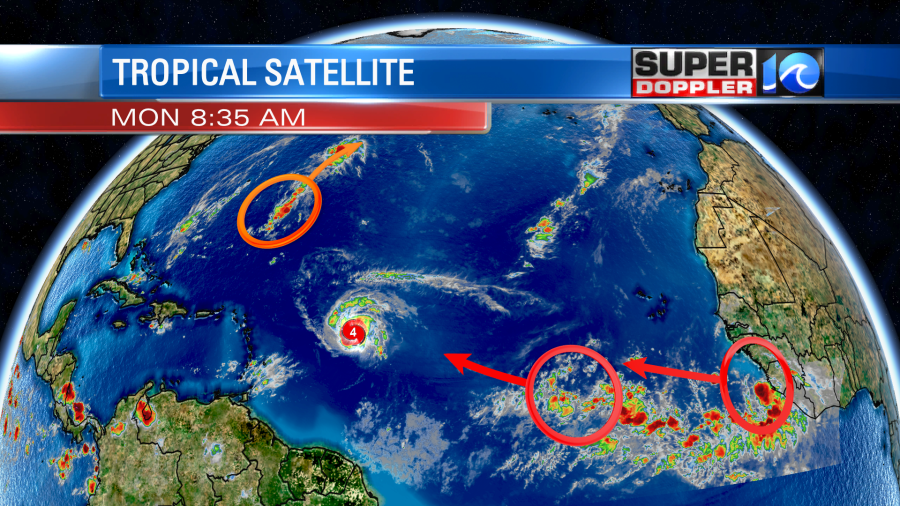
Hurricane Sam is a category 4 hurricane. However, it may be weakening a bit. The eye that was very clear yesterday as been covered up this morning. I may be going through an eyewall-replacement cycle.
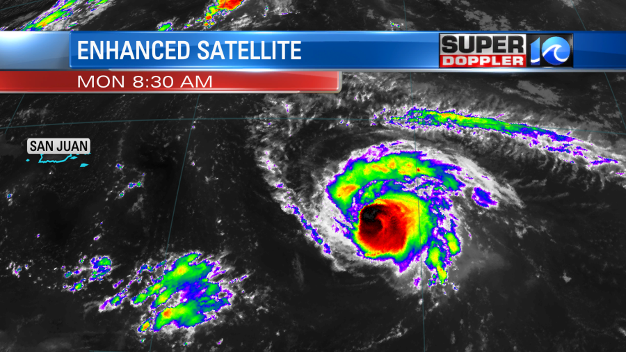
However, it is forecast to remain a major hurricane through the next 5 days. Eventually, wind shear will increase, and some dry air may begin to impact the storm. It will slowly and steadily move to the northwest then to the north.
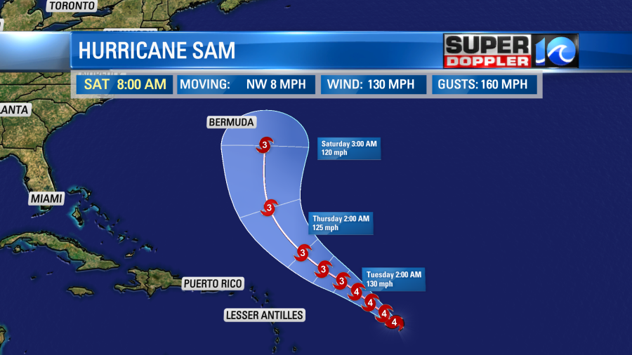
It may get very close to Bermuda. Some models have it closer to the island than others.

We’ll be tracking it closely through that time.
Meteorologist: Jeremy Wheeler
