
I was out walking yesterday morning, and the sun was out. It was nice. It was even a bit warm in the brief sunshine. However, by the late morning the clouds swept in and a cool breeze picked up out of the north. That was a cold front that has finally brought some Fall temperatures to the area. Today the front is slowly sinking to our south.
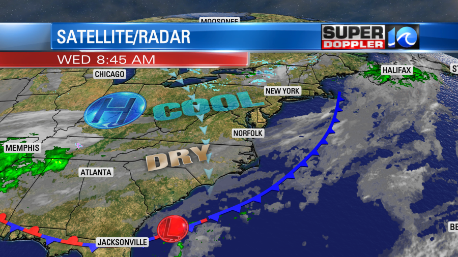
High pressure will edge a little closer to the area, but it won’t build in fully. So we’ll have clearing skies through the midday and afternoon. However, clouds will build back in again by the late afternoon. High temps will only rise to the mid 50s. We’ve had low temperatures in the 50s for many days over the past couple of months. So you will notice a much cooler/colder afternoon. The wind will be out of the north at 5-15mph this morning. It will be 8-12mph this afternoon.
Tomorrow a weak area of low pressure will creep northeast along the front. This will stay south of our region, but it will push some moisture up into our area. I don’t think we’ll have much happening in the morning. We’ll likely have a lot of clouds with a couple of stray showers. However, by the afternoon a large pocket of showers will be over northeast North Carolina. Some of that rain will also push up into Hampton Roads.
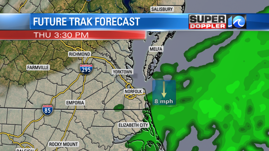
The models handle the moisture differently as it will likely be a thin (but saturated) layer. The GFS model has the rain a little more to the north than our Future Trak model.

So expect some rain tomorrow afternoon with the higher chances to the southeast and the drier conditions to the northwest. High temps will only be in the low-mid 50s.
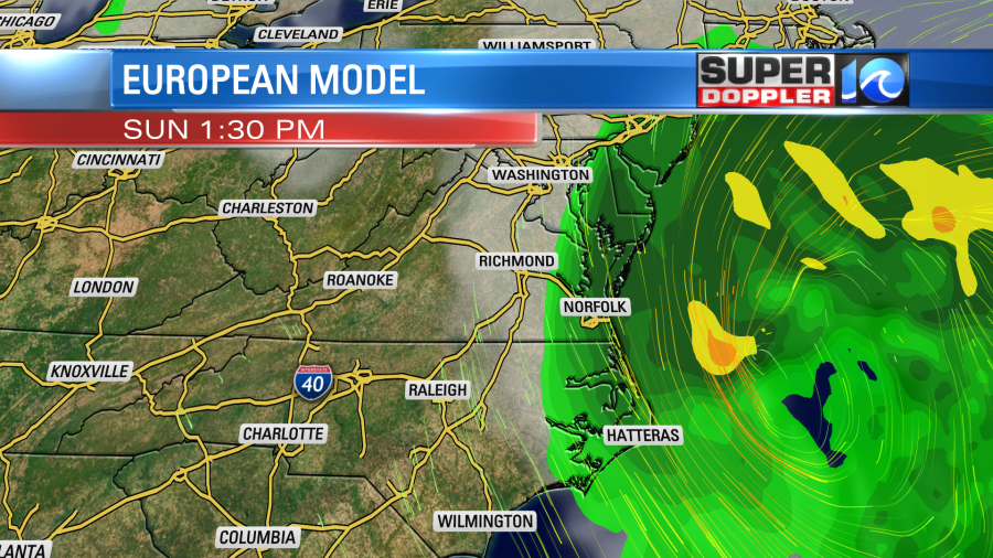
We’ll be dry and chilly on Friday with high temps still in the 50s. Then another offshore low will move to the northeast between Saturday and Sunday. The GFS model has most of the rain missing our area with just a few showers. However, the European model has quite a bit of rain over the Mid-Atlantic and Southeast.

Either way it will be cool and breezy through that time. I’ll have more updates on that part of the forecast tomorrow.
In U.S. News…I found an interesting article about air pollution and the shipping slowdown that has been a big problem in the U.S. It turns out that the ships that are parked near the terminals for a long time may be adding to the regional air pollution. Especially when it comes to Nitrogen Oxide. It’s not all bad news. There are some suggestions that less people commuting may be reducing some of the pollution over land in the big cities. Take a look at this article. It includes some Landsat imagery: Shipping slowdowns affect some regional air quality.
Meteorologist: Jeremy Wheeler


