Locally, today’s weather looks pretty quiet. We have high pressure to our southeast with a cool/stationary front to our west/northwest.
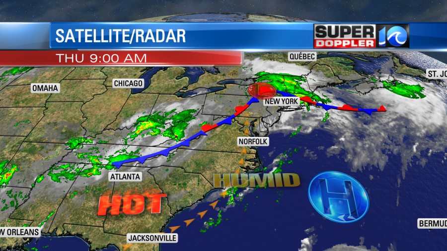
We’ll have partly cloudy skies with some isolated showers and storms popping up during the afternoon. High temps will be near 90 degrees, but the heat index will be in the upper 90s. By tomorrow morning the cool front will be moving in from the northwest. So we’ll already have some scattered showers and storms tomorrow for the morning commute.

The showers and storms will be on and off through the day, but it won’t be a washout. A few heavy downpours will be possible. At least it will be cooler. With the higher cloud cover we’ll top off in the mid 80s. It will still be pretty muggy though. Then on Sunday we’ll have partly cloudy skies with less of a chance for rain. High temps will be in the upper 80s.
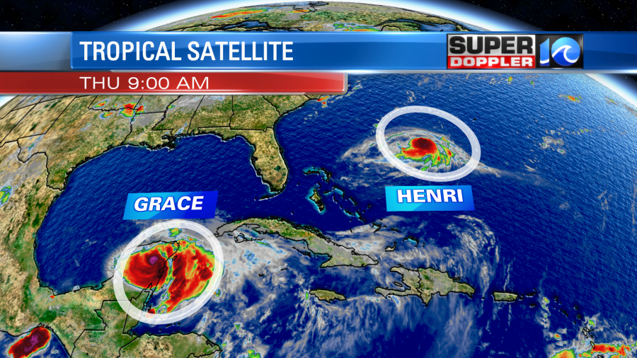
This weekend we may have some indirect impacts form Henri. Currently the storm is strengthening to the southwest of Bermuda. It had winds of 70mph sustained as of this writing. That’s not far from hurricane force winds.
The storm is still forecast to stay offshore as far as our region is concerned. However, the forecast and the models have been trending west over the last 48 hours.
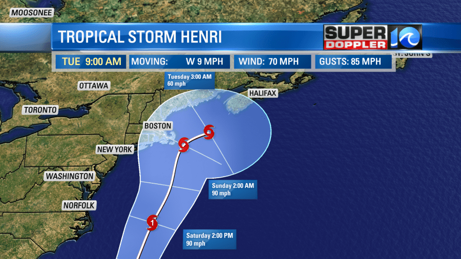
So now there is a greater chance for Henri to hit the Cape Cod area. Whether it hits there or not, it will then likely move northeast towards Nova Scotia. We’ll have to watch this storm carefully. On its most likely path we would have no impacts here from rain nor wind. However, if it were to follow the western edge of the cone of uncertainty, then it’s possible that we could have a couple of strong gusts near the shore. Either way we are still looking at some high waves in the region. They would build a little on Friday, but they would likely peak on Saturday. I’m thinking that we could see some 3-4 ft waves in Virginia Beach with 4-5 ft waves over the Outer Banks.
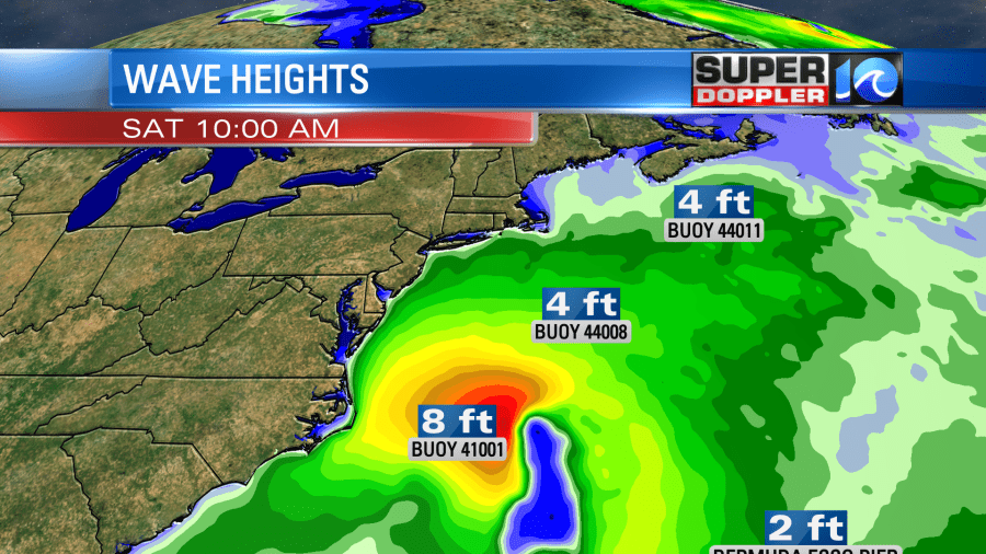
Today we already have a moderate threat for rip currents. The National Weather Service suggests that we’ll have a high threat from Friday through Sunday.
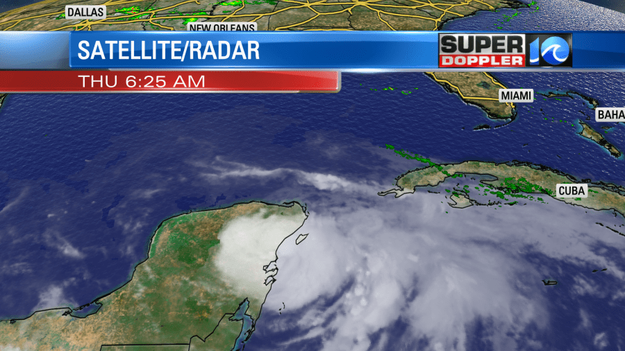
In the meantime hurricane Grace made landfall early this morning near Tulum, Mexico. That is just south of Cozumel. It had sustained winds of 80mph upon landfall.
Now the storm is weakening over land. However, Grace will move back over the water later today. Then it will restrengthen over the bay of Campeche. It will then move into eastern Mexico as a hurricane.
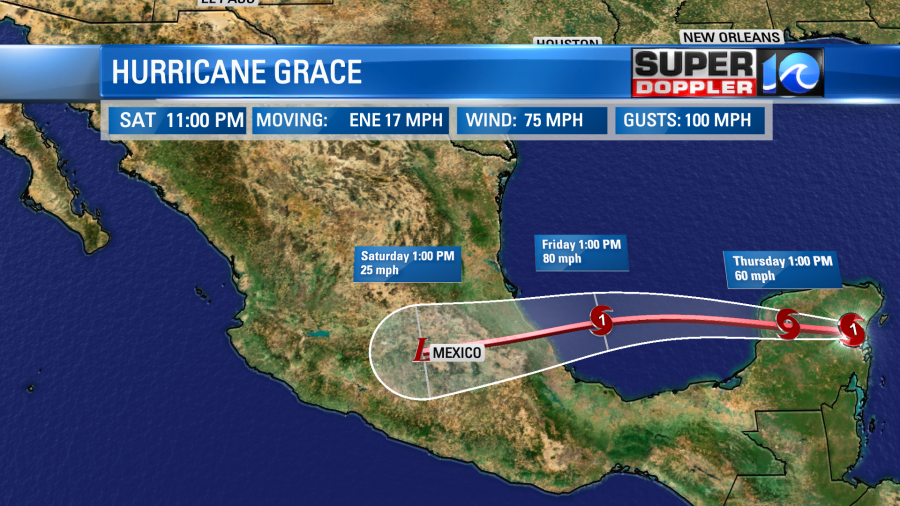
After that it will quickly weaken as it soaks central Mexico. This could create some flooding and mudslides. It is no threat to the United States.
Meteorologist: Jeremy Wheeler


