Happy Easter! We will see a cool Easter with temperatures about 10 degrees below average from what we typically expect to see this time of the year.
Highs will be in the upper 50s to low 60s this afternoon, with low 60s at the coast and temperatures around 62-65 for inland areas.

Interestingly, these temperatures are cooler than what we saw on Christmas 2021 and New Year’s Day. Now, that’s mostly related to the timing of our fronts and weather patterns, but it’s interesting none the less.

We will remain dry through Sunday but rain is in the forecast for Monday. An area of low pressure will track up through our region, helping to produce widespread showers and a few downpours Monday afternoon.
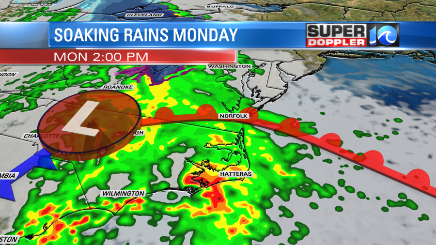
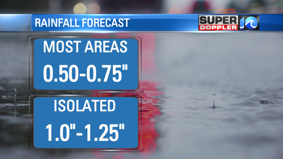
Rainfall totals across the area will be around 0.50-1.0″ with slightly higher totals possible across NE NC and the OBX where the heaviest rain is expected.
With the clouds and rain, we’ll stay cool on Monday. Temperatures won’t rebound much until late next week when we head into the low 70s for highs.

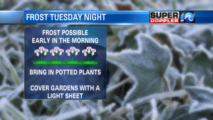
Tue night with partly cloudy to mainly clear skies – some patchy frost will be possible especially inland areas.
Hope you and your family have a wonderful Easter.
Meteorologist Ricky Matthews
Follow Ricky on Facebook and Twitter