
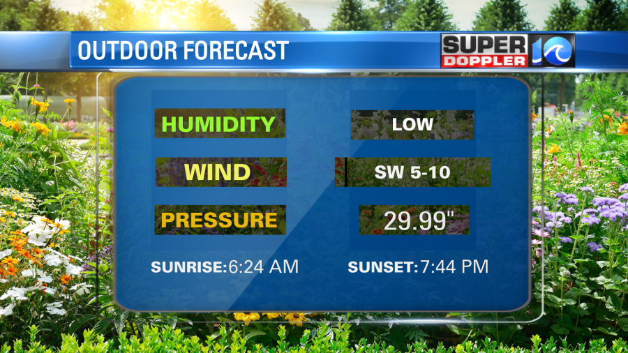
We are going to warm up nicely today. Temps started mainly in the 40s with a few upper 30s inland this morning. However, temps will warm to the mid 70s this afternoon. It’s another one of those days when it’s good to dress in layers. We have an area of high pressure moving in. We’ll also have a light southwest wind.
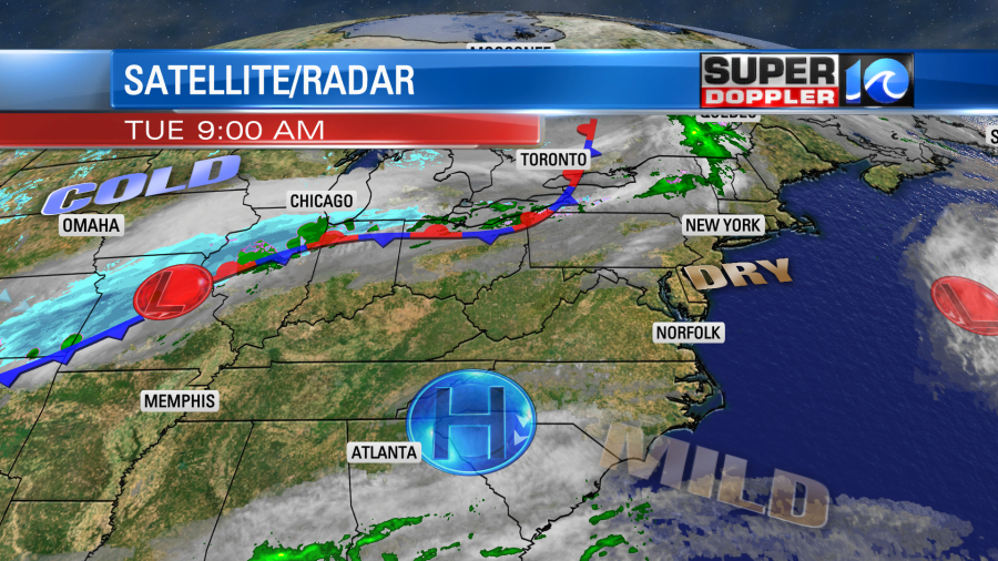
Notice that it’s so cold over the north/central U.S. that there is some snow in the some of the Midwest States. Some of that colder weather will head our way later this week. (no snow though!)
Locally, tree pollen levels are high today. Grass is moderate. Water temps are still in the upper 50s to low 60s. Here is some other outdoor information:
Get out and enjoy the weather while you can. Tomorrow we’ll still be warm, but there will be some scattered showers and storms forming during the afternoon.

These will form ahead of the strong cold front. The wind will already be a little breezy. Winds will gust to 25mph out of the west/southwest. So some of the storms could have some strong gusty winds and brief heavy rain. High temps will rise to the mid-upper 70s. The storms will move out by the later evening. Then we will dry out, and temps will crash!
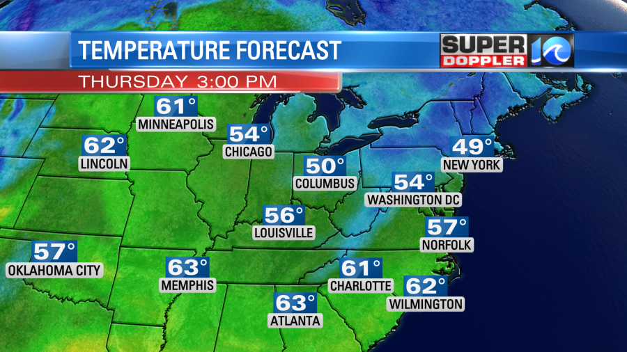
Low temps will drop to the low 40s by Thursday morning. If the winds die-off inland, then a few locations could drop to the mid 30s. This could allow for some patchy frost to form there. Then we’ll be seasonably chilly and dry on Thursday. High temps will only be in the upper 50s to low 60s despite a good amount of sunshine.
We’ll have another cold morning on Friday. There will be less wind. So we could have more temps in the mid 30s inland. The chance for some inland frost will be there again. Then we’ll warm to the low-mid 60s during the afternoon. Check back for updates on this chance for frost.
In national news… It’s about that time to change the climate…. Well, the climate normals anyway. The average temperatures around the country are calculated every 10 years based off of the previous 30 years. Locally, when we show the average on-air, it is based on that 30 year average. This gets updated in order to better represent your local temperature. The next update will happen on May 4th. Seems like there is a little more buzz about it this year. Maybe because the average (as a whole) is increasing about a half a degree higher. That might not seem like much, but remember that is an average over a 30 year period over the country. So our local averages may be higher than that. Here is the article with more information: Average climate temperatures increasing.
Meteorologist: Jeremy Wheeler


