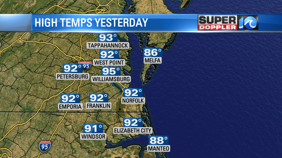
Hot, hot, hot! Yesterday was a bit rough. I actually cut grass around midday, and it wasn’t too terrible. But tree trimming in the afternoon was tough. Then a little more outdoor work in the evening (yes…I did a lot outside) was actually the worst as there was no breeze at all. High temps were in the low 90s as forecast with a few mid 90s inland.
Today we are going to stay hot and humid. We have a large area of high pressure to our southwest. There is a back-door cool front to our northeast, but it has stalled out.

There is a strong cold front to the west, but it has a long time before it will get here. High temps will aim for the low-mid 90s this afternoon. A sea breeze may develop, and that could cool down a few areas near the shore. However, most locations won’t be affected by that. So be ready for another hot day.
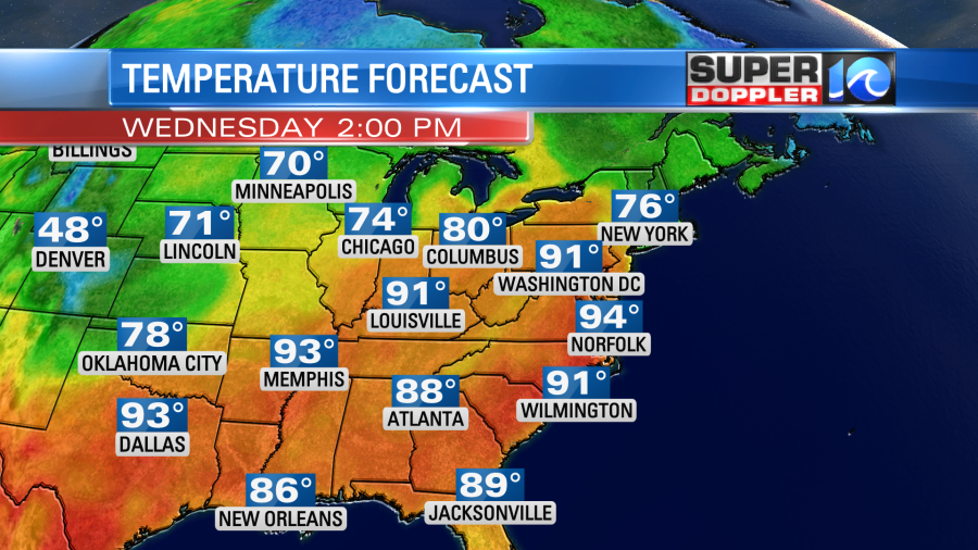
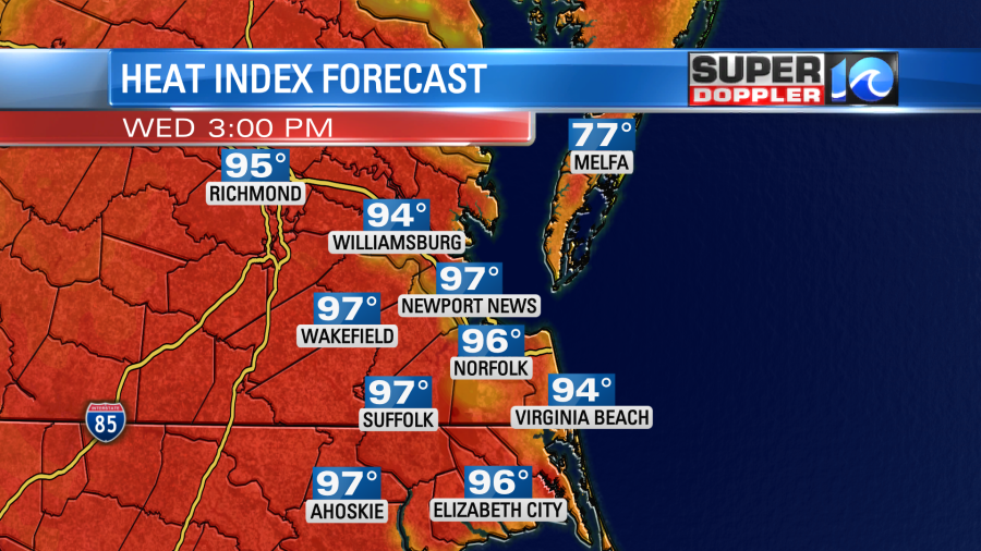
The temps will run up into the low-mid 90s, but the humidity is high. So the heat index will be in the mid-upper 90s this afternoon for many.
We’ll have mostly sunny to partly sunny skies. There will be a few isolated showers and storms popping up this afternoon. The chance for rain is 20%. There won’t be much wind. It will be light and out of the west. Then it will briefly turn out of the north.
Tomorrow we’ll still be hot and humid. The high temps will be in the low 90s again. The heat index will be in the mid 90s. However, there will be more clouds tomorrow overall. Plus, there will be a higher chance for some scattered showers and storms.

These will kick off in the mid-afternoon. Then they will increase going into the evening. There could be a few strong to severe storms between the late afternoon and evening.
A few of the showers will continue into Friday morning. They will push down to North Carolina and the Outer Banks in the afternoon. We’ll dry out nicely from the late afternoon into the weekend.
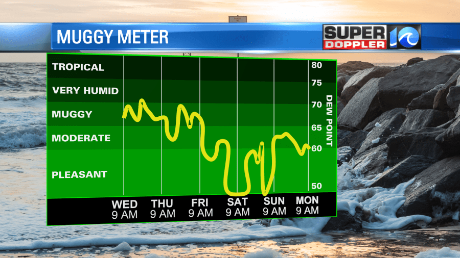
High temps will drop down to the upper 70s to near 80 Friday and Saturday. In fact…the weekend weather looks awesome!
Meanwhile in the tropics…
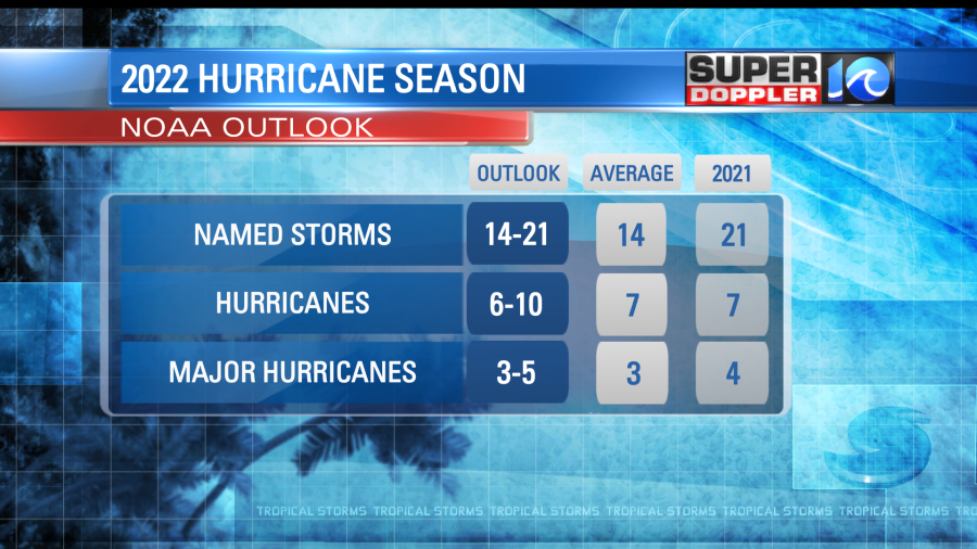
Today is the first official day of hurricane season in the Atlantic Basin. All of the forecasts call for an active season that will be above average. Here is the latest NOAA (National Oceanic and Atmospheric Administration) forecast:
The water temps are well above average.
There is a La Nina weather pattern in the Pacific Ocean which favors hurricane activity in the Atlantic. This is due to a teleconnection which typically creates less wind shear in the Atlantic basin. Also the Loop Current is farther north than usual for this time of year. So that could steer more storms than usual to the Florida region.
I’ve often asked people…”When is the last time you remember them calling for a below average season?”. Well….There haven’t been too many of those over the last 20 years. If fact, since 2007 there have only been 3 years below average.

There is actually a developing system down near the Yucatan Peninsula right now. This is the remnants of hurricane Agatha which struck southern Mexico on the Pacific side. This feature is likely to redevelop over the next couple of days.

It is forecast to move to the northeast. Whether it forms or not, many of the models take the heavy rain and send it over southern Florida. The European model has that scenario.
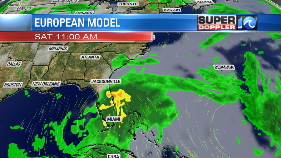
Then it keeps it going northeast. It keeps the system out to sea in a few days, but it has a bit of the rain and wind skirting the southern Outer Banks.
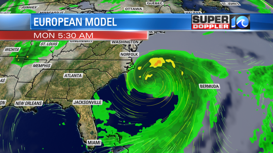
The GFS model keeps it weak, and it has it moving even farther away from land.
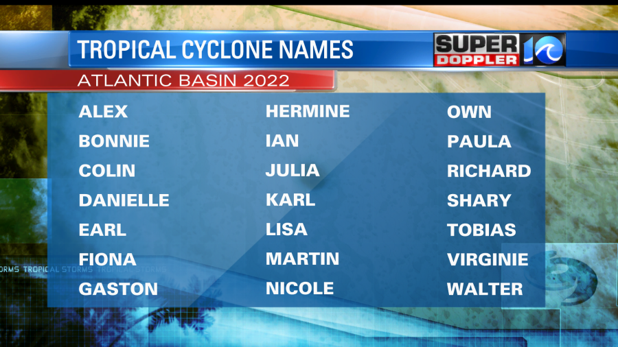
Whatever happens we’ll be tracking it. The first name on the Atlantic list is Alex.
Meteorologist: Jeremy Wheeler

