I’ll start with the local weather today. Then go into the tropics. Yesterday, had a small area of heavy rain. It was from the Great Dismal Swamp to the west/southwest where a slow-moving downpour occurred. Our radar estimated about 1-2 inches of rainfall there with possibly up to 3″.

A front was stalled out to our south, and so there wasn’t a big area of rain. However, today the front is drifting north into the viewing area. So we’ll have a higher chance for rain and storms over the region. They will be more spread out over the area, and a few heavy downpours will be possible.
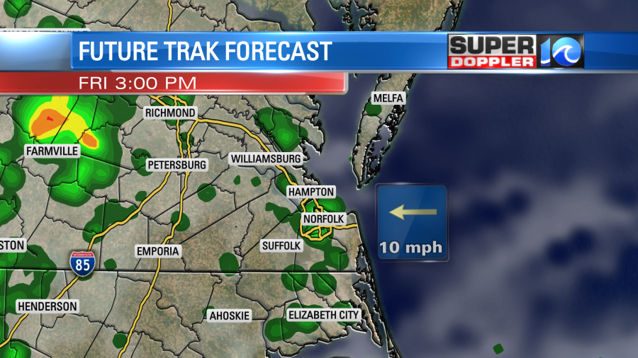
We’ll have a light easterly breeze this afternoon. High temps will be in the mid 80s with some upper 80s inland. Tomorrow a weak area of low pressure will creep along the stalled out front. We’ll have mostly cloudy skies with more scattered showers and storms. There will be a light southwest wind. High temps will be in the upper 80s. The low pressure system will bounce out of here by Sunday. The front will fall apart to our west, and high pressure will build into the region. So we’ll FINALLY have a stretch of quiet weather. We’ll be partly cloudy on Sunday with high temps near 90. We’ll have similar weather for Monday through Wednesday of next week.
Ok…Now the tropics. There are 3 features that we are watching in the Atlantic Basin. There is a weak disturbance coming off of Africa and two tropical depressions.
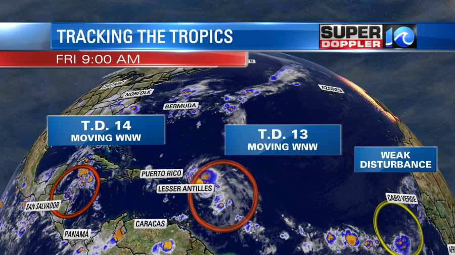
I won’t talk much about the disturbance at this time, but it is moving west. So we’ll watch its progress over the next couple of days. Tropical depression 13 has been struggling to maintain its strength for the past few days. It has been fighting not only some wind shear at times, but it has also been surrounded by some very dry Saharan air.
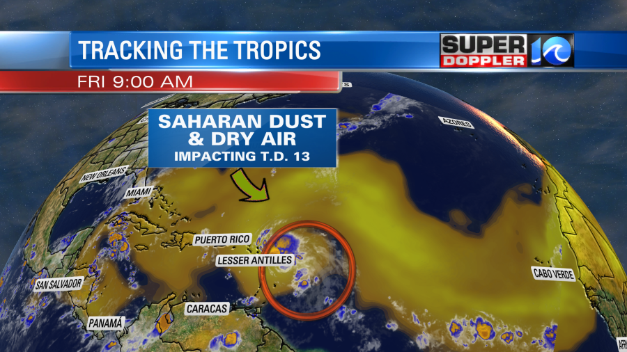
So despite the forecast to strengthen, the system has remained a tropical depression up until 9am this morning. The Hurricane Hunters just found a tropical storm force wind. So now it is tropical storm Laura as of 9:05am Eastern Time. The system is forecast to move west/northwest and pass north of the Lesser Antilles today. Its edge may interact with land, but the non-distinct center will likely pass north of the islands. The system is forecast to move west northwest over the next 2-3 days. Its track may have it moving over parts of Cuba, Hispaniola, or the Bahamas for a time. However, the most likely path takes it in-between land masses.
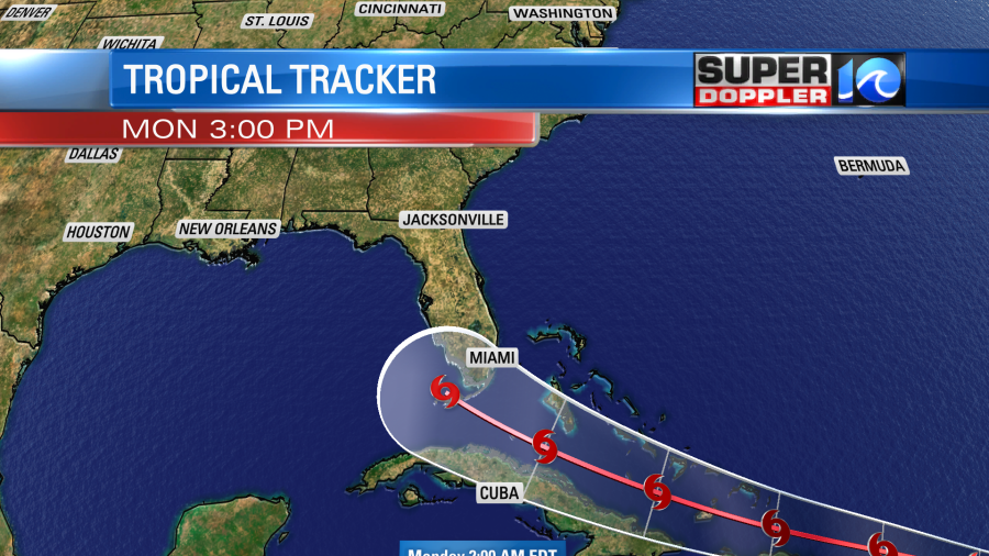
So due to the possible/multiple land interactions there is a large amount of uncertainty in the forecast strength. The National Hurricane Center has it as a landfalling hurricane in a few days, but even they admit that there is a low confidence in that exact track.
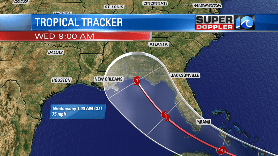
The model consensus does have it threading the needle and staying over the water. At least until it reaches the Florida Keys.
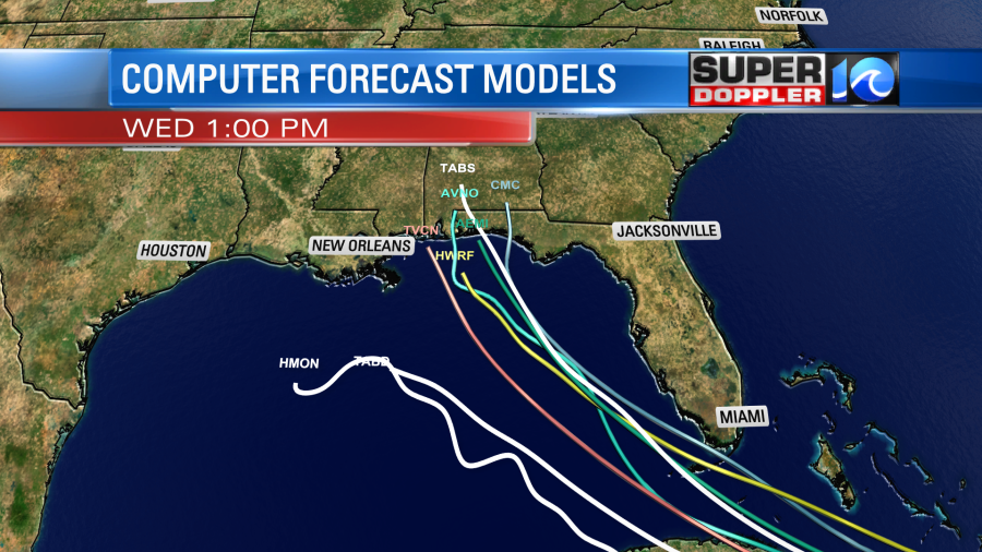
Keep in mind that some of the global models do kill off the system before it even reaches the Gulf of Mexico. In sharp contrast the Hurricane WRF model has it as a cat 4 hurricane in a few days. That’s a huge spread. Some models are starting to trend more to the west. That would take it closer to the path of (now) Tropical Depression 14.
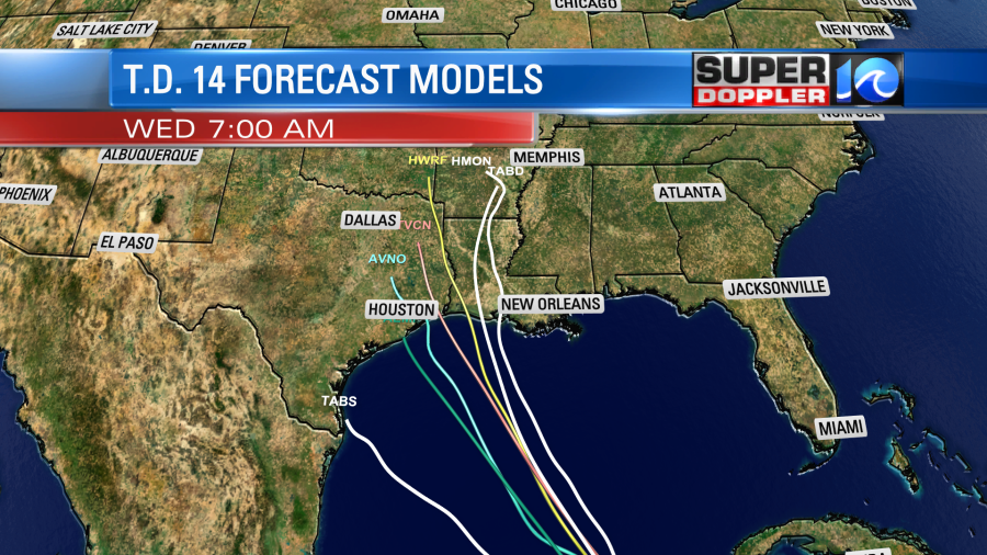
Tropical Depression 14 has been skirting the coast of Nicaragua and Honduras. It is forecast to become a tropical storm, move over the Yucatan Peninsula, and then slide over the Gulf of Mexico. After that point it is expected to move north/northwestward. The latest track has it moving close to the Houston area in 5 days. Possibly making landfall as a strong tropical storm or minimal hurricane near that region.
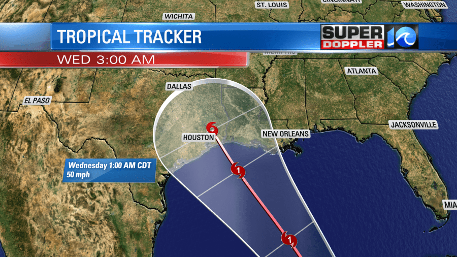
The models are in fairly good agreement on the track through day 4. However, there is a bit of a spread by day 5.
So it is possible that 2 tropical systems could make landfall on the same day. I don’t know if that’s ever happened before. I’ll have to do some research to find out. Leave it to 2020 to possibly break another record. Keep in mind that there probably will be some changes to the track before next week.
Stay tuned for updates.
Meteorologist: Jeremy Wheeler