Today is going to be another great weather day…overall! Yesterday, we had high temps in the 70s with lots of sunshine.

I was doing lots of yard work while soaking up the sunshine. It was warm in the March sun, but it felt great. Today it will be even warmer as the wind picks up out of the southwest. High pressure is centered just to our southeast. There is a cool front far off to the west.
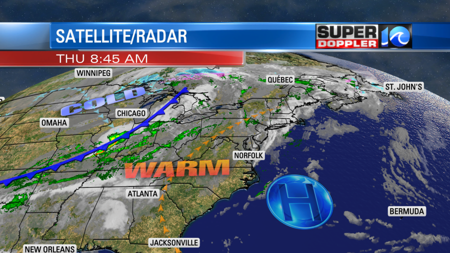
We’ll have lots of sunshine through the day. The wind will increase out of the southwest at 10-15mph with some gusts to 25mph. While this will create great outdoor weather it will also create one problem. It has been super dry out lately, and that helped to dry out the ground. However, today that will lead to an increased fire danger. So much that there is a Red Flag Warning for southeast Virginia.
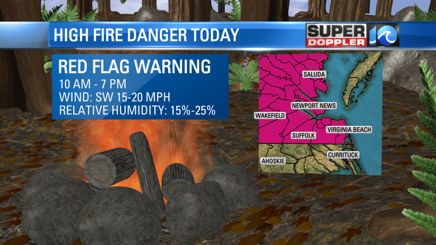
The relative humidity will be down to 15-25%. So be careful with any flame units today like grills. Another speed bump in today’s road to nice weather…. The pollen levels are increasing. Tree pollen is now going up to high levels, and mold is low. The problem (ironically) is that it hasn’t rained in a while. So the pollen is collecting.
Tomorrow we’ll have another warm day. High temps will run up into the mid 70s. There will be a southwest breeze. However, tomorrow we’ll have more clouds. There may even be a couple of stray showers in the afternoon and evening. However, the dry air should really limit their coverage. Winds will turn to out of the west late. That will be the cold front entering the region.
Behind the front on Saturday we’ll really cool down. Our model is calling for low 50s. I think we’ll be more in the mid-upper 50s. Either way it’s back to reality!
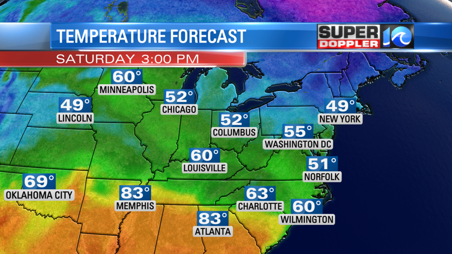
We’ll be cool on Sunday with high temps also in the 50s. The front will get hung up to our south for a bit. So there may be some isolated showers in the region. Especially south of the metro. The expected rain on Monday has been pushed back in time. So now it looks like we’ll only have some isolated showers late in the day on Monday. The Euro really holds off the precip until Tuesday, but the GFS model has a little precip by the evening. It even has a brief wintry mix in the region, but I’m not buying it just yet. I think our surface temperatures will be too warm. High temps are forecast to be in the 40s during the day. I bet we’ll be just a bit warmer than the models show. We’ll see. Either way it looks like there will be a higher chance for rain on Tuesday with high temps back in the 50s. This time frame (early next week) will likely shift around a bit. So stay tuned for updates.
Meteorologist: Jeremy Wheeler

