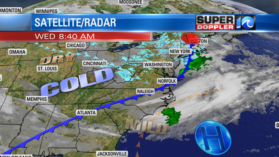
The temperatures yesterday were fairly mild, but the breeze did make it feel chilly at times. Today it will be colder, and the wind will be much stronger. Both here and in the D.C. area. A strong cold front moved through Washington this morning.

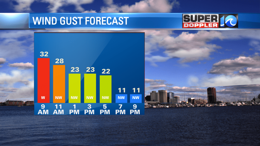
The front will drop to our south today. We already have clearing skies. Winds will be very blustery behind the front. At least for a time. They will run out of the northwest at 10-20mph with gusts to 30mph. This will be from the mid-morning through at least the early afternoon.

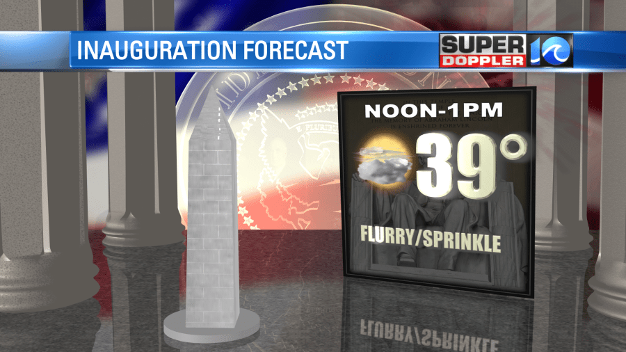
The temps this morning were mainly in the 40s, but temps will stay down today despite a good amount of sunshine. There will be couple of 50s to the south. It will be colder in the D.C. area during the midday and afternoon. Temps will be in the upper 30s at noon with wind chills closer to 30 degrees.

By the evening our winds will die down. We’ll be mostly clear tonight with low temps near 30 degrees in the metro. It will be in the 20s inland. However, tomorrow the wind will be out of the south/southwest. High pressure will build right back into the area, and that will give us fair skies. So high temps will bounce back to the mid 50s. We’ll be dry with mid 50s on Friday, but there may be some isolated showers over North Carolina.
We’ll have another cold front move through Friday night. This will bring in some much colder air this weekend. High temps will only be in the mid 40s on Saturday (maybe even in the low 40s). Low temps will be in the 20s Sunday morning.
In world news… Some new research and data from the European Space Agency has discovered an interesting fact about the solar wind and the magnetic poles of the Earth. It turns out that the solar wind (a river of charged particles that emanate from the sun) heads more towards the north pole than the south pole. It’s hard to say exactly how this affects the planet. Here is an article with more information: Solar Wind and the poles.
Meteorologist: Jeremy Wheeler


