Today’s weather is looking pretty good locally. We have a large area of high pressure off to our northeast. This is the same system that has brought us the dry weather for the past few days.
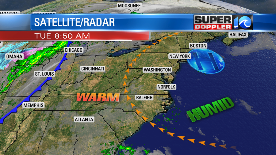
We’ll have partly cloudy skies with perhaps a stray shower to the south. Overall, it looks like a nice/quiet day. However, it is going to be pretty warm for this time of year. High temps are going to rise to the upper 70s this afternoon. There may be a couple of 80s inland/south. The average high is 63 degrees for this time of year. The record for today is 83 set back in 1979. Dew points are near 60 now. So it’s pretty humid.
Tomorrow the dew points and overall moisture will increase. High pressure will still be to our northeast, but it will be a bit farther away. We’ll have increasing clouds with scattered rain showers moving in towards the late afternoon and early evening.
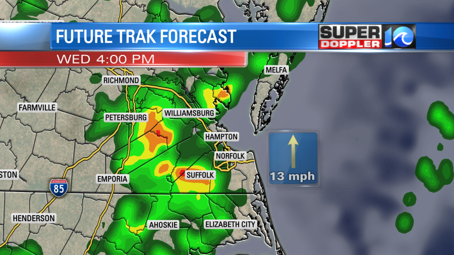
High temps will run up into the upper 70s to low 80s tomorrow. With the high humidity it will almost feel like late Summer. Rain showers will increase Wednesday night into Thursday morning. Rain may be heavy at times.
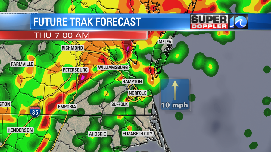
Then we’ll have a decreasing chance for rain late Thursday as a cold front moves slowly to our south. High temps will be near 70. We’ll cool down to the 60s on Friday behind the front. There may be a few am showers, but I think we’ll dry out later in the afternoon. We’ll be dry and cooler on Saturday. Highs will be in the low 60s. By the way…Low temps will be in the 60s tomorrow through Friday. They will finally drop back to the 50s by Saturday morning.
We could pick up about 1-2″ of rain from tomorrow through Thursday mid-morning.
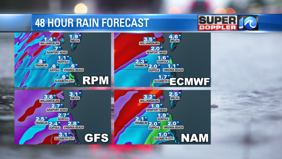
Then we could see another inch or two Thursday into Friday. This could lead to some localized flooding.
Things haven’t really let up in the tropics. Tropical storm Eta is meandering around the Gulf Of Mexico. It’s not too far from western Cuba. It is back over warm water now, and there isn’t too much wind shear. However, there is some very dry air wrapping into the system.
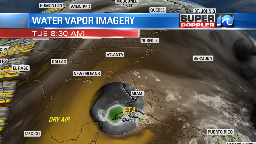
This should stop it from strengthening much in the short term. As it slowly heads north it will encounter cooler water temps, and the wind shear should increase.
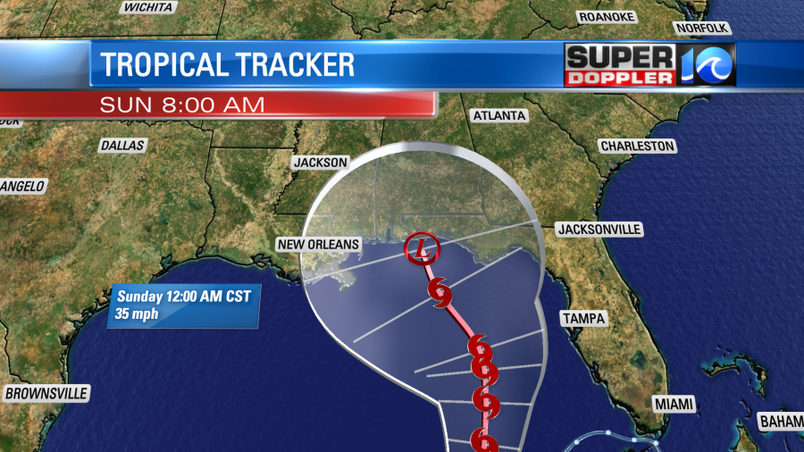
So if it does make it to the Florida panhandle, then it could be down to a weak tropical depression by that time. However, that is not set. Notice how large the “cone of uncertainty” is (white area). It’s possible that Eta won’t even make it that far north. To give you a better sense of that take a look at the latest computer models for Eta:
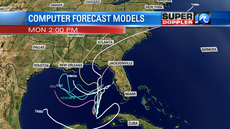
Notice that there are several (including the GFS) that take it west before it even gets close to land. Let’s hope that pans out as they don’t need any more systems down there making landfall.
Meanwhile a record was broken early this morning. Subtropical storm “Theta” formed in the eastern Atlantic which is the 29th named storm this season.
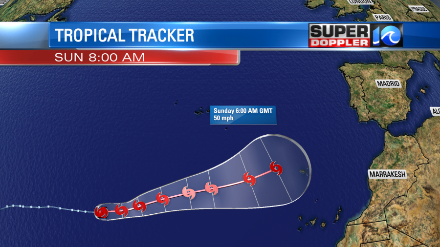
This makes 2020 officially the busiest season on record as it beats out 2005’s record year. Luckily it is over the eastern Atlantic, and it is moving east. It is attached to a cold front that is falling apart. So it is forecast to become tropical in a day or two. Down the road it may impact Spain and Portugal.
There is another tropical disturbance in the eastern Caribbean that is moving west. It has a low chance of formation in the short term, but has a medium chance in a few days.
Stay tuned for updates.
Meteorologist: Jeremy Wheeler


