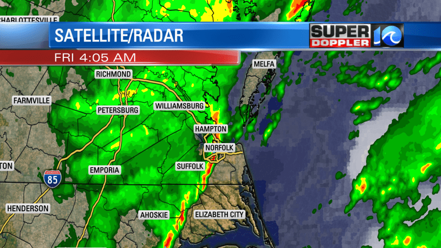
Zeta is long gone. It became extra-tropical yesterday as it merged with a stationary front. We had a few showers in the region as it passed just to our north. Winds were strong and gusty out of the south. Plus, the sun popped out for a while. So high temperatures shot up to the low-mid 80s during the afternoon. We actually broke a record. The high in Norfolk hit 84 degrees. This broke the old record of 82 (1946). A strong cold front moved through early this morning. This produced a round of brief and heavy showers.
The front is now offshore along with an area of low pressure.
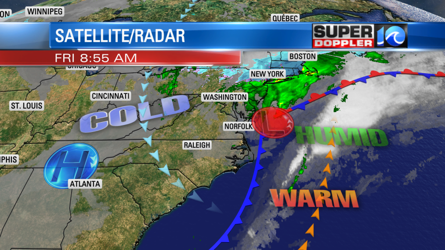
High pressure is building in from the west. As that happens surface winds will pick up out of the northwest. This will pull down some much cooler and drier air compared to yesterday. Temps already dropped to the 50s and low 60s this morning. We will end up in the upper 50s this afternoon. A few spots may get back up to near 60. The dew points are dropping. They will be in the 40s this afternoon. An upper level low will still be over us this afternoon. While we are drier than yesterday, we will still have enough moisture for an isolated shower.
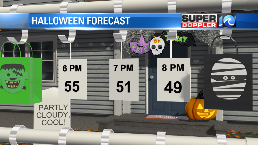
Tomorrow we’ll be cool and dry with highs in the upper 50s. We are looking good for tomorrow evening for any Trick-Or-Treaters that will be out there.
For a while I just figured that Halloween was cancelled. But I guess many families are still going to participate. So I’m going to tape some candy to a large piece of card board this year, and let kids pull them off one-by-one. My sister up north decided to stay home with her kids and do a pinata. Whatever you decide to do. Everyone be safe!
We’ll warm up a little on Sunday ahead of the next cold front. High temps will be in the upper 60s. We’ll have some scattered showers later in the day. We’ll cool down on Monday with a few showers. Highs will drop to the mid 50s. Then we’ll be cool and dry on Tuesday for Election day. High temps are aiming for the low 60s, but stay tuned for updates.
While Zeta is gone, there is another feature that we are watching. “I KNOW….Right!” There is a tropical disturbance in the eastern Caribbean that now has a high chance of formation.
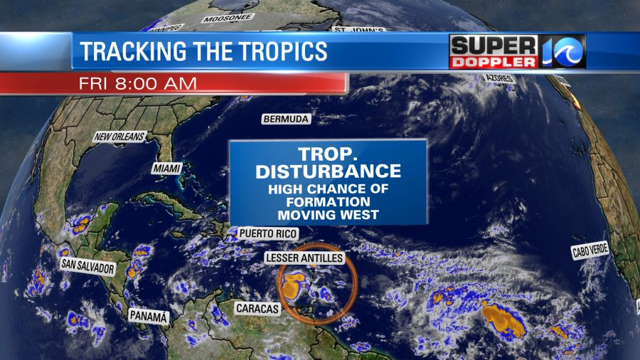
This is moving to the west. We’ll be tracking that over the weekend.
Meteorologist: Jeremy Wheeler