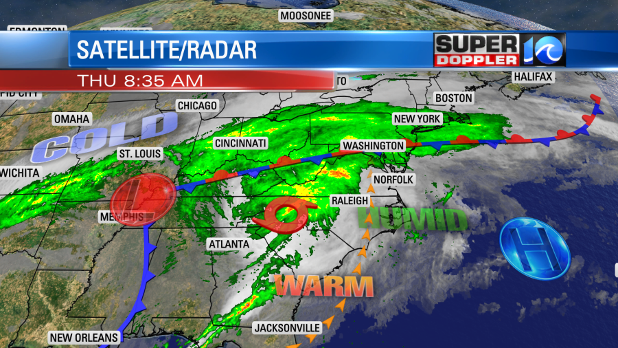
Zeta made landfall along the Louisiana gulf coast last night as a category 2 hurricane. It has been slowly weakening as it races across land. It was a tropical storm this morning. It has been moving faster since then. This morning the motion was northeast at near 40mph, and it’s expected to increase even more. Zeta will pass just to our north this afternoon/evening.

It will then quickly move out to sea tonight. While the center may pass to our north today, we will still have impacts here. Mainly the wind… There is a Wind Advisory in effect today for the viewing area. It goes from Noon until 8pm. Winds may gust up to 50mph. Our model has been increasing the wind speed/gust forecast since yesterday.
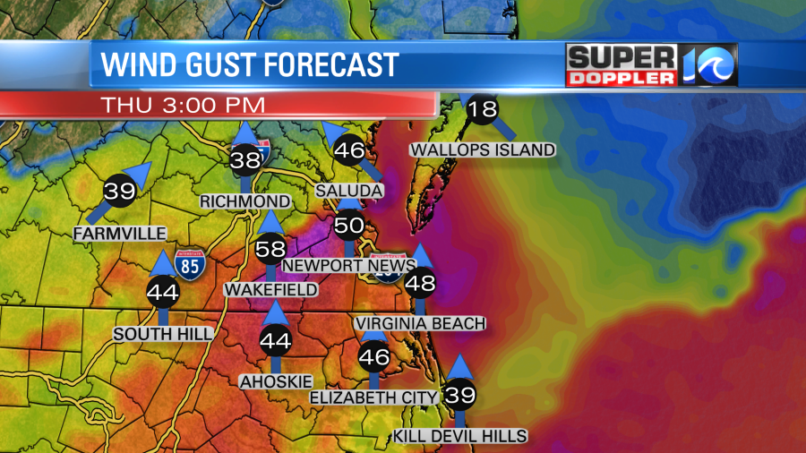
The wind gusts will ramp up between noon and 3pm. It will be strong through the evening. So this will impact the evening commute. It will be tough driving over bridges and overpasses. There may be some scattered power outages.
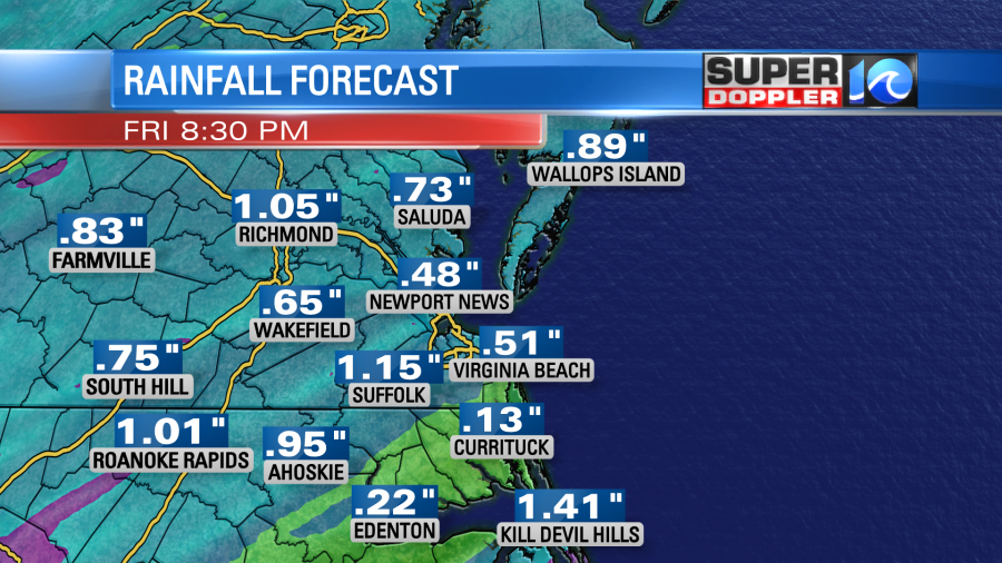
Rain will also increase today. There wasn’t much this morning, but we’ll have a lot of rain (in terms of coverage) by the early afternoon.

Scattered showers will then decrease during the evening as Zeta moves away from the region. Rainfall totals will be about a quarter to 3 quarters of an inch. There will be a few areas that get up to an inch. There will be higher amounts to our north.
Zeta is going to interact with a stationary front. The front is just to our north today.
We’ll heat up this afternoon to the low 80s due to the strong south winds. The record high for today is 82 degrees (1946). We could definitely tie or break that record. It is also going to be very humid for this time of year. As Zeta and a secondary low move past our region, there will be some much colder air behind it. The cold air will pour south tomorrow into our region. We’ll start with temps in the 60s, but they will drop to the upper 50s by the mid-afternoon.
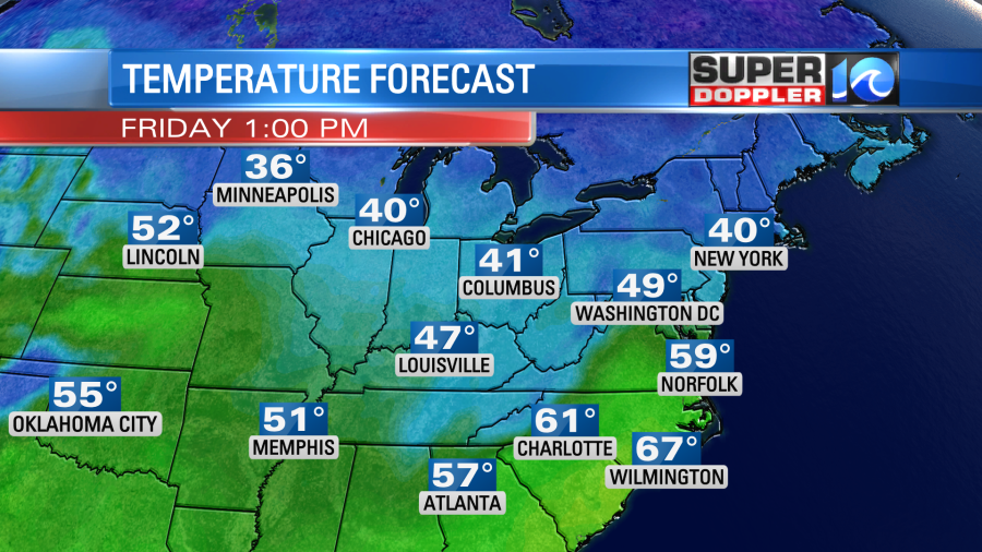
There will be a few showers in the morning, but the afternoon should be fairly dry. Winds will be out of the north at 10-20mph with gusts to 30mph.
We’ll be dry and cool on Saturday. So the forecast doesn’t look too bad for Halloween. Maybe a little on the chilly side in the evening. Temps will be in the low 50s, but they may drop to the upper 40s. We’ll warm up a bit on Sunday. High temps will be in the upper 60s. We’ll have a mix of sun and clouds with a few showers possible. We’ll be cooler on Monday with high temps back in the 50s. So far Election Day looks cool and dry. Let’s hope that doesn’t change.
Stay tuned for updates!
Meteorologist: Jeremy Wheeler