Yesterday we had some ocean overwash along the Outer Banks. Winds were very gusty down there. Today we will have more of that. there have already been some more wind gusts to over 35mph there this morning. The high tide for Duck, NC today is forecast around 6.5ft. This is up to major levels. However, there are also some high waves on top of the tide. So expect parts of highway 12 to be blocked by ocean overwash for a while.

That will be the worst tide in the region. The lower Chesapeake Bay will experience more in the way of minor to moderate tidal flooding during high tide. Here is the forecast for Sewell’s Point:
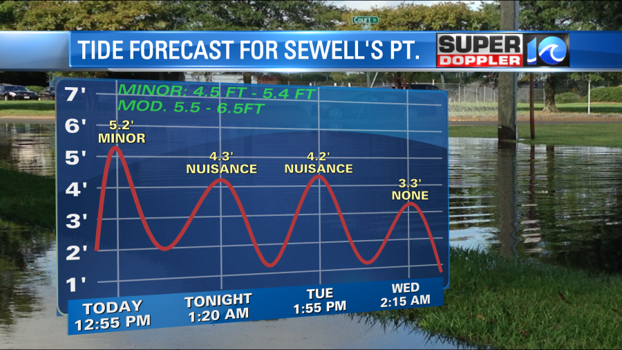
The tide is high because we have a very strong area of high pressure to our north and a rather large hurricane Teddy well offshore.
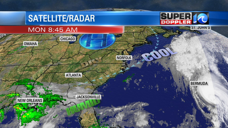
The wind between the 2 systems has been pouring out of the northeast for the past 2 days over a large area. This has created the tidal flooding, but it has also brought us some nice Fall-like weather. (Fall officially starts on Tuesday). High temps today will again be in the upper 60s to low 70s. We’ll have the northeast wind running at 10-20mph with gusts to 30mph. A few higher gusts will happen near the shore. However… tomorrow the high pressure will drop to the south, and Teddy will move to the north (more on that in a bit). Locally, this will create a sunny day with a lot less wind. High temps will be in the lower 70s. The breeze will be out of the north at 5-15mph. We’ll stay dry all week.
However, temps will warm up as we see many quiet days with sunshine. We’ll be closer to 80 degrees Wednesday and Thursday.
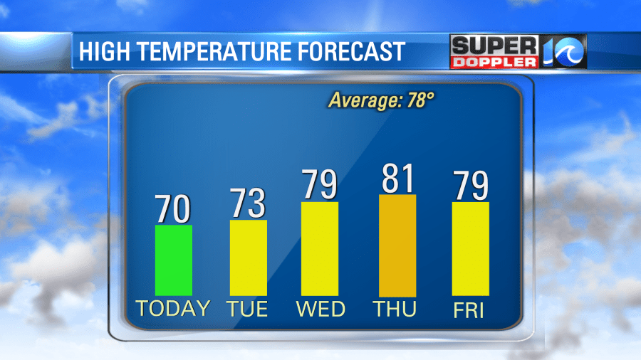
We’ll have more nice weather on Friday, but there may be some more clouds and isolated showers on Saturday.
The tropics have adjusted again. Wilfred is gone. The remnants of Paulette could re-form over the eastern Atlantic. Hurricane Teddy is passing east of Bermuda today, and Tropical Storm Beta is affecting the Texas coast.
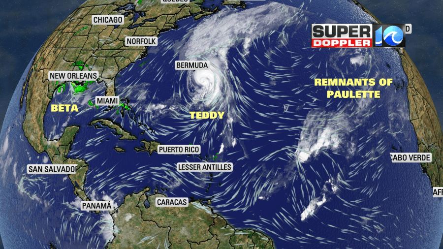
Hurricane Teddy is affecting our region with high waves. Waves are running about 4-8 feet along the shore. They are over 10ft just offshore. It’s too rough for surfers, and it’s too dangerous for swimmers. I guess it could be worse. I read that the waves along Bermuda’s coast are up to 20ft. There’s talk about waves as high as 100ft as Teddy moves north towards Nova Scotia in a couple of days. It is forecast to move there later this week as a nor’easter.

Meanwhile, tropical storm Beta has been roaming over the Gulf of Mexico for days.
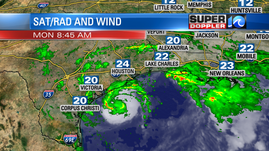
It has pushed a lot of rain onto the coasts of Texas and Louisiana. Beta is forecast to make landfall sometime either late today or tonight just southeast of Victoria Texas. After that point it should hook to the north/northeast and become a depression. It should fall apart over Mississippi in a few days.
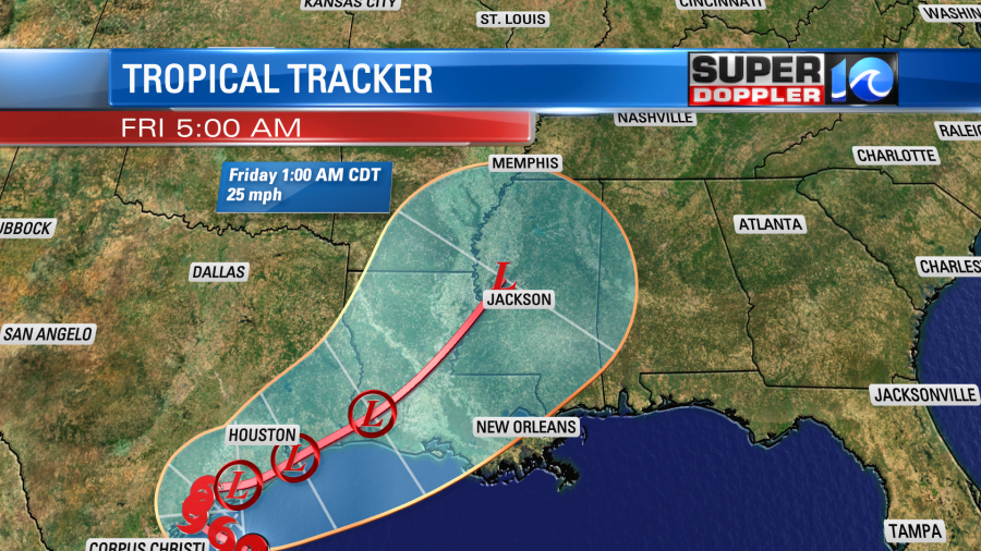
It shouldn’t have an impact on our weather as the strong high blocks Beta. Stay tuned for updates.
Meteorologist: Jeremy Wheeler