This morning was rough. As expected there were some very heavy downpours over Hampton Roads between about 2-5am.
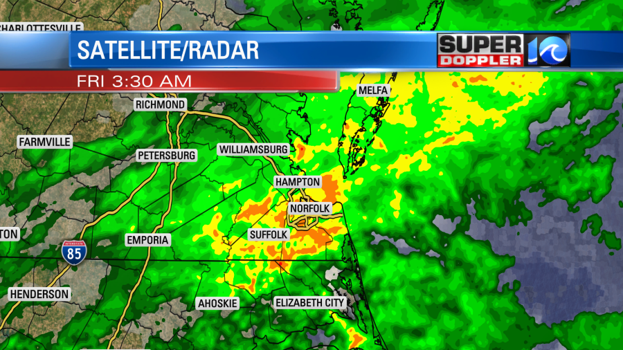
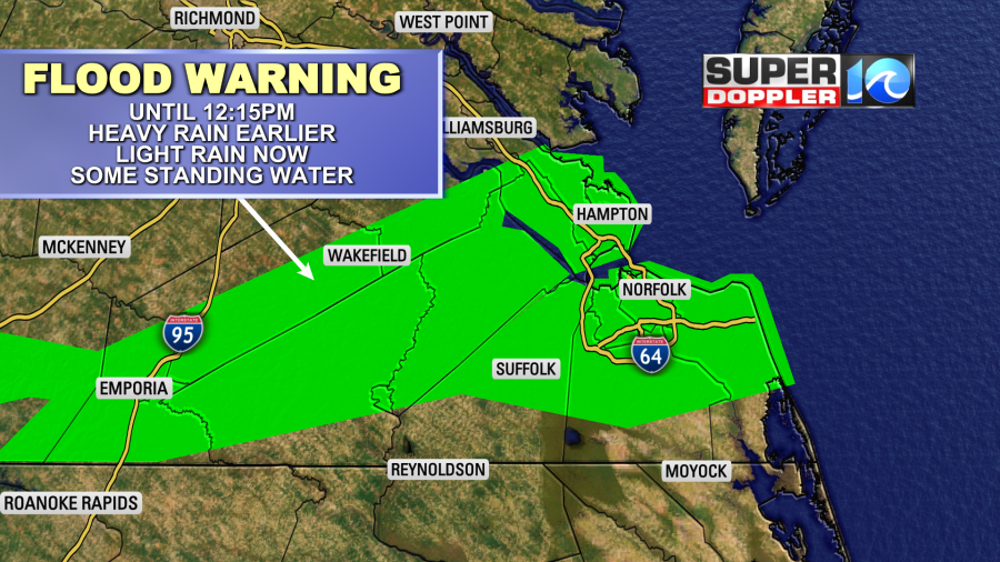
This created lots of flooded roads. There were numerous Flash Flood Warnings. After the heavy rain moved out, some light rain stuck around. So the warning turned into longer-term Flood Warnings for Hampton Roads and points westward.
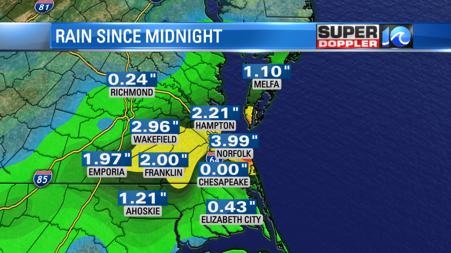
The rain totals were impressive. Just between midnight and 8am we had about 2-5 inches of rain.
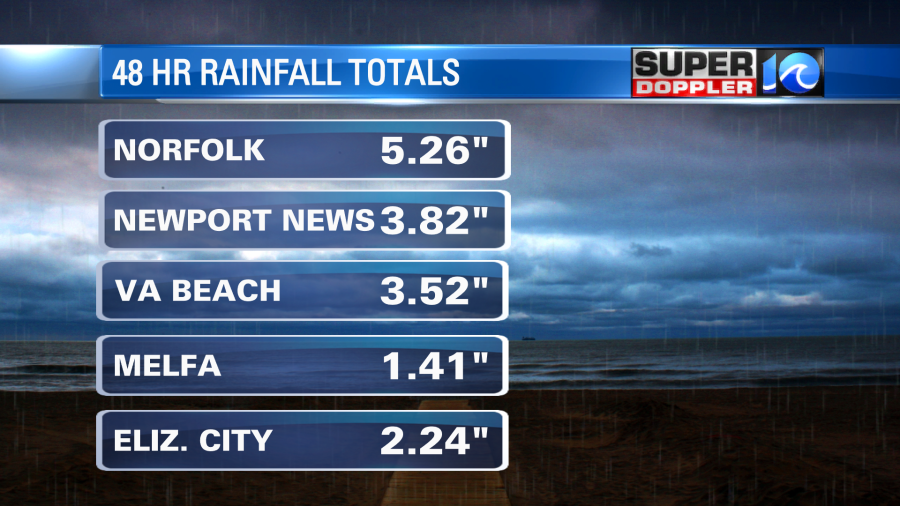
Here are some of the 48 hour rain totals.
The remnants of Sally moved through the region, but it was also wrapped up in a couple of fronts.
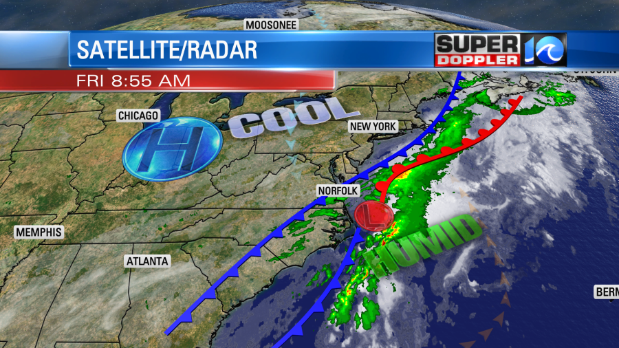
The remnant low moved out to sea, and the heavier rain went with it. However, a large cold front was dropping to the south. The front will drop to our south through the day, but moisture will come in off of the ocean. There will also be some upper level energy overhead. This will bring us more scattered showers into the afternoon.
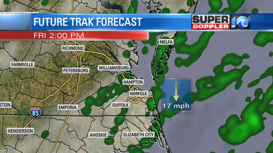
Rain amounts should be much lighter going forwards. We’ll probably only see another couple tenths of an inch up to a half an inch. We’ll be cloudy with a few possible breaks in the clouds late. High temps will be mainly in the lower 70s. Winds will stay strong out of the north/northeast. They will run at 10-20mph with gusts up to 30mph. This could produce some nuisance to minor tidal flooding today. This tidal flooding will increase tomorrow as the northeast winds stay up. The fetch (distance that the strong winds blow over) will increase tomorrow. So the tidal flooding is forecast to go up to moderate levels.
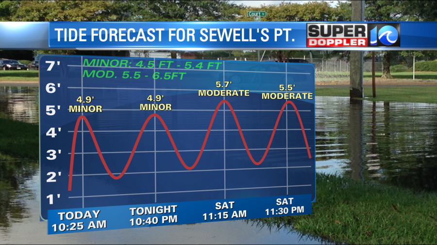
The tidal flooding could reach up to almost major levels on Sunday. At least that’s what the models are showing. However, I’m a bit skeptical for now. Yes, we are in a new moon phase. So there’s a higher than normal natural tide. However, we should be mainly dry this weekend. Plus, the winds shouldn’t be severe. So I do think we’ll have moderate tidal flooding, but we’ll see if we hit major levels (6.5ft or higher for Sewell’s Point). I do think the busy tropics will keep creating some higher waves along the oceanfront regardless of the high tides. More on that in a moment.
We’ll have a mix of sun and clouds tomorrow with some spotty showers for the first half of the day. As mentioned, the breeze will stay strong out of the northeast. Gusts will be up to 30mph. So high temps will only be in the upper 60s with a few 70s inland. A huge area of high pressure will build in to our north. It will build a little closer to us on Sunday. So we’ll have partly cloudy skies, and the wind will stay up out of the northeast. High temps will be in the upper 60s to low 70s. Low temps will be in the 50s. This setup could continue into Monday, but I’m hoping that the winds die down a bit. (though the models don’t show that). We will have calmer weather Tuesday onward. Temps will rise steadily, and it looks fairly dry. Other than the tidal flooding, next week’s weather looks pretty good.
The tropics are still busy. Hurricane Teddy is a major hurricane in the central Atlantic, and tropical depression 22 has formed in the western Gulf of Mexico.
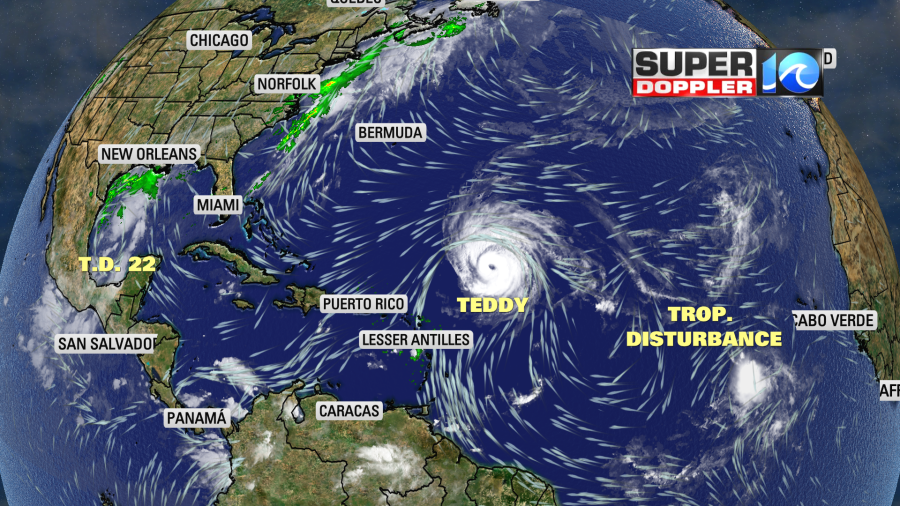
Teddy is forecast to move to the east of Bermuda as a category 2 storm in a few days.
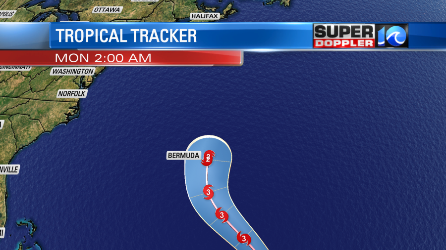
Then it is forecast to jet quickly to the north. That would have it making landfall over Nova Scotia Canada around the middle of next week.
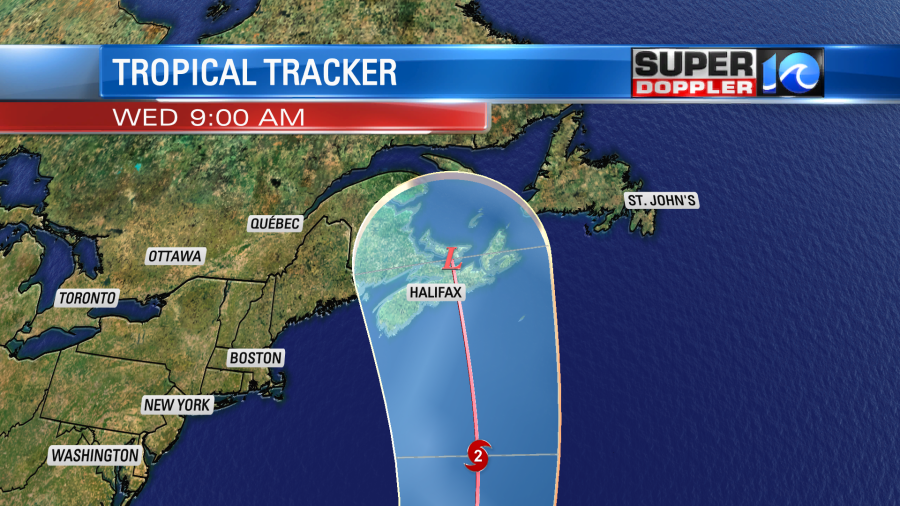
This strong storm will have some very high waves over the ocean. It will keep the higher than usual waves rolling onto the east coast. We’ll have a higher threat for rip currents for a while.
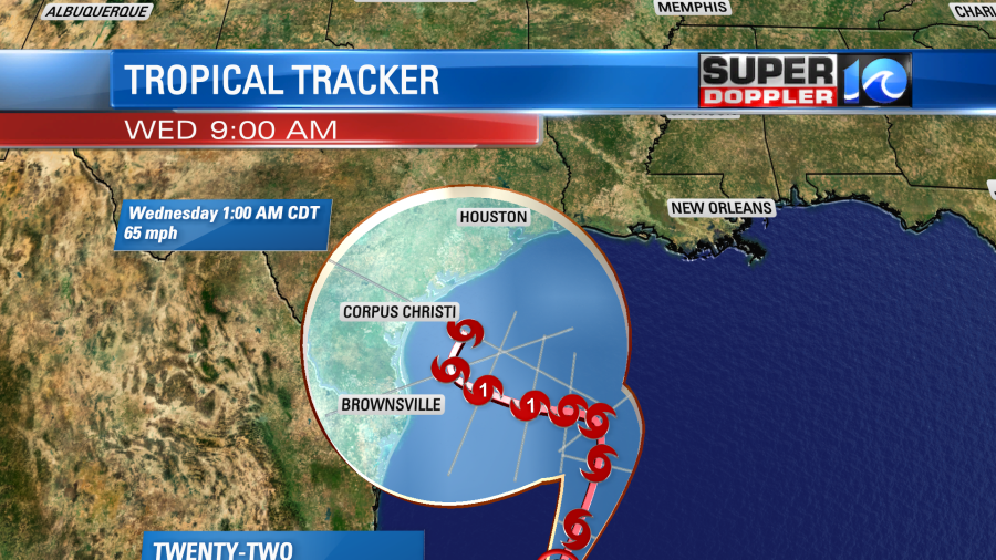
Tropical depression 22 is going to meander around the Gulf for a while. It could become a hurricane in a couple of days. It’s tough to say where it will go as the steering currents are weak. There’s a decent chance that it will make landfall somewhere along the Texas Gulf Coast next week.
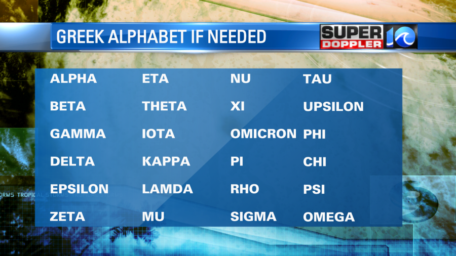
It’s a guarantee that we will have to tap into the Greek alphabet now for hurricane names. Here is the list of names:
Stay tuned for updates on the tidal flooding over the weekend.
Meteorologist: Jeremy Wheeler


