Before I go into the current and future weather, I want to briefly mention the past. Last night we had a cluster of strong thunderstorms form over the area. This formed near Richmond, and then dropped to the southeast.
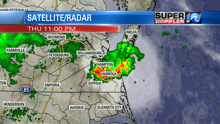
There were several warnings, and there were a few damage reports and power outages. There was also a lot of lightning. Those storms dropped to our south before sunrise. Then we had quiet weather for the rest of the morning. This was not connected to Laura.
Tropical Depression Laura is churning over the mid-Mississippi River valley today.
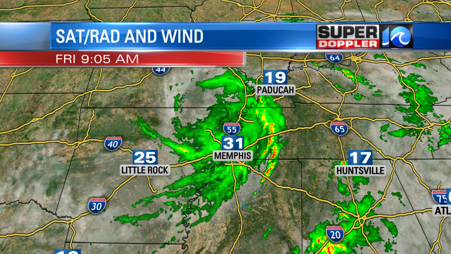
It has weakened dramatically from yesterday. It’s basically now just a rainmaker, but there are a few strong gusts surrounding the storm. There will also be a chance for isolated tornadoes out there today. Locally, we have high pressure in the region with a warm front to our north.
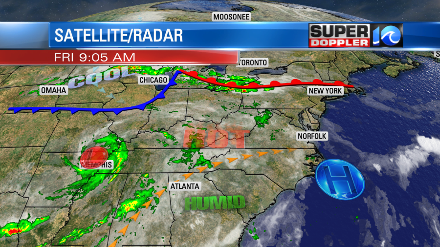
We’ll be partly cloudy today. It will be hot and humid again. High temps will be in the mid 90s with the heat indices in the upper 90s to lower 100s. There will be a light breeze out of the west, but it won’t be as strong as yesterday’s winds.
Tomorrow Laura will weaken even more. It will likely become non-tropical as it moves east/northeast. Meanwhile the cold front in the Midwest will drop quickly to the southeast.

To me it looks like the surface low will completely fall apart. At least it looks that way on all of the models that I analyze. However, some of the upper level energy does hold together. Whether the low holds together or not there will be a big area of tropical humidity east of the cold front. So that will be plenty of fuel for thunderstorms to form. There will also be some upper level wind shear. Remember, that tends to weaken tropical systems, but it aids in severe thunderstorm potential. So a broken line of showers and storms will move into our region during the afternoon and early evening, and some of them could pack a punch.

Keep in mind that Saturday won’t be a washout. The first half of the day looks fairly quiet. Maybe just an isolated shower. The general wind will be out of the southwest at 10-15mph with gusts to 25mph. Some of the storms could contain severe winds. Heavy rain will be possible but briefly. Amounts are forecast to run between a quarter of an inch up to an inch. We may also have some isolated tornadoes in the region. If the non-tropical low does hold together, then that threat could be elevated. High temps will be in the upper 80s, but again…it will be humid. All of this moves out by Saturday night. Then we’ll have some really nice weather on Sunday and Monday. High temps will be in the lower 80s with fair skies. It will be much drier.
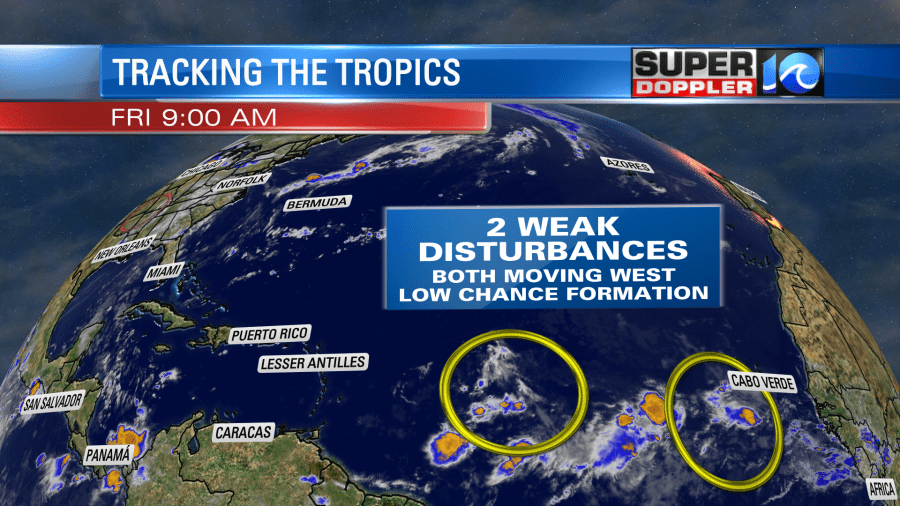
I hate to say it, but the rest of the tropics are not quiet. We have 2 tropical disturbances in the Atlantic that are moving west. For now they both have a low chance of formation.
Stay tuned for updates on the chance for storms tomorrow.
Meteorologist: Jeremy Wheeler

