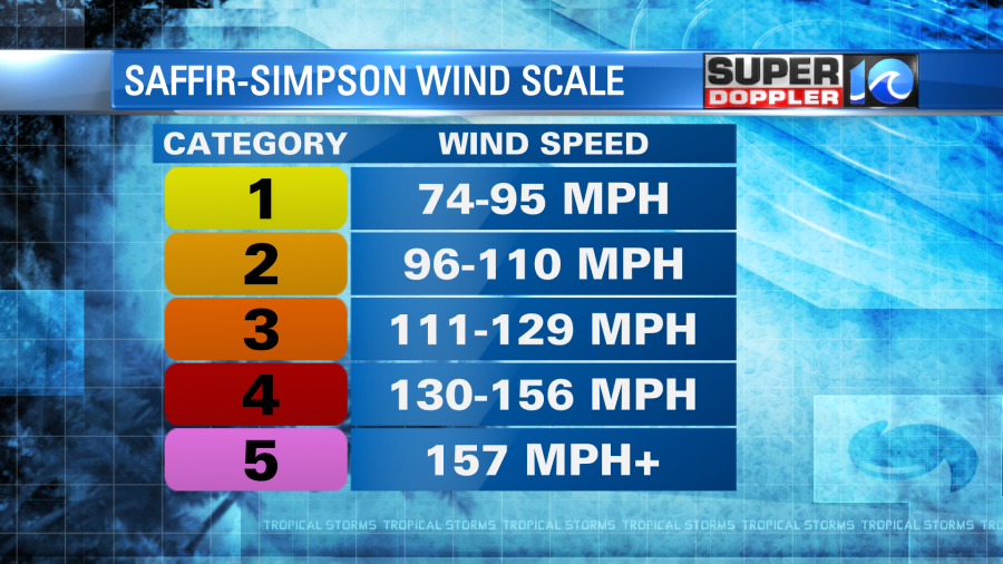
Hurricane Laura made landfall Thursday morning as a Category 4 hurricane.
Sustained winds at the time were around 150mph. That’s actually not too far from a Category 5.
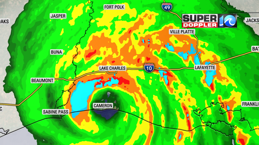
As the storm moved north the eye slowly started to fill in, and the surface winds gradually weakened. As I write this Laura has dropped down to a Category 2 hurricane with winds of 100mph.
The forecast is for Laura to move north today through northern Louisiana. It’s possible that it could weaken to a tropical storm later today, but the official forecast keeps it as a Category 1 hurricane up until just south of Little Rock Arkansas.

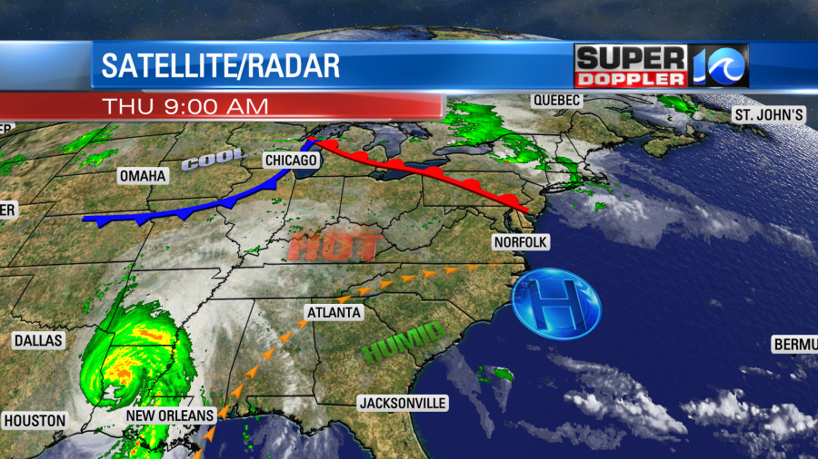
The system will begin to interact with a cold front on Friday as it moves to the east/northeast. It will weaken to a depression. Then as the system moves into Virginia it will likely become a non-tropical low.
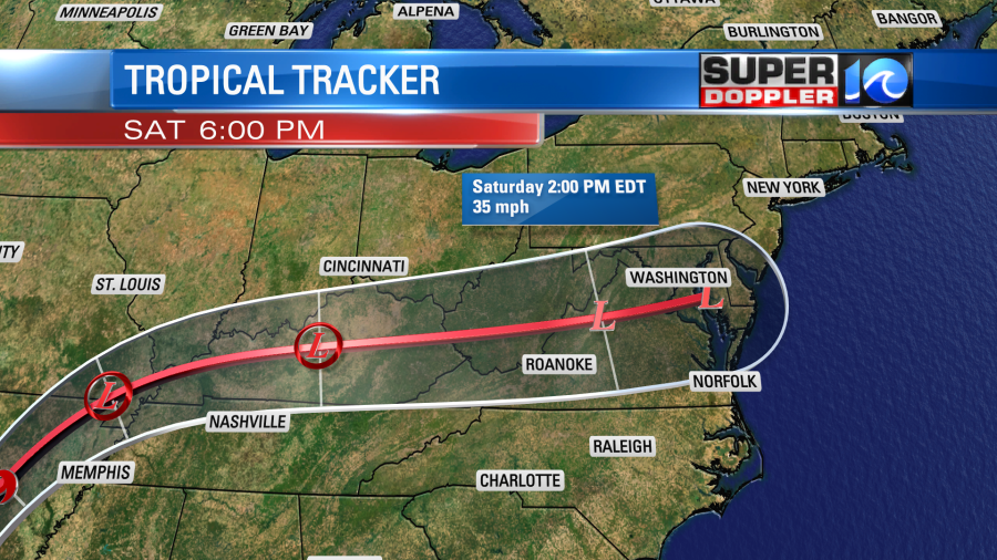
It may be absorbed into the actual front itself. I’ll talk more about that in a bit when I go more into the forecast models.
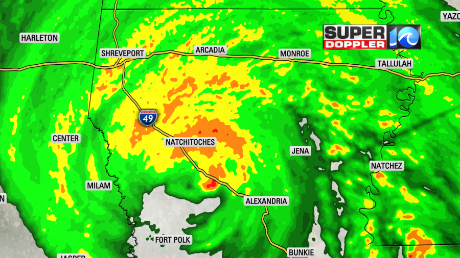
Going forward there could be 2-4″ of rain in the path of Laura up into central Arkansas. The GFS model doesn’t have too much rain for us through Sunday.

The bulk of what you see will come in Saturday afternoon or evening. Then we’ll likely dry out on Sunday.
The models have done a good job with the track of Laura up to this point, but they underforecast the strength. The models are in pretty good agreement in the track up through the Appalachians. Then they split a little bit on Saturday.
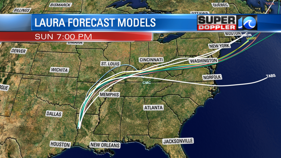
Yesterday I mentioned that the European and the GFS models were split. The GFS model had Laura falling apart, and getting wrapped up into the cold front. The Euro had the low moving through our region intact (though weaker than off to our west). Today the models have come into better agreement. The GFS still has the storm dissipating, and the cold front sweeping through. Now the Euro has trended in that direction. However, it doesn’t really dissipate the low until it gets right into our region. Here is the Euro Saturday evening.

The NAM model also follows the GFS in having Laura falling apart along the front. All of these scenarios have the system (or front) moving out to sea on Sunday. It’s possible that the low could reform as a non-tropical low. There will probably be a few strong gusts of wind near the shore. It’s still a bit early to have the specific gusts though. We’ll likely have some pretty nice weather following the system as it moves to the northeast.
Locally, today we have high pressure nearby. There is a warm front to our north.
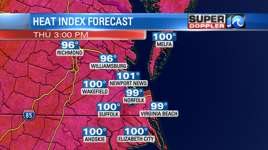
It is going to be very hot and humid. High temps will rise to the mid-upper 90s. The record is 98 degrees (1987). I’m calling for 96. The heat index will be in the upper 90s to lower 100s.
We’ll be mostly sunny with a few more clouds and a stray shower or storm later in the day. We’ll have similar weather tomorrow. Then on Saturday we’ll have more clouds and increasing rain showers. High temps will be in the upper 80s. I mentioned nicer weather on Sunday… High temps Sunday and Monday will be in the low-mid 80s with lower humidity. It should be awesome, but a bit breezy at times on Sunday.
Stay tuned for updates to all of this.
Meteorologist: Jeremy Wheeler


