Update on the tropical information. See below.
Today is looking fairly decent overall. It will be pending this stationary front that lies just to our south.
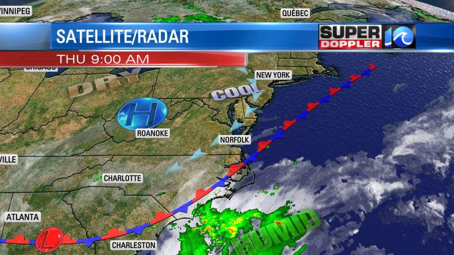
The front is forecast to sink south just a little bit more this afternoon. There is already a northeast wind in place. It should pick up a little bit. We’ll be partly cloudy today with a few pop up showers and storms this afternoon. They will push inland/west later this afternoon/evening thus lowering the rain chances near the coast.
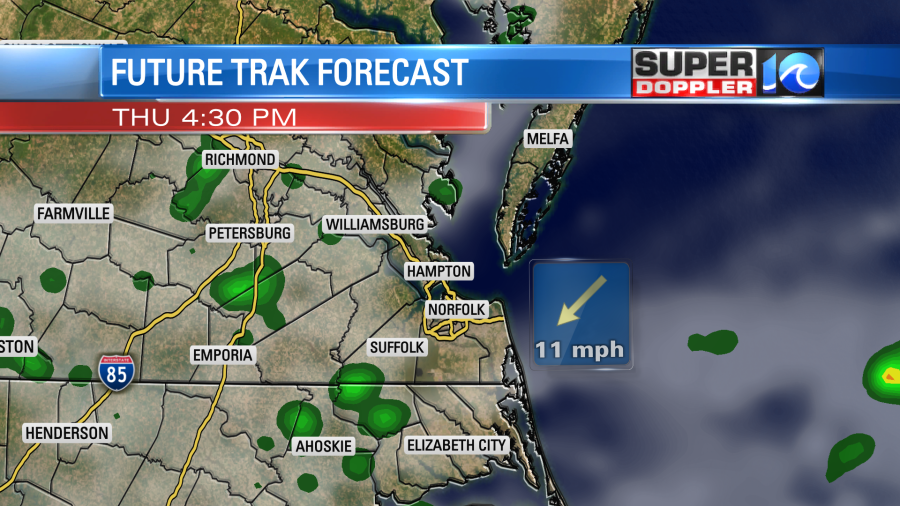
High temps should be held down a bit. They will be in the low 80s near the shore with mid 80s inland. A few upper 80s will be possible. Tomorrow the front will bump back north a bit. So the rain chances go up a little as well. So do the high temperatures. They will be in the mid 80s with upper 80s inland. We’ll have similar weather on Saturday. Neither of those days will be a washout, but the chance for rain is pretty decent. Then on Sunday we’ll finally break the pattern. High pressure will build south into the region. Basically, it will merge with the Bermuda high. So we’ll have very little rain from Sunday into the middle of next week. However, high temps will run into the 90s during that time as well.
Things are fairly active in the tropics. There is a tropical disturbance that is likely becoming the next tropical depression (or storm) in the central Caribbean Sea. Then we also have tropical depression 13 east of the Lesser Antilles.
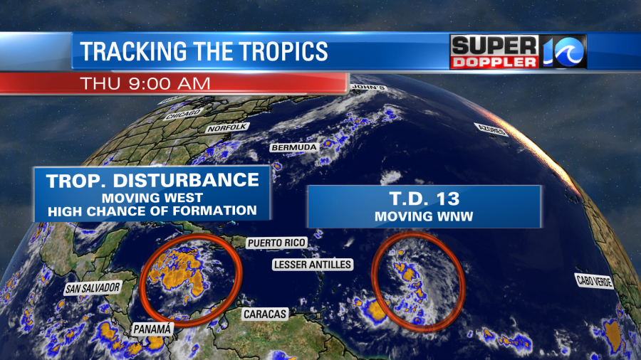
There is another wave just coming off of Africa that could form into another system in several days.
The models show the Caribbean disturbance moving west/northwest and impacting the Yucatan Peninsula in a couple of days. A few do keep it over the water and then push it into the Gulf of Mexico.
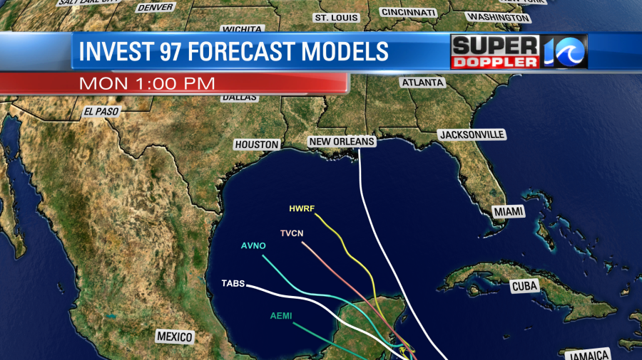
I think based off of it latest track it would likely interact with land before moving into the Gulf. We’ll see. After that it would likely restrengthen over the Gulf.
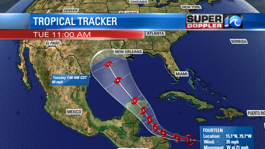
Update: Tropical Depression 14 has formed. Here is its latest track:
Tropical Depression 13 is moving quickly to the west/northwest at close to 20mph. There is some dry air nearby. So that may be why it has remained weak in the short-term. There has been some wind shear along its past path. However, that has weakened a bit. It is over very warm water. so some strengthening is forecast. It is expected to become a tropical storm and pass north of the Lessern Antilles and Puerto Rico. After that point the track is fairly uncertain.
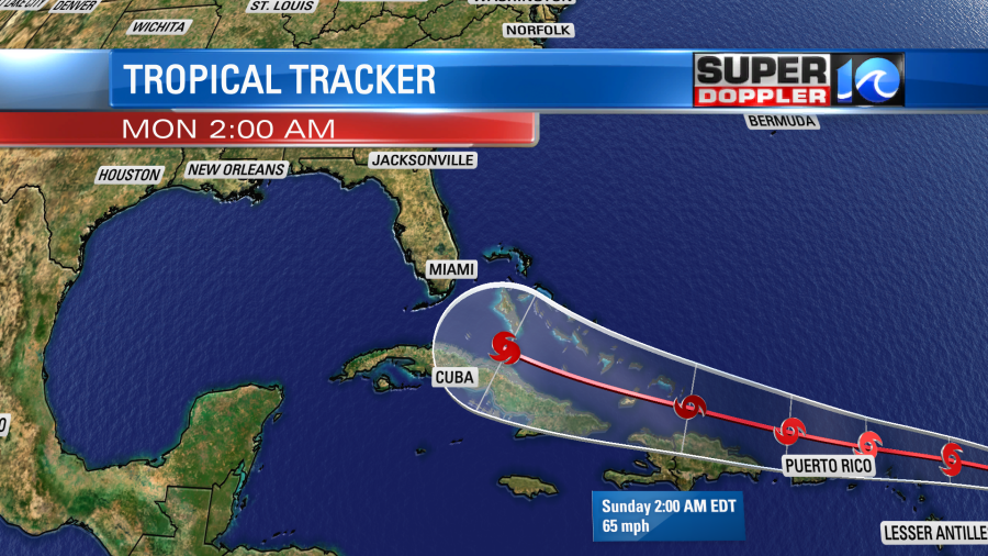
It could pass a little more south and interact with Cuba or Haiti. It could also pass a little more northward and interact with the Bahamas. That would weaken the storm. However, there is more of a consensus that it will thread the needle and stay over water. Then those models have it going into the Gulf of Mexio.
Update: The National Hurricane Center has the storm as a category 1 hurricane in 5 days.
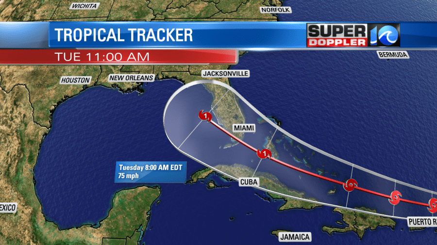
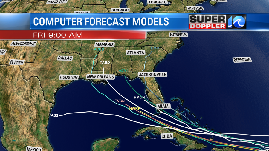
The latest official track has it close to the southwest coast of Florida early next week. It’s still early. So we’ll see how the models trend over the next few days.
Meteorologist: Jeremy Wheeler


