Isaias is making its way through the Bahamas and headed towards the east coast of Florida. As of the 8AM update, the eye of the storm in 50 S of Nassau and moving NW at 12 mph.
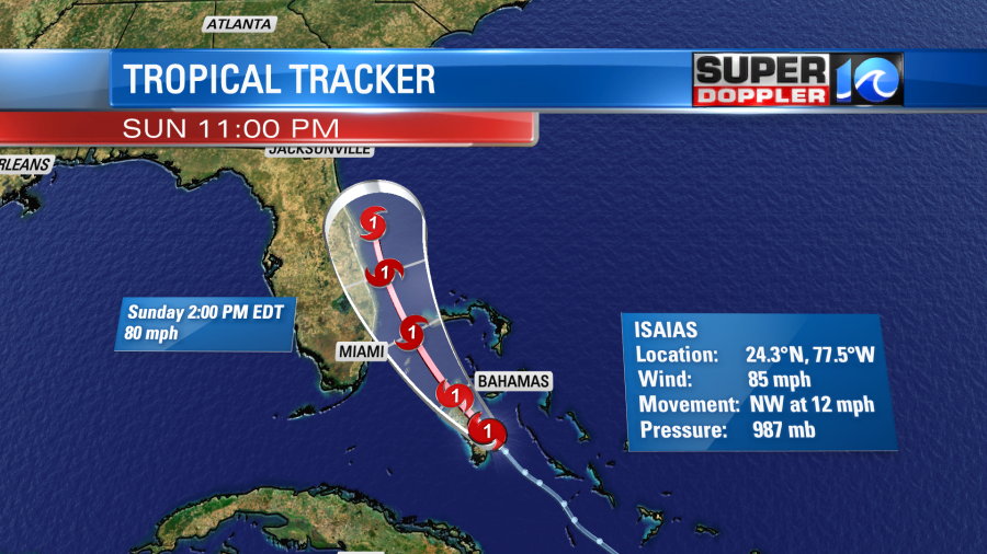
The timing of this storm has slowed a bit, so that will make the biggest impacts for us on Tuesday. But we will even start to see some of the impacts this weekend with increased swell and a moderate risk for rip currents. The bigger impacts though is what everyone needs to keep their eyes on.
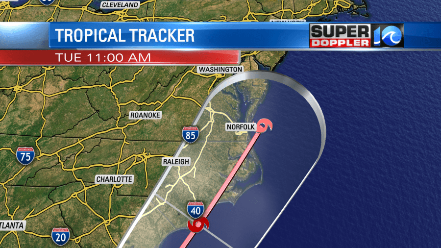
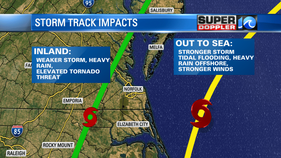
While the red line does show the predicted track of the hurricane, the eye of the storm can be anywhere in that cone. That significantly changes the impacts we would see! More inland means less rain overall but higher risk for tornadoes. If it stays out to sea, we’re looking at a higher rain totals, stronger wind gusts, etc. Most models do have a more inland track but that can’t be written in stone just yet!
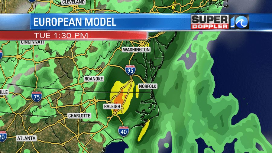
The European Model is one of models that we use, so I’ll use this output as an example of the outcome we could see. But each model does vary! The Euro has a more inland track, which puts heavy rainfall amounts near the I-95 corridor.
This update has the timing a little slower than previously thought. This would put the heaviest rain throughout Tuesday.
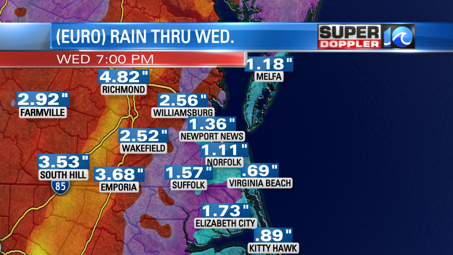
If the storm does take the more inland route, the highest rain totals would be for the western side of the viewing area.
Either way, expect strong winds and heavy rain with flooding possible. Prepare this weekend! If you need any essentials, head to the store now in case there are power outages. We’ll keep you updated as this changes!
-Meteorologist Casey Lehecka