Well… Last night was a non-fun smack in the face. At least meteorologically speaking. I did call for a wintry mix with a brief changeover to snow, but no model yesterday morning caught what happened last night. (Though Future Trak ironically did have a close solution the day before). Don Slater increased the forecast and did call for some light accumulations last night. Mostly on grassy areas. However…..it was COMING DOWN and it did stick to the roads! Why?
Well, some folks thought it was purely because there was a nor’easter out there. True, there was a developing area of low pressure at the surface, but it was already offshore. There was actually a potent upper level system that had moved in yesterday evening.
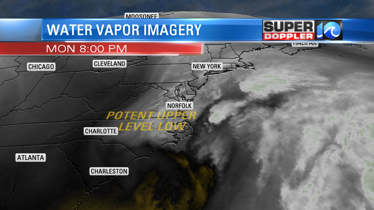
This created some heavy precipitation in our area. It was rain over most of the region at 5pm. The rain became heavy in many locations.
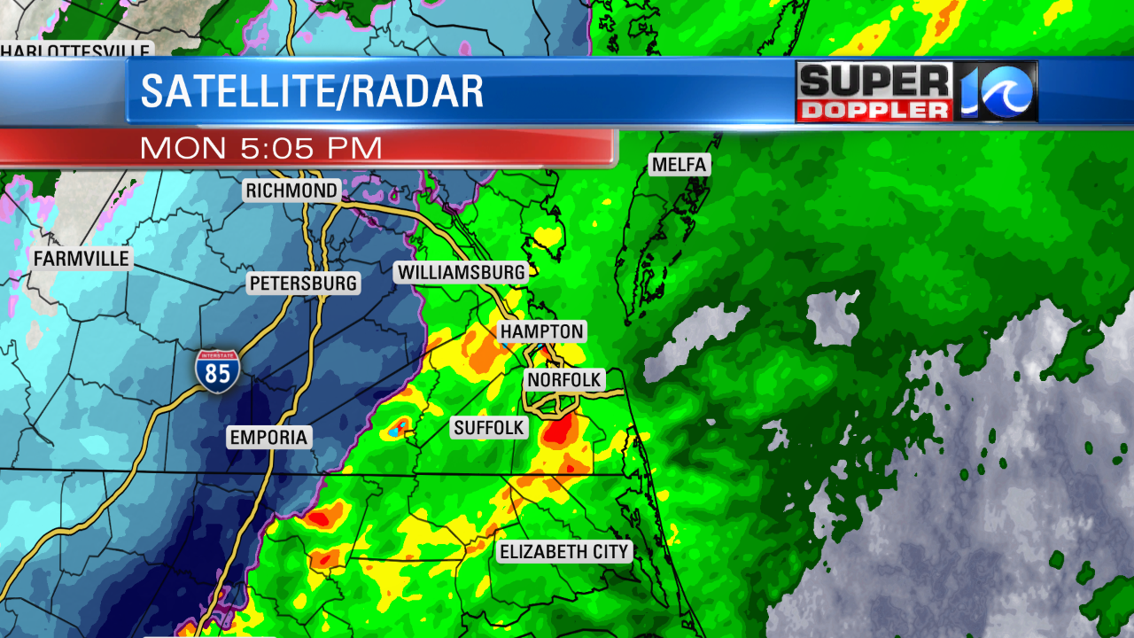
However, a band of heavy snow had formed inland by that time. It was misleading on the radar because it showed heavy rain over some areas that were already changing to snow. In reality it was heavy wet snow falling. This caused bright-banding. That is when you have very wet snowflakes (partial melting). It reflects the radar beam back to the radar system with a very strong return. In essence…the radar thinks that the big wet snowflake is a giant raindrop. That shows up as the orange and red areas on the graphic. So that happened last night. Then the radar caught up as the band of heavy snow moved east during the evening.
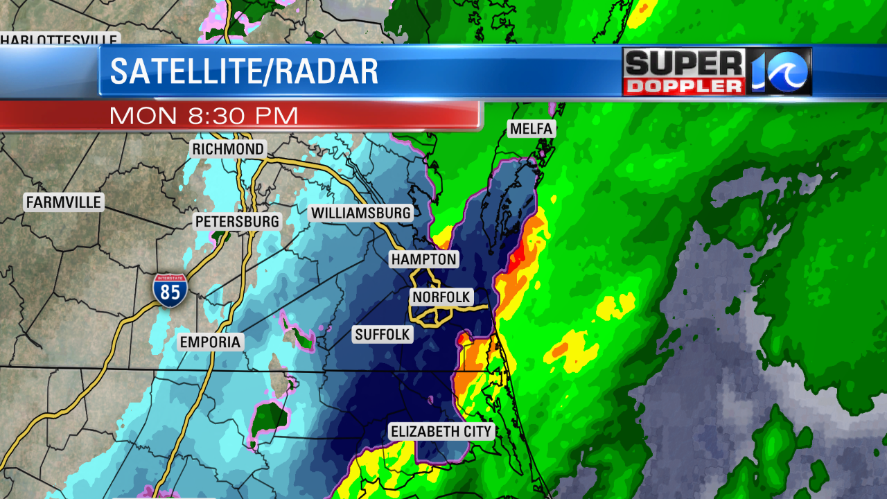
Surface temps were well above freezing. Colder air was aloft in the metro at first.
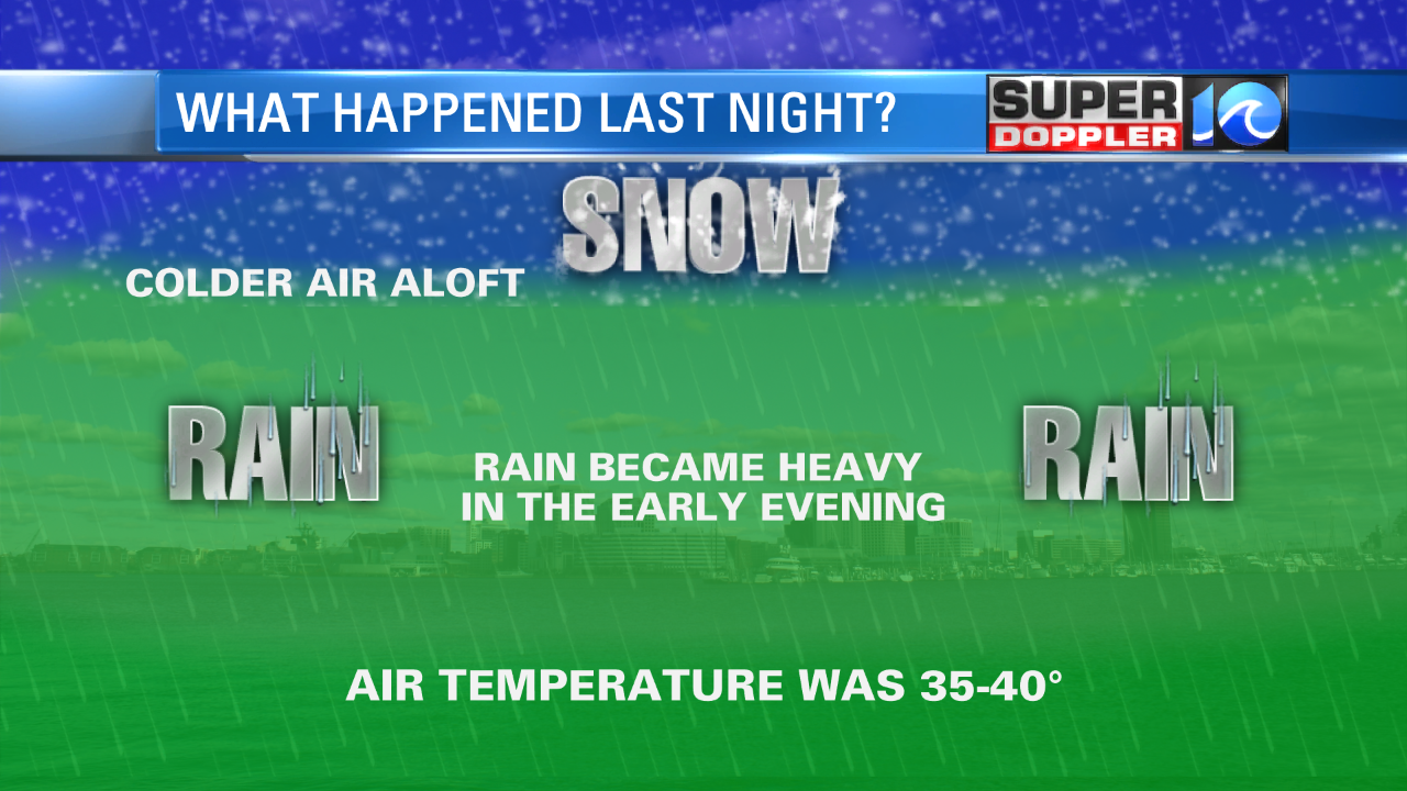
Then the heavy precipitation dragged down the colder air from aloft. The temperatures dropped at the surface down to the low 30s in about an hour to an hour and a half.
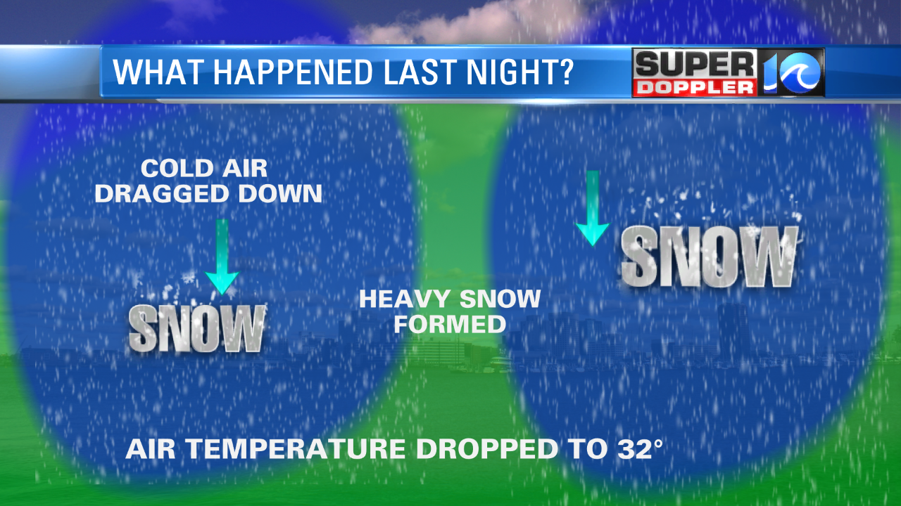
This allowed the snow to make it to the ground. The ground/soil temperatures were well above freezing. In the 40s I believe. However, if you keep throwing snow on the ground, then eventually you cool the surface. Snow was so heavy last night that I could barely clean off my car. (Yes, I was out at a scout meeting for a while). ((We quit early)). So we caught about 1-2″ in the region with a couple of spots getting 3″. However, even by the time I got home the snow had stopped and melting was occurring. It actually felt like it was warming up after the snow stopped. Overnight surface temps were mainly above freezing in Hampton Roads with some freezing temps inland. A lot of the snow had melted by the time I got to work. Here is what I saw this morning.
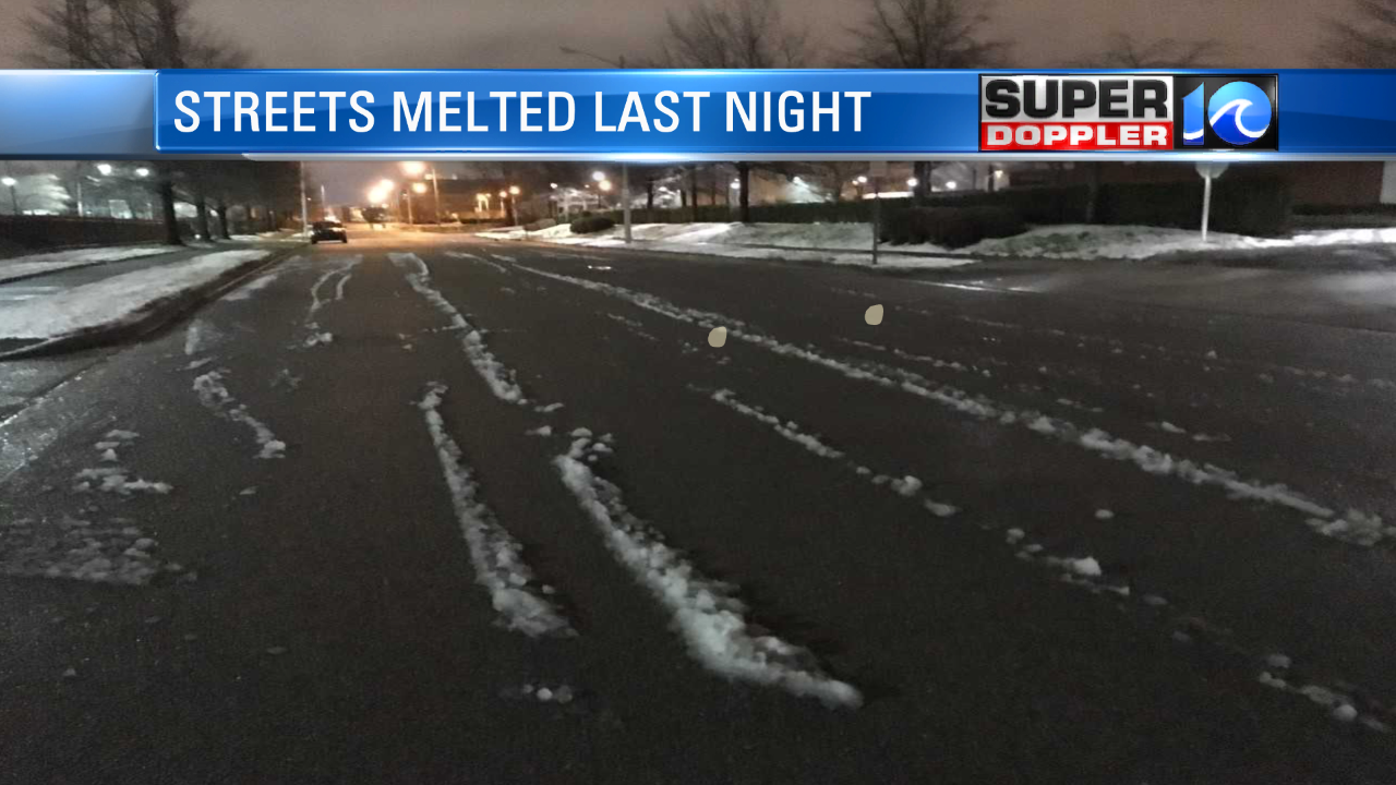
That road was covered in snow last night. There were several roads and bridges that had ice on them. Even where roads were just wet, we had lots of traffic problems. So that is what happened. I feel bad that I didn’t catch it, but I tried to show that it was a local and exceptional situation.
Now…going forward. The low has moved well offshore to our northeast. Now it is going to wreak havoc across the northeast states today. Some locations up there will get over a foot of snow through tomorrow. This is system number 3 for them. All within 2 weeks of each other. Meanwhile, we have high pressure building in here.
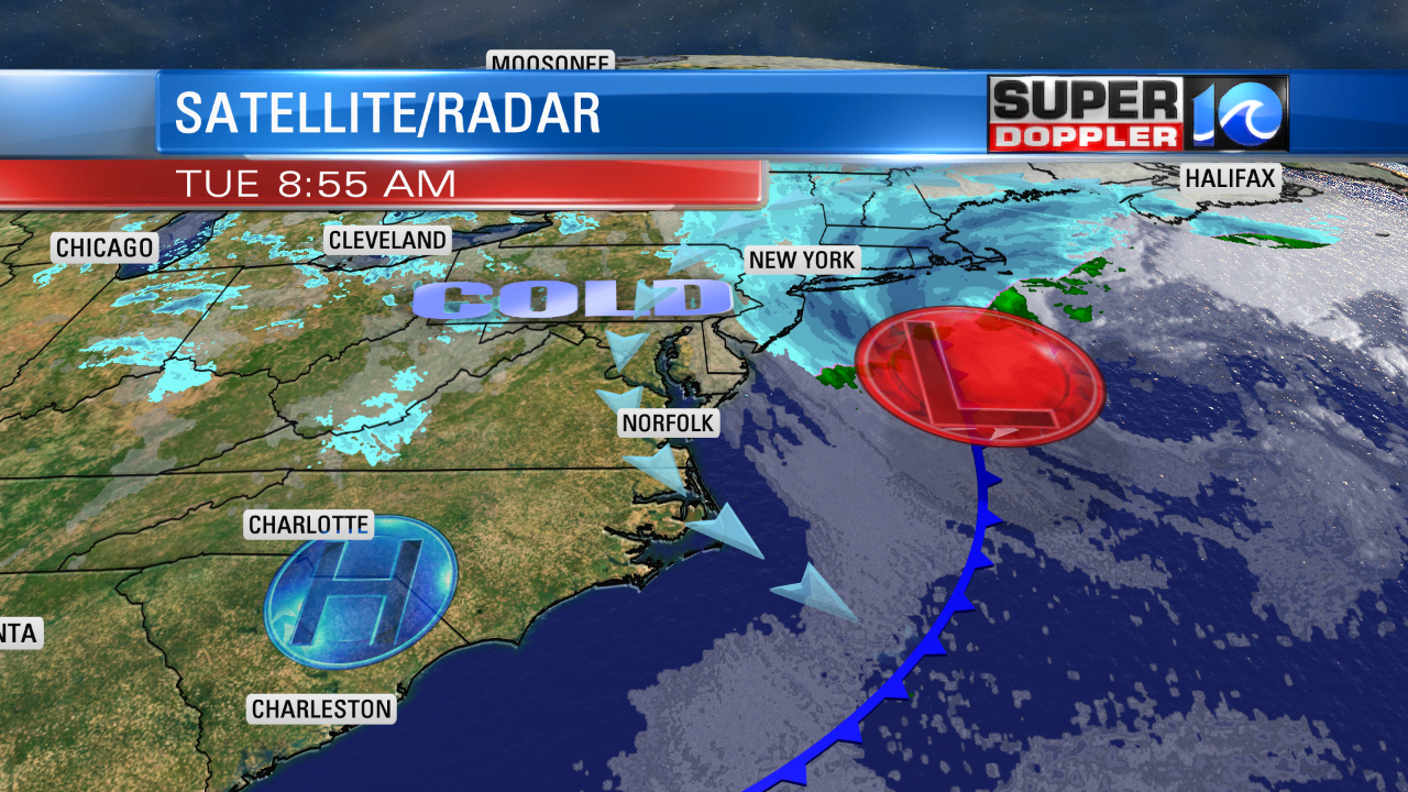
The wind is up between the 2 systems. We had some gusts to 30mph near the shore. Winds will be out of the northwest at 10-20mph with gusts to 30mph this morning. Luckily the wind will taper off through the day. It will be more westerly at 10-15mph by the late afternoon. A few gusts to 20mph.
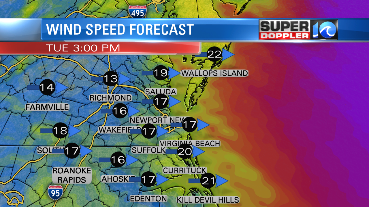
Temperatures will rise to the upper 40s. If we’re lucky then we’ll have a few 50s. We’ll have fair skies all day. Tonight we’ll have mostly clear skies. Temperatures will drop down to the low 30s with a few 20s inland. For part of the morning tomorrow there will be a weak disturbance in the region. We may see a few flurries early. It should be no big deal. And this time the atmosphere will be much drier and calmer compared to last night. We’ll have a mix of sun and clouds through the day. Highs will only be in the 40s again. We’ll have some nice weather Thursday and Friday. Highs will be in the mid-upper 50s with partly cloudy skies. There may be a stray shower by Friday evening. That will be a cold front. The front will drop temps on Saturday for a bit. Highs will be back in the 40s. However, we’ll get back to some warming Sunday into Monday. Highs will be in the 50s and 60s. For now things look dry for the St. Patrick’s Day parade. Hopefully, that doesn’t change. They’ve often had rain on that parade. No pun intended. It’s rain or shine. Anyway…stay tuned for updates and thanks for your feedback about last night’s weather.
Meteorologist: Jeremy Wheeler

