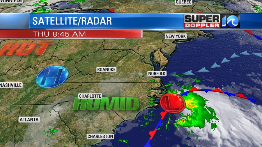
We’ve been tracking an area of low pressure for a few days now. Even last weeks some of the forecast models showed a coastal low near the region. It started near the Gulf Coast, but now it has moved up closer to our region. Today it is moving along the North Carolina coast. There is a large area of rain well east of the center, but scattered showers are reaching north of the rain shield.
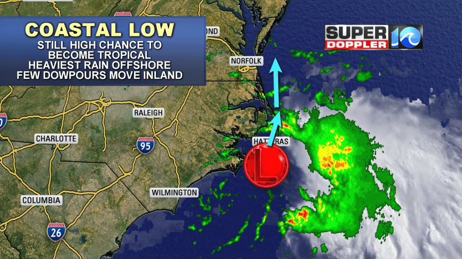
The system still has a high chance of becoming a tropical or subtropical system. However, even if it does become tropical it should have only minor impacts on our region. The low has been moving northeast along a stationary front. Now it is forecast to move more northerly.
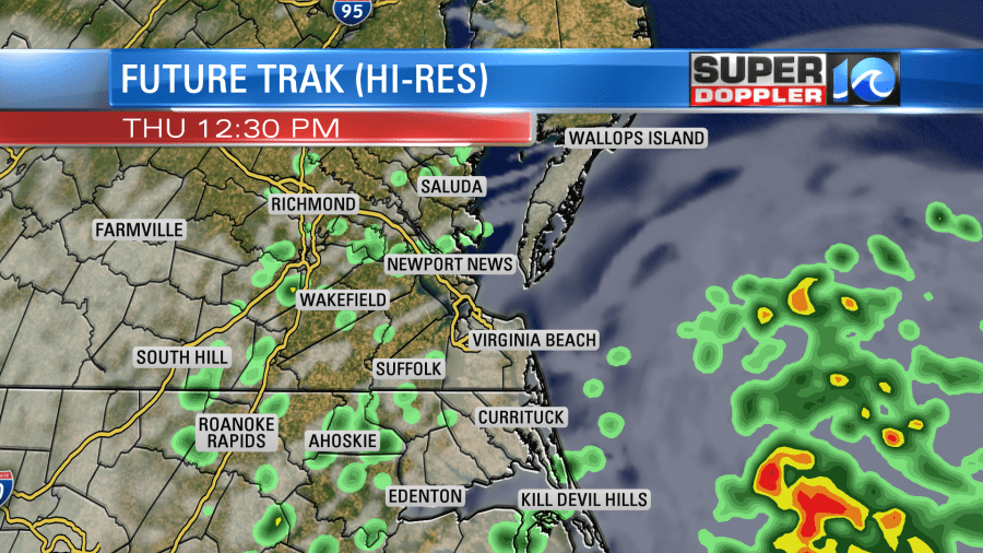
The big area of rain is forecast to stay offshore, but the models do show scattered showers moving in off of the ocean and pushing to the west. These could contain several heavy downpours.
We’ll have a mix of sun and clouds along with the scattered rain showers. Winds will increase today. We’ll have an east/northeast wind at 10-15mph, but some of the gusts will be up to 25mph. Especially near the shore.
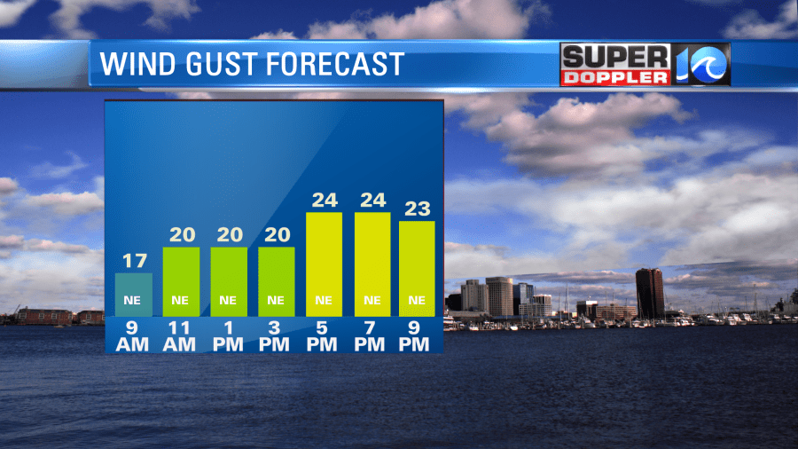
A few gusts could be up to 30mph near the shore, but that’s still not strong enough to cause a lot of problems. No severe winds are expected today. Tidal flooding looks minimal. At most there may be a little nuisance tidal flooding up to low-end minor. The onshore breeze and building clouds should keep the high temps in the mid 80s. However, it is very humid. Dew points are in the mid 70s. Luckily the breeze will help a bit with how it feels.
By this evening the low will move north. Some of the models are now allowing some of the bigger areas of rain to move west to near the coast/shore. Some heavy rain could move onto the Eastern Shore early tomorrow morning
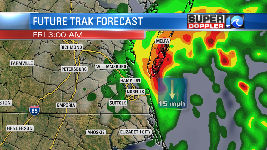
This could be good news for a few areas north of Hampton Roads.
The low will steadily move north tonight. Our Future trak model lingers the system near the Virginia/Maryland state line tomorrow morning. However, a few other models take it north into Maryland by then. Either way we’ll have less rain chances than today. Skies will become partly cloudy with some isolated showers during the afternoon. We’ll have a breezy northwest wind. However, high temps will still be able to reach to near 90.
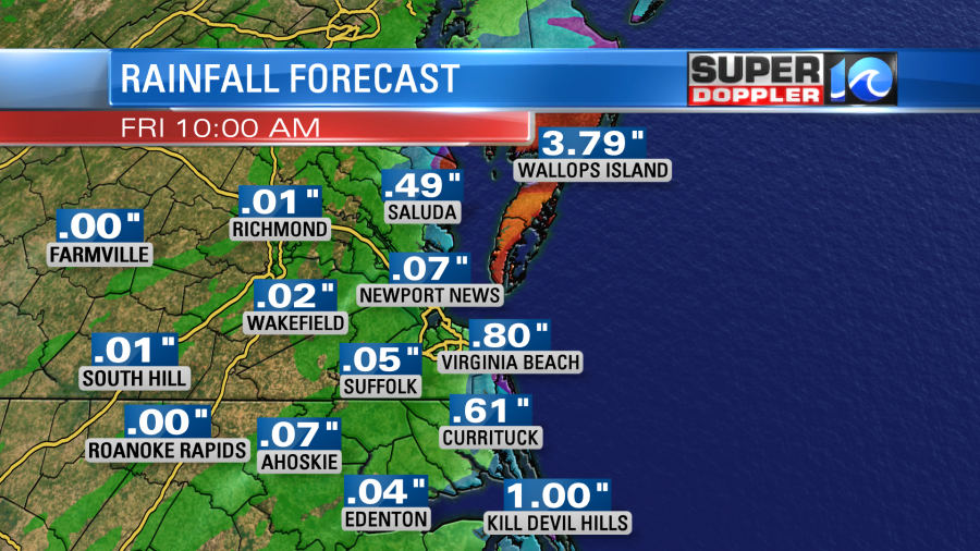
Before the rain ends Friday we’ll see widely varying amounts of rain totals. Inland locations are only expected to get a quarter of an inch up to possibly an inch. However, some locations along the shore could see 1-2″. It’s possible that the Eastern Shore could see the most rain out of everybody. Here is what Future Trak is forecasting:
The NAM model is similar in its trend:
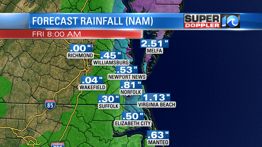
However, the GFS still has much less:

Stay tuned for updates!
We’ll have typical Summer weather over the weekend. Skies will be partly cloudy. We’ll have some scattered showers and storms popping up. Mainly in the afternoon. High temps will be in the 90s and it will be humid.
There has been a lot of heat over the rest of the U.S. lately. Power demands are high due to the large geographic area that this covers. This heat is going to build and migrate east by next week. I wouldn’t be surprised if we hit the mid-upper 90s locally during that time. We’ll have updates on that over the next few days.
Meteorologist: Jeremy Wheeler


