Yesterday we ended up hitting the 90s over much of the region. However, it felt like the mid-upper 90s with the heat index. We will have similar conditions today with a couple of subtle differences. We still have high pressure offshore. Today there is a warm front to our north. There is also a cold front to the west that is moving east.

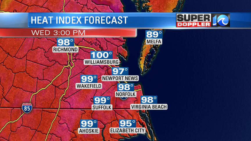
We’ll be in the hot zone today. Winds will pick up out of the south at 10-15mph with gusts to 25mph. That will push in the heat, and it will also stop any sea-breezes from forming. So high temps will rise to the low-mid 90s with the heat index in the mid-upper 90s. A few inland spots will probably hit 100 degrees (again…for the heat index).

The breeze will help a little. We’ll be partly cloudy today. Due to the higher heat and humidity, we will probably pop up some isolated showers and storms this afternoon.
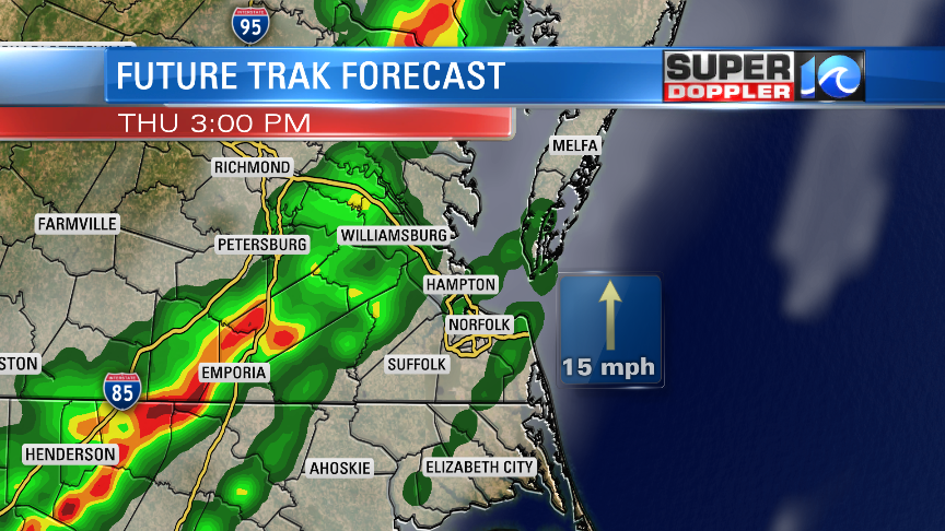
Tomorrow the front will get closer to us, but it won’t move in until late in the day. Probably even in the evening. We’ll have more clouds tomorrow. So that will hopefully cap the high temps to the mid 80s. It will be humid again though. So it will feel like the low-mid 90s with the heat index. By the afternoon we’ll have scattered showers and storms in the region. These will form ahead of the front.

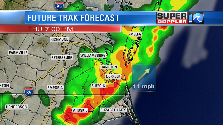
A line of storms will form and move in during the evening. Rain will be heavy at times along the line. Some of the storms will have strong gusty winds. Isolated severe winds will be possible.

The front will slow down as it enters our region. It will still be near the area going into Friday morning. So rain chances will continue until then. We will be cooler on Friday with high temps in he lower 80s. The forecast beyond that point gets tricky as some models stall the front out around the southern Outer Banks while others stall it out over Hampton Roads. For now I have high temps in the upper 70s with a 30-40% chance for showers. This could change by tomorrow. So stay tuned if you have weekend plans. I’d say either way that there is a higher chance for rain over the Outer Banks.
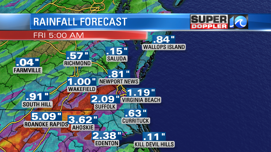
Rain amounts will add up in the rain gauges. Our future Trak model calls for a widespread 0.5″ to 1.5″. However, it is also showing some areas of 2-3″.

It’s possible that we could have some localized flooding between late Thursday and early Friday. Again, stay tuned for updates!
Meteorologist: Jeremy Wheeler


