So far Arthur has been behaving pretty much as forecast. It might be a good time to point out that so far it has followed a lot closer to the GFS model than the European model… (I sided with the Euro, but I’m just sayin….)
Anyway, the center of the storm has passed a little east of Hatteras and is moving north/northeast. It will move out to sea today, but the winds will increase on the back side of the storm.
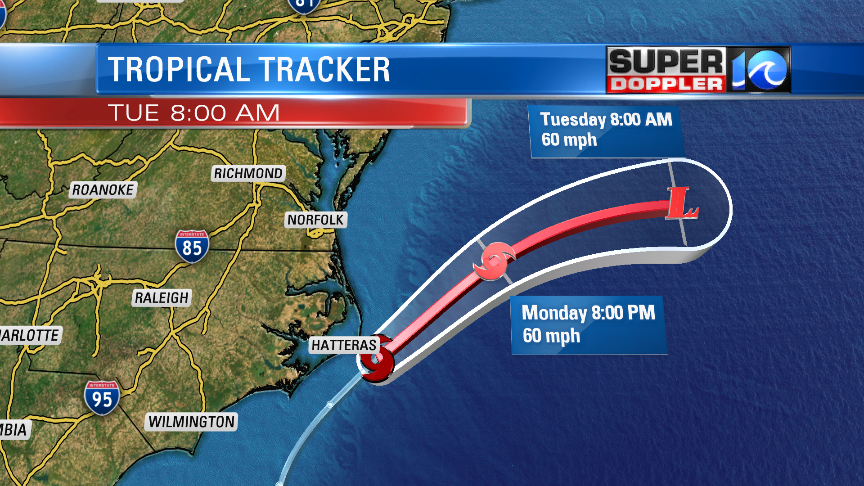
The storm will then turn more to the east between tonight and tomorrow. It will become extratropical during that time. It will then move east and southeast and eventually weaken over the cooler waters. The storm is interacting with a stationary front and some cooler air. So I would think that the system is more subtropical right now, but officially it is tropical as of the 11am update.
So far winds haven’t been too strong. However, the models have suggested since this morning that the winds will increase on the back side of the storm. Winds could gust up to 35 mph near the shore with gusts to over 40 mph along the Outer Banks. However, the rest of the area will only see gusts to 25 mph.
So far we’ve had about 0.5″ to 1.5″ with a little more to the southeast.
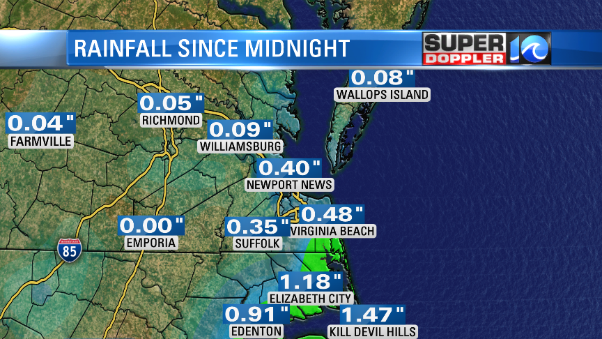
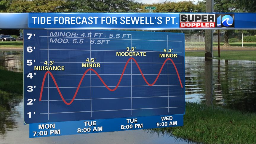
We could see another 0.5″ to an inch of rain, but most of that will be along the coast. Luckily tidal flooding is not an issue today. However, that will change over the next couple of days. Arthur will churn up the waters offshore Tuesday into Thursday. However, we’ll also have another area of low pressure move in from the west (over land). The way that will set up will keep a persistent northeast wind going through Wednesday. So the tide and waters will build through that time. The latest forecast now calls for some moderate tidal flooding as we get into mid-week.
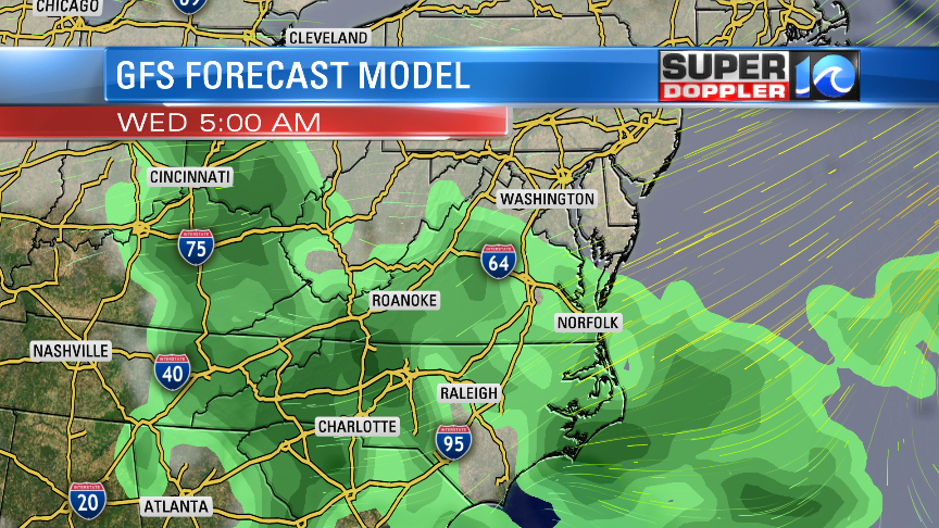
There will also be more rain showers moving back in late tomorrow into Wednesday and Thursday….and Friday. Not good!
To put salt in the wound we will only have high temps in the 60s through Wednesday. We will warm up later this week, and we should clear up some by next weekend. Hopefully, the forecast dries up a bit before then. Stay tuned for updates.
Meteorologist: Jeremy Wheeler
