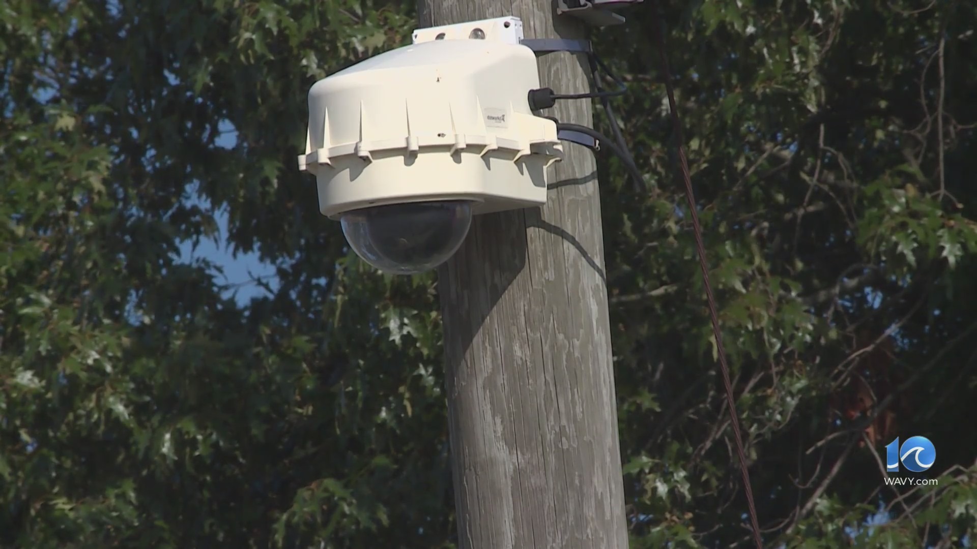
We had a rough day yesterday, but today is looking a lot better. There were numerous reports of damage from yesterday’s winds.
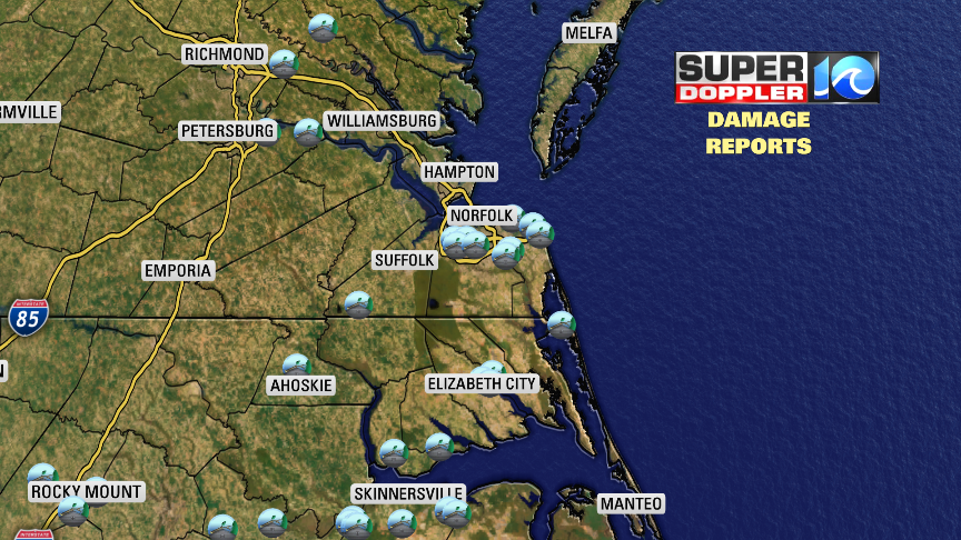
These were mostly reports of trees down or large branches. There were hundreds of thousands without power, but many of those have been restored. Today we will be cooler and drier. A cold front is sinking to our south.
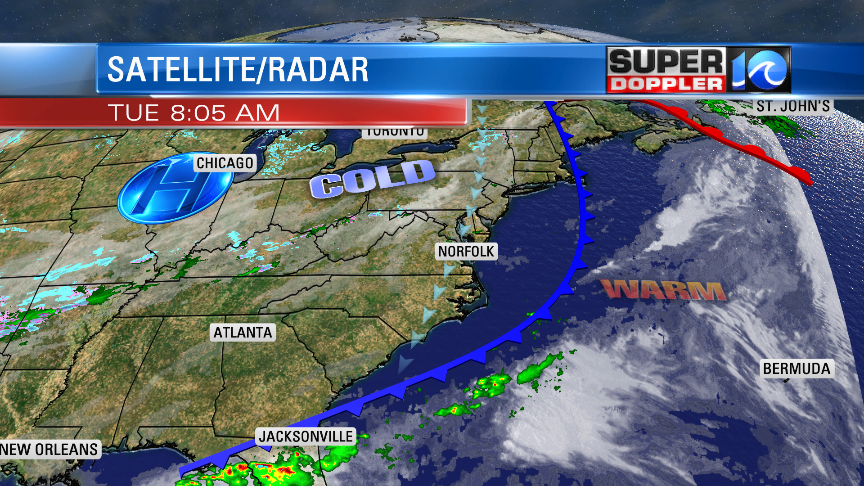
High pressure is still fairly far away, but it is getting a little closer. We’ll have a northeast breeze through the day, but it won’t be nearly as bad as yesterday. It will run at 10-15mph with gusts to 20mph near the shore. High temps will only be near 60 this afternoon with low-mid 60s away from the water. We’ll be in the upper 50s near the shore.
The front will stall out just to our south tonight. It may bump back north just a bit. Meanwhile an area of low pressure will form along the front and move northeast. This will bring us scattered rain showers to the region overnight. By tomorrow the low will move gradually offshore to the northeast. We’ll have a lot of rain in the morning. It will be chilly, but not cold enough for snow….here. However, there will be a rain/snow mix up towards Richmond and D.C. Yep!
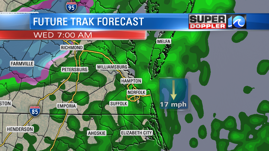
Most of it should melt, but some could stick in spots. Again…this is outside of the viewing area. All we could see here are a couple of sleet pellets mixing in with the rain north of the metro. Even that should be limited. The rain showers will continue until midday. Then we’ll dry out in the afternoon. It will be seasonably chilly tomorrow with high temps only in the low-mid 50s. That will be way below the average high of 67 degrees.
We’ll be mild and dry Thursday and Friday with highs in the 60s. We’ll have some more rain on Saturday with highs in the low 60s.
One more thing before I go. I’ve been tracking the flooding caused by the recent wind-tide effect over areas north of the Albemarle Sound up to southern Virginia Beach. The tide gauge at Dawley Corners (USGS) made it up to 2.5 ft yesterday. With today’s north/northeast winds this should drive the water levels down.
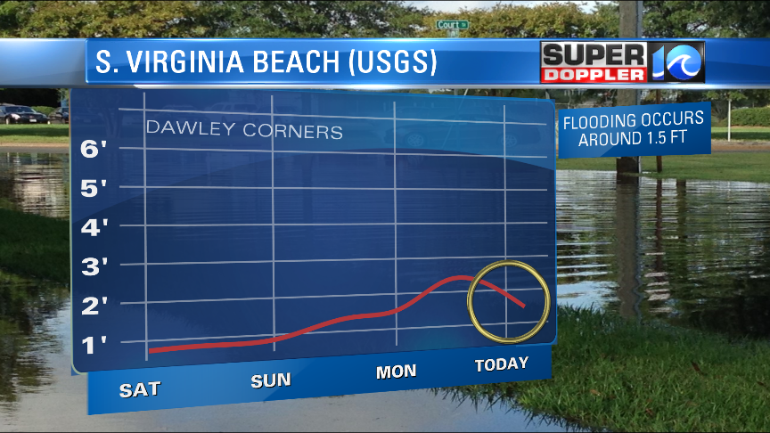
It is currently below 2 ft. It should drop to below 1.5ft later today. This is about where the level of flooding begins. Then it will drop even more tomorrow. So flooding will retreat.
Meteorologist: Jeremy Wheeler


