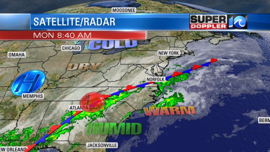
We are in the middle of a warm streak, but we are also beginning the work week with another streak of wet weather. A stationary front is lined up from southwest to northeast. This is sitting right on top of us.
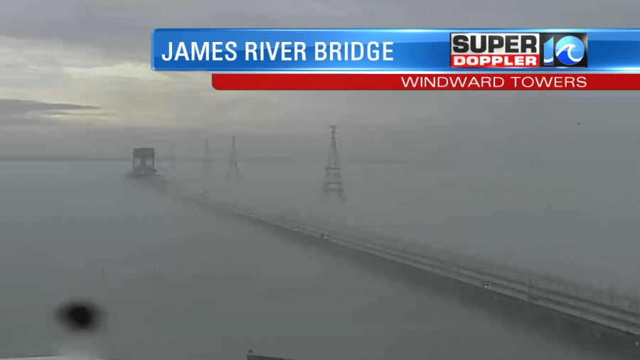
There is a lot of moisture coming up from the south. One neat effect due to the high humidity was some marine fog over the James River. The cooler waters of the river cooled the air above it to the dew point (which is unseasonably high right now). So the fog was pouring over the bridge at times.
The front will only drift around slightly today. It will create on-and-off showers through the day. Some of them could be heavy at times.

We’ll be cloudy all day. However, that won’t keep us cool. most of the region will be on the warm side of the front. High temps will be in the upper 60s with a couple of 70s over North Carolina. It will be less warm north of the front/metro. So highs will be in the low-mid 60s there. We’ll have more on-and-off showers tonight into tomorrow morning. There may be some more heavy downpours at times. In fact…our Future Trak model picks up the rain again tomorrow morning.
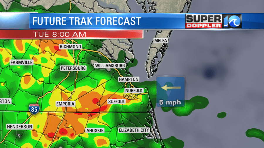
Our model tapers of the rain by tomorrow afternoon, but some other models aren’t quite as dry at that time. We could see about an inch to an inch and a half of rain near and south of the front. We should have lesser amounts north of the front.
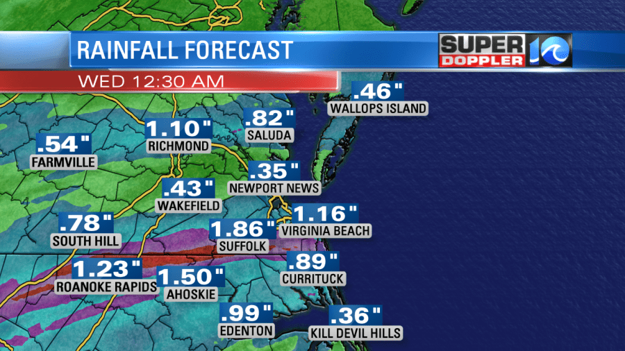
Either way high temperatures will be in the low-mid 60s. We will dry out on Wednesday. We’ll be partly cloudy with only some isolated showers possible. Highs will be in the 60s. We’ll be in the 60s on Thursday with a few showers in the morning. Then we’ll dry out the rest of the day. We’ll be dry and more seasonable on Friday. Highs will be in the upper 40s. We’ll briefly warm up again on Saturday, but there will be more rain showers moving in with the warm temps. Stay tuned for updates.
Meteorologist: Jeremy Wheeler


