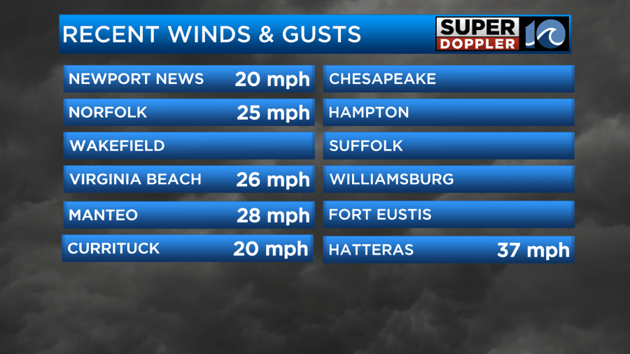
This morning when I got in the weather wasn’t too bad. The rain was widespread, but only a few spots were heavy. It was actually nice to have a good soaking rain. The wind wasn’t too strong except for the Outer Banks. Then as the morning went on, the rain slowly started tapering off from west to east. However, the wind gusts started to increase.
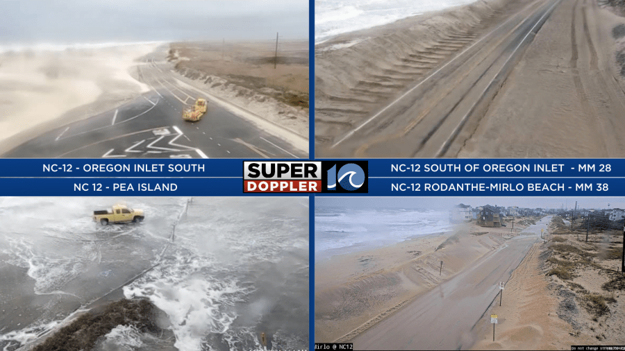
The wind had caused some tidal flooding to happen. The ocean overwash was pretty bad along the Outer Banks.
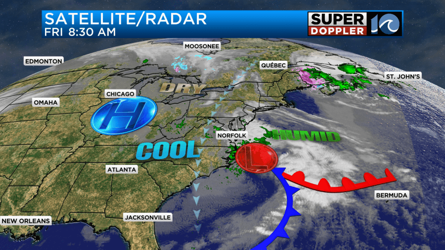
The area of low pressure started moving offshore. The winds were increasing behind the low.
The rain will taper off soon, but the wind will take longer to do that. Then we’ll have some clearing this afternoon. Winds will gust up to 30mph in the metro area from the mid morning through the mid afternoon.
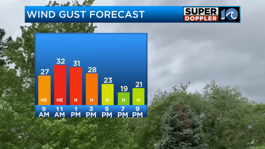

The highest gusts will be over the Outer Banks where there could be a few reaching up to 35-45mph. Especially on the south end.
With the winds staying up today the temps will be stuck in the 50s.
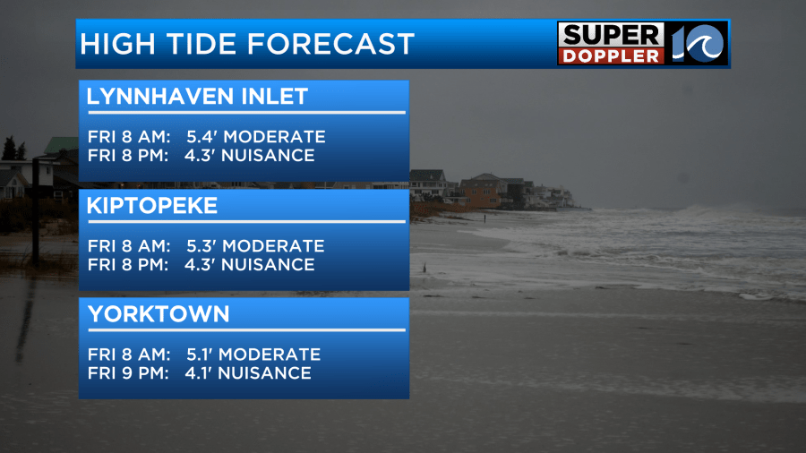
The tidal flooding did create a lot of ocean overwash over highway 12, but it also caused moderate tidal flooding in Hampton Roads and the southern Chesapeake Bay. This created some problems for folks getting around, but it wasn’t too bad overall. The tide reached up to about 5.5 ft at Sewell’s Point and 5.4ft at Lynnhaven Inlet.
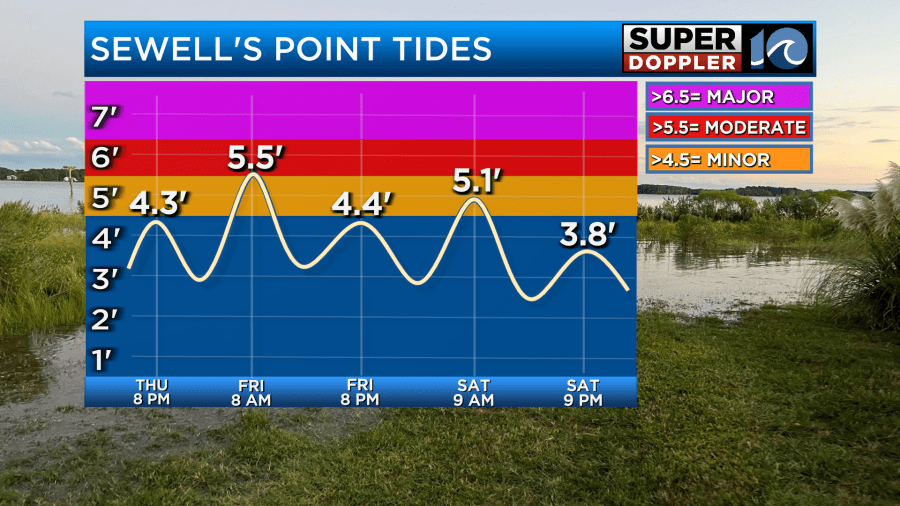
It actually reached up to about 6.8ft in Duck. That is considered “Major” tidal flooding. However, without the huge waves the impact was more moderate. Going forward this evening shouldn’t be as high for the next high tide. It will come up a bit higher though by Saturday morning. It is forecast to be about 6.3ft at that time which is moderate. Here are some other tide forecasts for this evening.
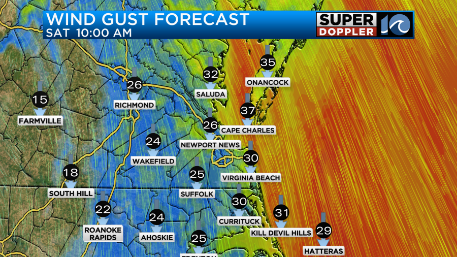
Tomorrow will be decent, but it will be cool and breezy. High temps will be in the low 60s with lots of sunshine. There will be some coastal clouds, but no rain. We’ll be dry. Winds will be out of the north at 10-15mph with gusts to 20mph. There will be a few gusts up to 30mph near the shore.
By Sunday the weather should be nice and calm. We’ll have mostly sunny skies with highs in the 60s. We’ll have drier/milder weather early next week.
Besides the nice weekend weather the other good news is that we had a really nice soaking rain over the last 36 hours. It added up to about 1 to 1.5″ with a few spots up to 2″.
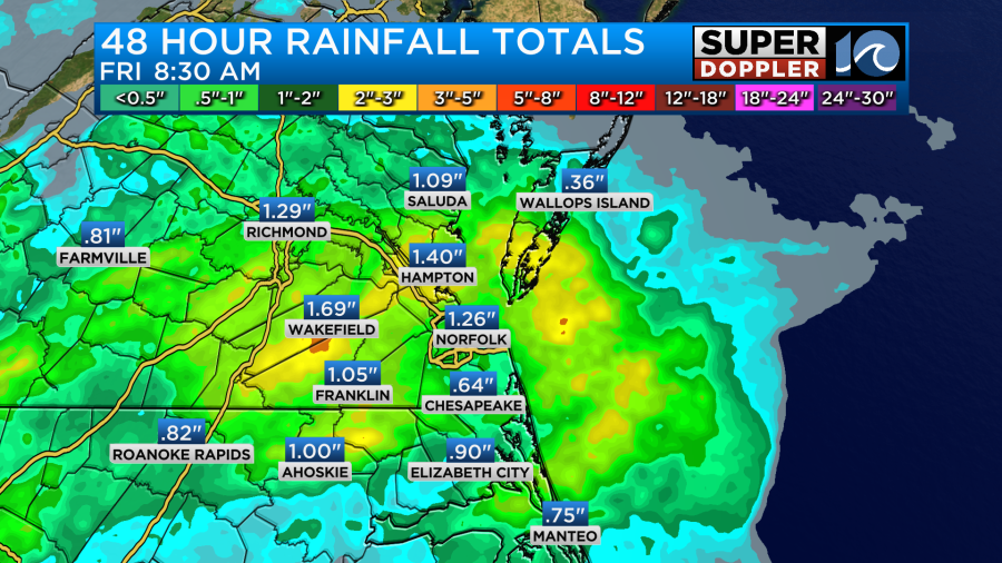
This will help out with the drought in the short-term, but we still need more rain in the long-term.
In the tropics tropical storm Sara is producing flooding rains over central America. It is primarily going to be a rainmaker down there and for the Yucatan Peninsula over the next few days.
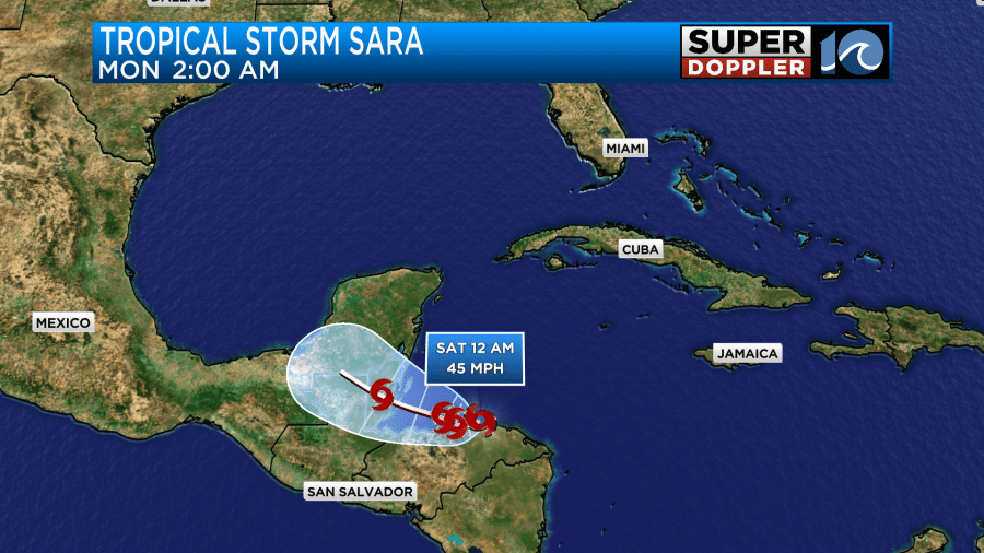
The National Hurricane Center has it falling apart by early Monday morning, but the remnants could get into the Gulf of Mexico and strengthen again down the road. Due to its recent weaker nature, the long term forecast has a lot of uncertainty. Stay tuned for updates.
Meteorologist: Jeremy Wheeler


