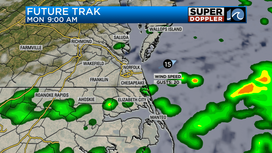
We’ll see mostly cloudy skies through the day Sunday. An isolated shower or two is possible late in the day Sunday, towards the upper end of the Peninsula (New Kent/JC/Wburg) and Surry/Sussex. The rain will then move east overnight, and we’ll see some on/off showers through the overnight and into early Monday.


Rainfall totals, while heavier than recent rain, are expected to be around 0.50″ of an inch or so. A spot or two could see a little more, but the general idea is for 0.10″ to 0.50″. While this is welcomed, we need a good soaking rain to realy put a dent in any drought conditions. But hey we’ll take this too!

Mild Monday with temps in the low 70s. Monday night, the cold front moves through and that cooler air holds on through next week. Highs in the low to mid 60s each day from Tuesday through Saturday.

In the tropics, Tropical Storm Rafael is falling apart over the central Gulf Of Mexico as wind shear and dry air impacts the system. It’s still a 40 mph TS as of Sunday morning according to the hurricane center, but all the storms are far east of the center which isn’t good for it’s health. I expect it will weaken/fall apart early into this week.

If you missed the sunrise this morning, you missed a good one. Hope you have a great day!

Meteorologist Ricky Matthews
Follow Ricky on Facebook and Twitter


