Last night hurricane Milton made landfall near Siesta Key, Florida as a category 3 hurricane.
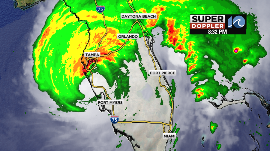
This was around 8:30pm EDT. The sustained winds were 120mph sustained. The storm surge was pretty high in Sarasota and Fort Myers, but it wasn’t as bad in Tampa due to Milton’s track. It looked pretty rough from the shots of the reporters in the field at the time.
Milton then rolled northeast through Florida as a hurricane producing more wind and rain. There were still strong wind gusts as it reached the east coast of the state.
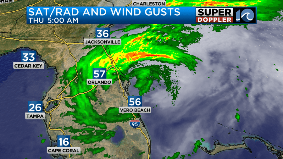
Now Milton is moving offshore. It will continue to move east over the Atlantic.
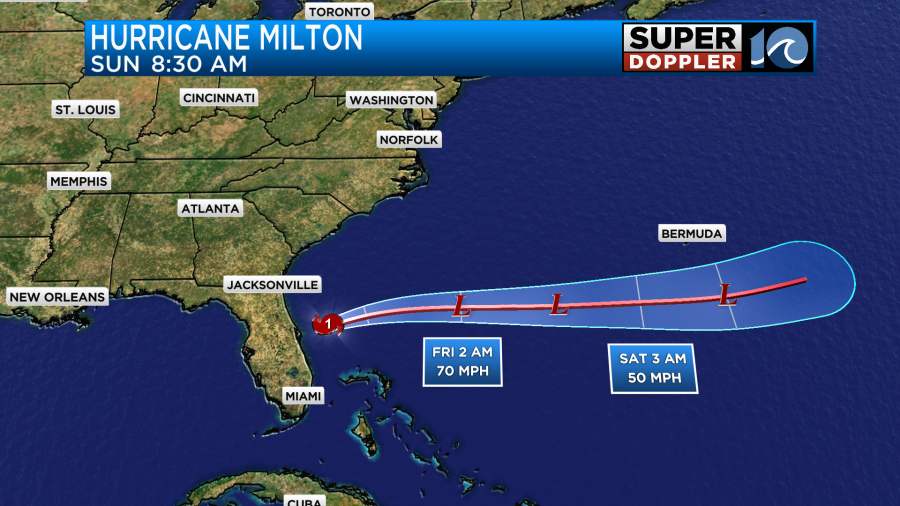
It should become post-tropical by this evening or tonight. Then it will be a broad area of low pressure south of Bermuda by Sunday.
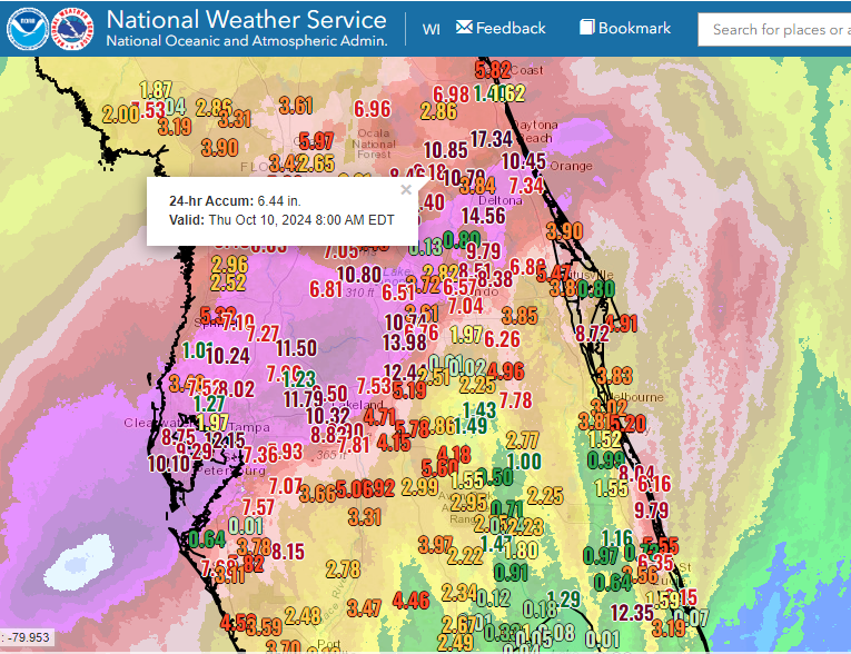
The rainfall was extensive in central and northern Florida. There was a swath of about 10-15 inches between St. Petersburg and Daytona Beach.
As we go through the day we’ll start to see more of the damage reports from down that way.
The other tropical system that we are tracking is Leslie. It is still out over the middle of the Atlantic, but it has actually strengthened since yesterday.
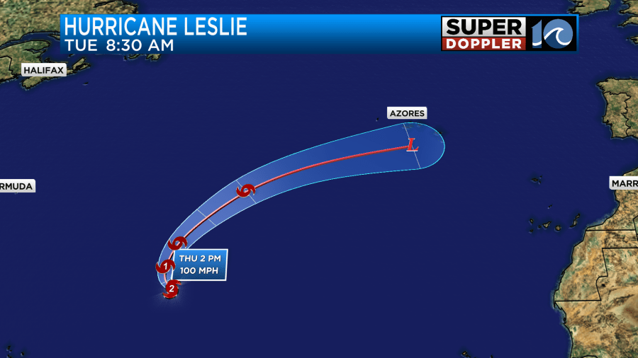
It was a category 2 hurricane this morning. It will move north over the cooler waters of the Atlantic and weaken over the next few days. It will eventually become post-tropical as it heads towards the Azores region.
Meanwhile we have some cool, dry, and breezy weather up in our area. Milton is to our south, and it is interacting with a stationary front. We have a cool front dropping to our south.
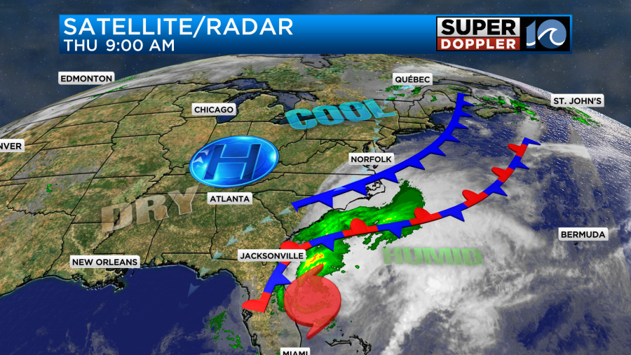
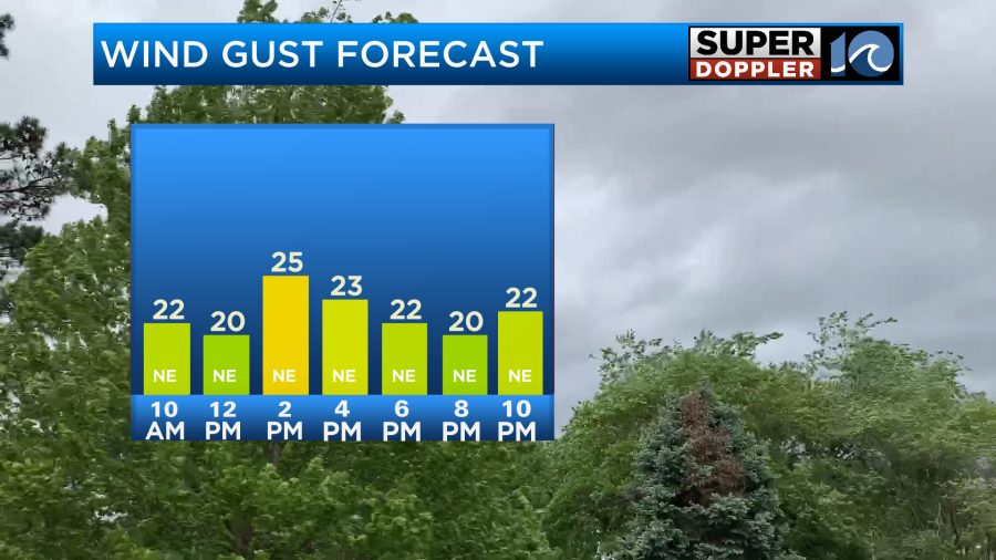
High pressure is to our north. This setup is creating an increasing northeast breeze. It will gust up to 20mph today. There may be a few gusts to 25mph near the shore.
While we are dry at the surface, there is a thin layer of clouds in the upper levels. This is a thin layer of moisture pushing far away from Milton. So we started the day with a lot of cloud cover.
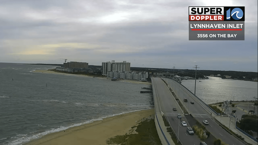
Through the day the clouds will push east and southeast. We’ll have gradually clearing skies. However, despite the clearing, we will stay cool all day. High temps will only be in the upper 60s this afternoon.
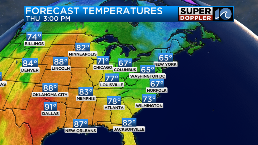
We’ll be mostly clear and dry tonight with light winds. So low temps will be in the low-mid 50s with lots of 40s inland.
Tomorrow we’ll have lots of sunshine, but the northeast breeze will keep blowing. So high temps will only be in the upper 60s again.
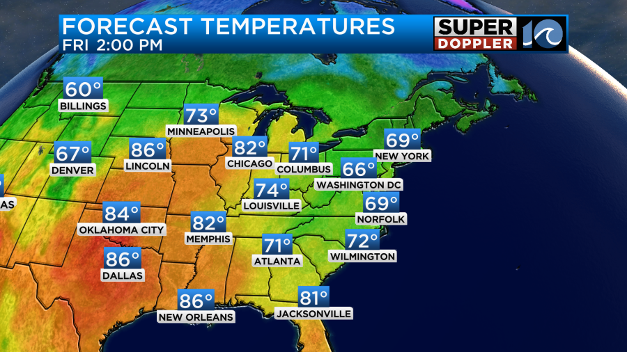
Some of the warmer air to the west will push into to the region over the weekend. High temps will warm to the 70s.
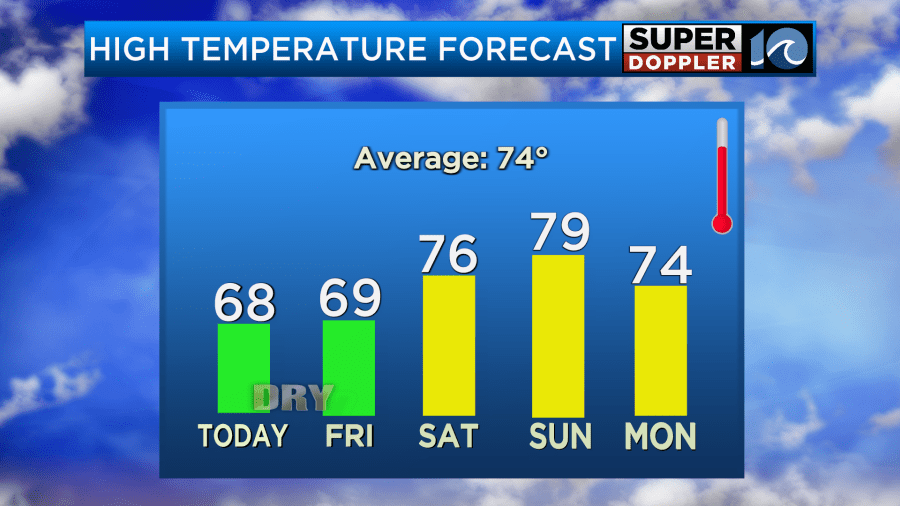
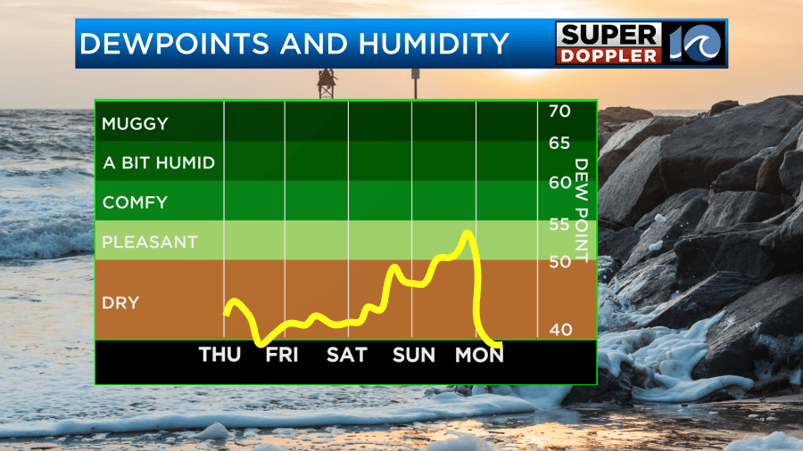
The good news is that we’ll stay dry through the whole weekend.
One interesting thing that could potentially happen comes from space. Chief meteorologist Jeff Edmondson talked about the possibility of seeing the northern lights tonight. So I used his graphic this morning to talk about it some more.
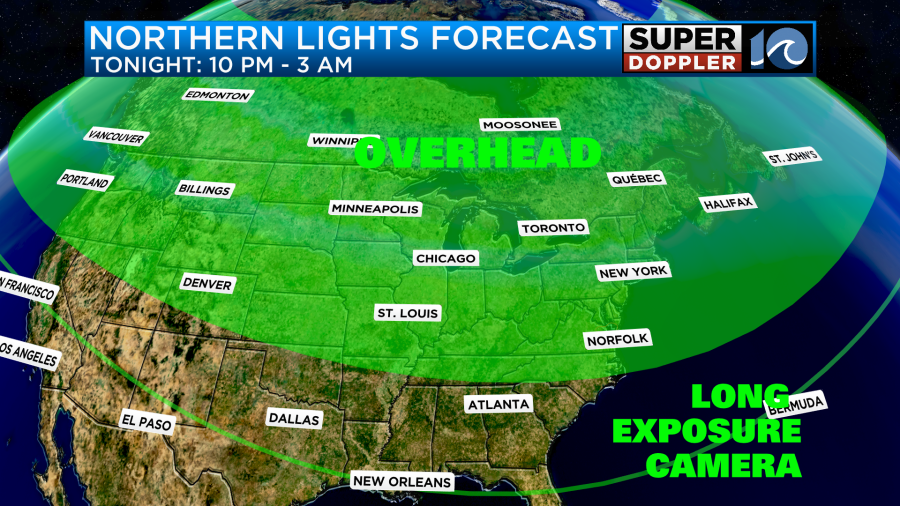
A lot of times these are overly optimistic, but I’m hopeful that we’ll be able to see them briefly. The time is late though. It will be between about 10pm and 3am. Maybe I’ll get to view it tomorrow morning when I get in. You will definitely want to get away from the larger cities if you want to view them. So plan accordingly.
Meteorologist Jeremy Wheeler
