This morning Milton had made it into the range of the U.S. radars. So I was able to track and show the clouds and the rainfall around the eye of the storm.
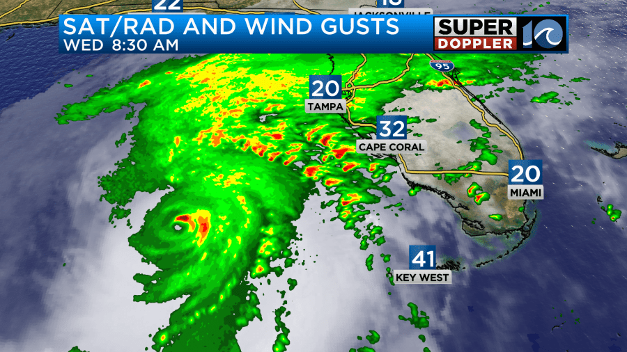
The eye has been present since yesterday. It was still pretty sharp this morning. Unfortunately, the hurricane had regained category 5 status for a time. The sustained winds were up to 160mph. The gusts were up to 195mph. The 8am update brought the winds down to a category 4, but it was on the high-end.
The rain has been moving to the northeast hundreds of miles away from the center. Preceding rainfall will already create a saturated ground ahead of the storm. This will help to create the flooding conditions across parts of the Peninsula over the next 36 hours
Through today, Milton will track to the northeast towards the west coast of Florida. Scattered showers and storms will continue to push onto the peninsula.
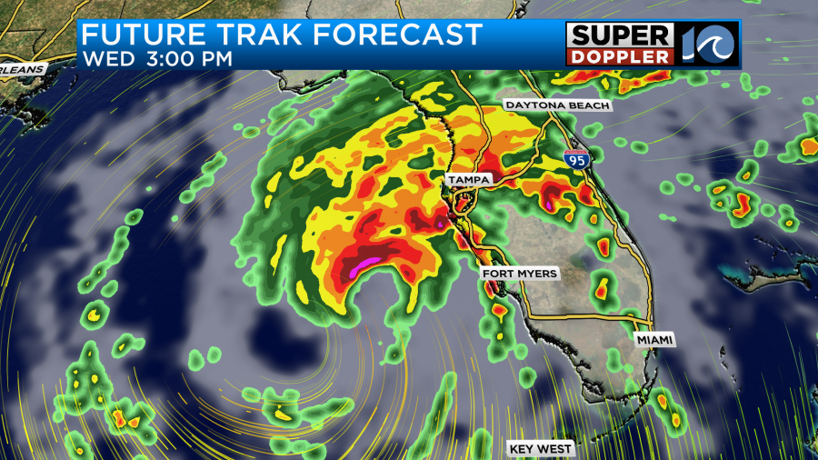
The hurricane is expected to make landfall some time late tonight. It will probably happen after midnight.
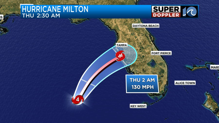
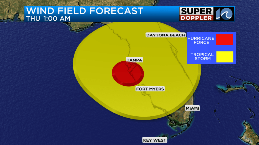
The latest forecast has Milton making landfall as a category 4. I think there is a growing confidence in that strength at landfall, but there is still some wiggle room in the strength and the track. The trend from yesterday has taken the track a little more to the south. This puts more of the focus for the surge towards Ft. Myers and a little less on Tampa. The latest storm surge forecast shows this.

However, they can’t let their guard down in the Tampa area as a small jog to the north could revert the forecast back to a near-worst case scenario. They are still expecting damaging winds there, and the surge could still be over 9 ft.
After landfall the system will move northeast as a hurricane. The hurricane force winds will affect Tampa, Orlando, and Cape Canaveral.
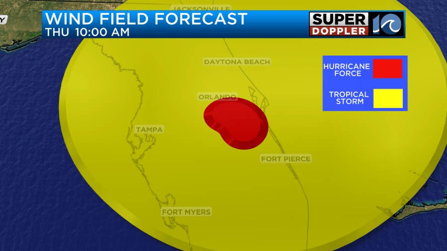
The system will probably move offshore as a category 1 hurricane Thursday morning. The storm will then move east, weaken, and become post tropical late Thursday into Friday.
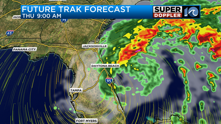
The heaviest band of rain is forecast along and just north of the track. Huge amounts of rainfall will likely create flash flooding over a large zone.

According to our model some locations could potentially get up to 20inches. This is partly due to a stationary front interacting with Milton. Plus, there is a high amount of deep tropical moisture around the storm. Flooding from rainfall could pose a huge problem by itself. Let alone the large amount of wind damage and damage from storm surge.
Unless, there is some wild twist in the forecast, it looks like all parts of the storm will stay well south of our region. This is due to the upper level wind flow, and also due to the cold front which has settled to our south.
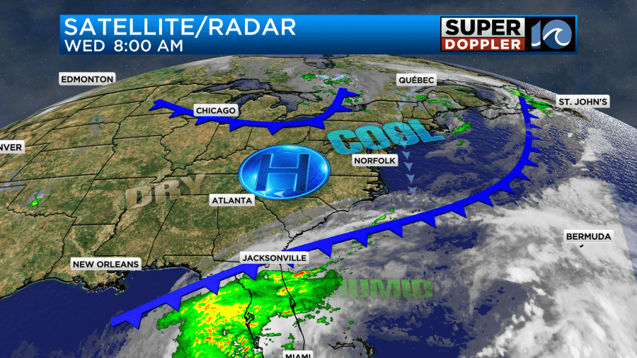
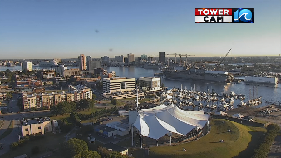
This has brought us some very nice Fall weather to the region. We started off the day with sunshine and temps in the 40s and 50s.
The dew points are in the 40s and 50s.
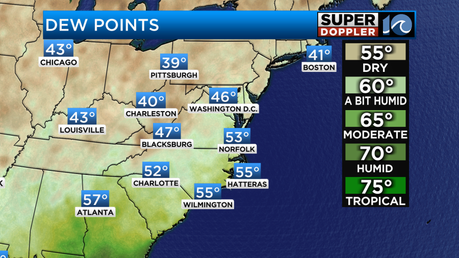
So there is some super dry air in place. We’ll have a very light northwest breeze through the day. We’ll have a lot of sunshine up through the mid-afternoon. Then some thin upper-level clouds will increase by the evening. These conditions will allow temps to warm up fast. After starting in the 40s and 50s our temps will warm up all the way to the mid 70s later today.
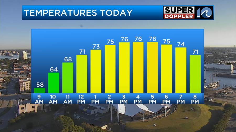
It will be very nice out!
Tomorrow a second cold front will arrive, and that will bring us a reinforcing shot of cool/dry air. So tomorrow high temps will only be in the upper 60s.
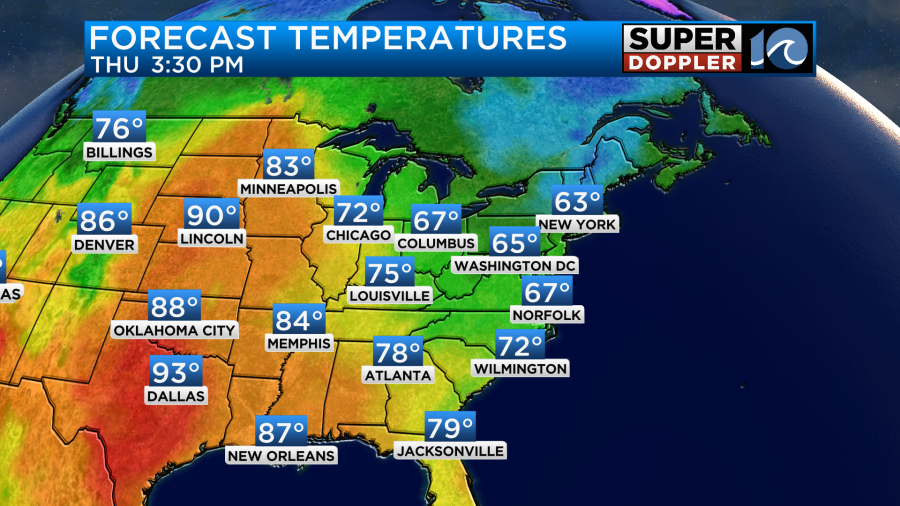
We’ll start off with some clouds, but skies should clear through the day. Also, the winds are going to increase behind that second front. They will run out of the north/northeast at 10-15mph with gusts to 20mph. After that we’ll have a dry and chilly Friday morning. We’ll have clear skies with lows in the 40s and 50s. We’ll top off in the upper 60s with lots of sunshine in the afternoon.
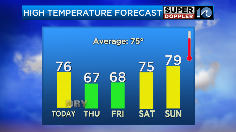
We’ll stay dry through the weekend.
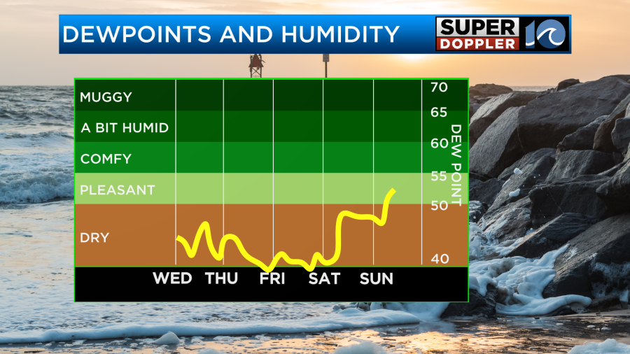
We’ll be mostly sunny Saturday and Sunday with high temps warming back up to the 70s. Our next chance for a few showers will be early next week.
I haven’t talked too much about hurricane Leslie. It is still out over the middle of the Atlantic, and it is now on more of a northerly track.
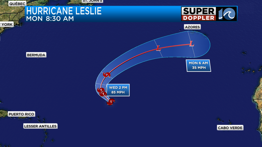
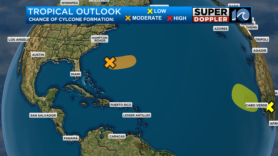
This will stay out to sea, but it will keep our seas a bit rough for the next few days. That and an an area of low pressure far off the east coast. There’s a medium chance that that low could become briefly tropical, but it will definitely stay out to sea.
We’ll have update on all of this throughout the day.
Meteorologist: Jeremy Wheeler


