The title may start with the local “Fall temps”, but I am actually going to start this blog talking about hurricane Milton.
When I did the forecast last Friday morning, the long-range models really didn’t do much with the low in the Gulf of Mexico. Though once in a while they would try to concentrate the energy a bit. My gut said that this didn’t feel right due to the very warm waters over the Gulf. However, I did not write that in the blog. I ended up doing the midday weather on Friday, and there was a shock! The late morning edition of the GFS model came in and showed a sizeable storm over the Gulf and hitting Florida. So I mentioned it during the midday show. I will say that since then everything in the Gulf forecast has changed. It’s a great example of why when we tell you to stay tuned for updates over a weekend, then you really should.
Ergo…Milton is now a category 4 hurricane in the western part of the Gulf of Mexico.

Tropical moisture was spreading east into Florida. There are already some scattered heavy showers there. The 9am update from NHC had sustained winds around Milton’s center were at 150mph. Milton is currently moving to the east/southeast. It may dip back to the south a bit, but then an upper-level trough will pick up the system and send it to the northeast. The latest track has it hitting near the Tampa region some time late Wednesday.
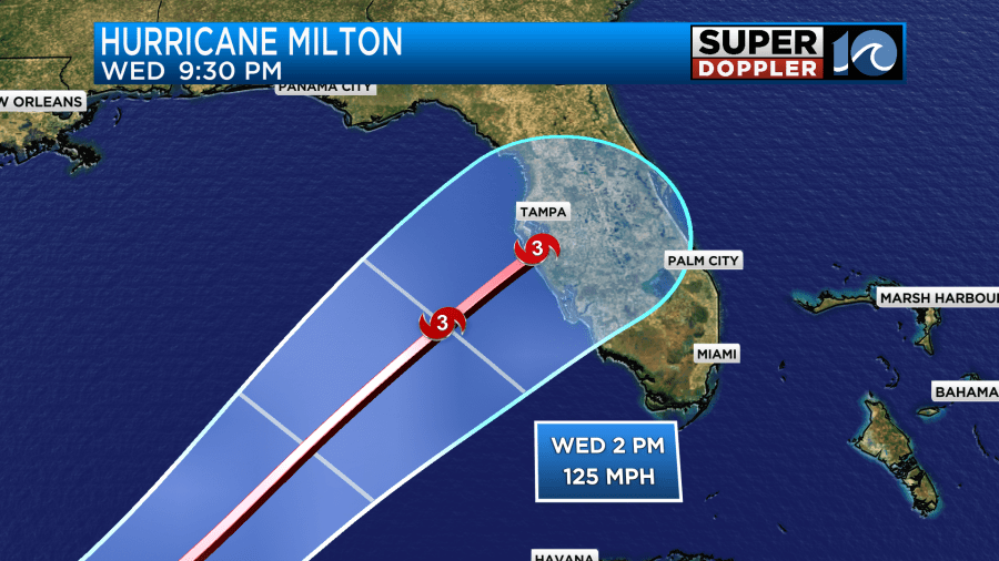
Due to the short-term rapid strengthening. The landfall forecast will probably go back up to a category 4. However, it may bounce around over the next 2 days either way.
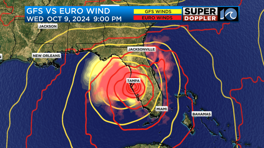
The models are in pretty good agreement up to that point. The GFS and European models are even in better agreement now.
This is terrible news for that region. They are still recovering down around Tampa from the storm surge from Helene. Some small communities were wiped out over the Big Bend region from Helene. Unfortunately, they aren’t getting a lot of national media attention. Don’t get me wrong. I do believe a much larger region was completely devastated from flooding over parts of the Appalachians. Still…
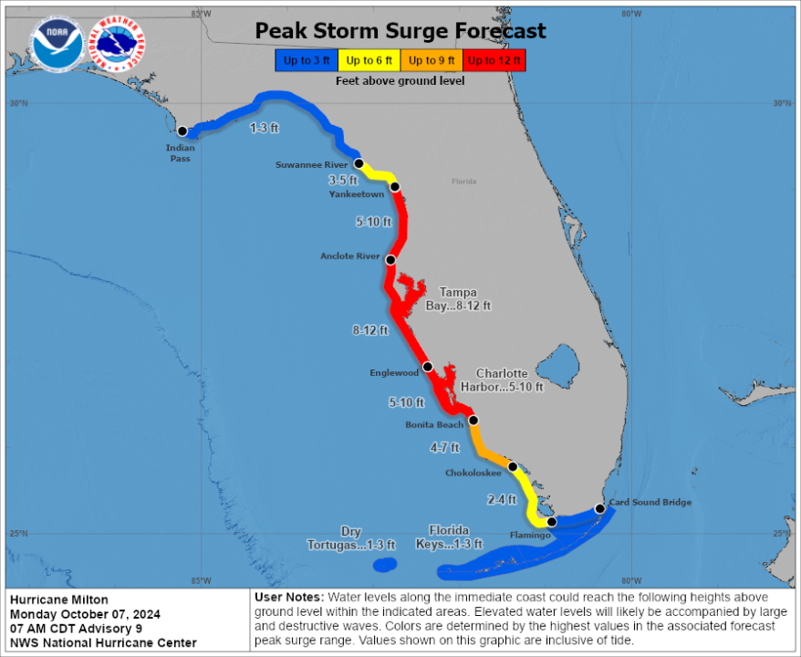
Anyway, Milton is going to cause big problems along the Florida west coast. The surge could be 8-12ft and possibly higher for hundreds of miles along the coast. (I’ll post more about that in tomorrow’s weather blog).
Again, by some time late Thursday evening Milton is forecast to make landfall as a category 3 or 4 hurricane.
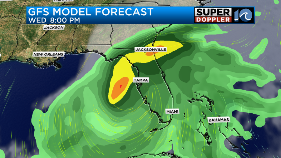
It will then move northeast through the state as a hurricane. On the other side it will begin to morph into a hybrid (tropical-non tropical) system. It should then become post tropical as it stays to our south and moves east/northeast.
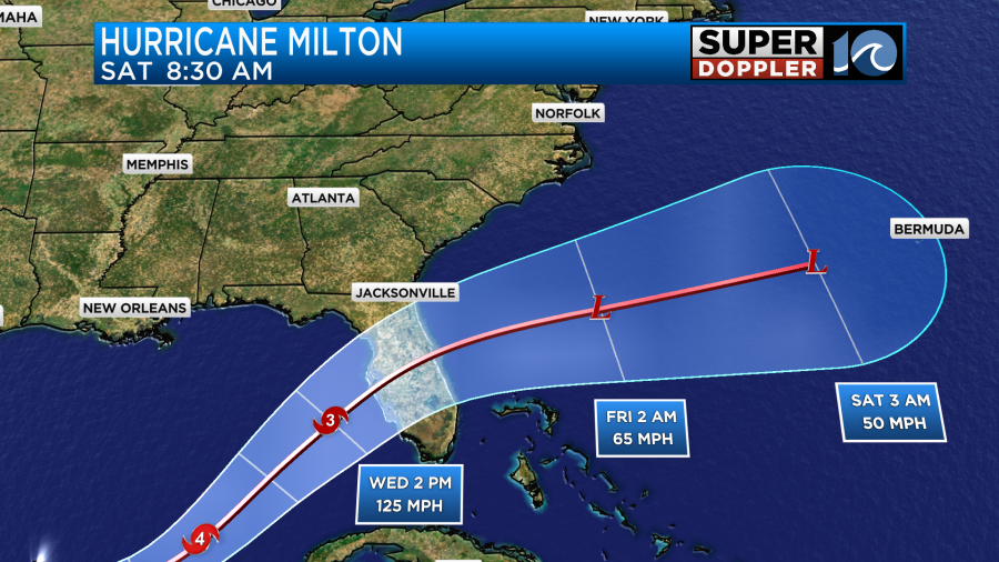
While this would keep the storm to our south. We may be on the edge of some of the rainfall. At least the Outer Banks would be. It’s possible that some of the rain may reach as far north as the southern Outer Banks.

The models are in pretty good agreement as to landfall and for keeping it to our south.
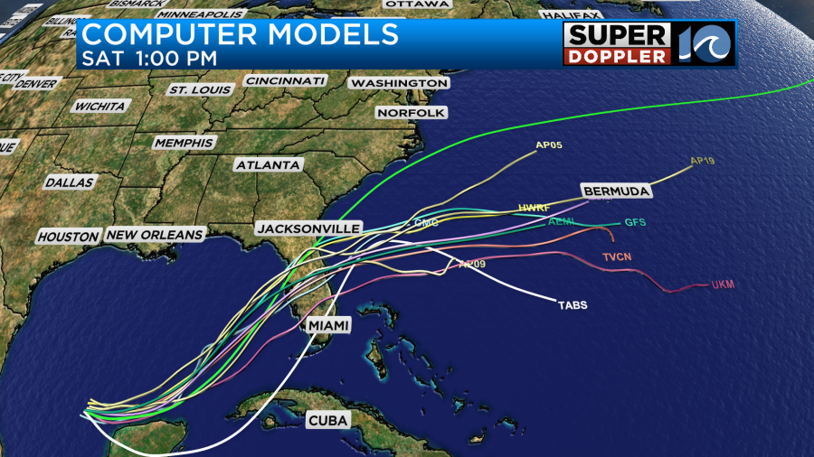
However, there is still a good amount of uncertainty in how far north & south it will go in the 3-5 day range.
One thing that I think is agreed upon by all models is the heavy rain potential for all of Florida. If the current forecast verifies, then some location could see 10-15inches of rainfall.
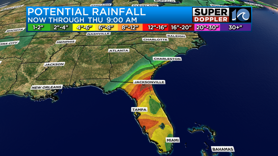
Those types of amounts may fall even in northern Florida up to parts of Georgia where people may be going to evacuate. We’ll have updates on this over the next 24-48 hours.
Meanwhile the rest of the tropics are active. Kirk is becoming post-tropical over the Northern Atlantic. Leslie is losing strength over the central Atlantic.
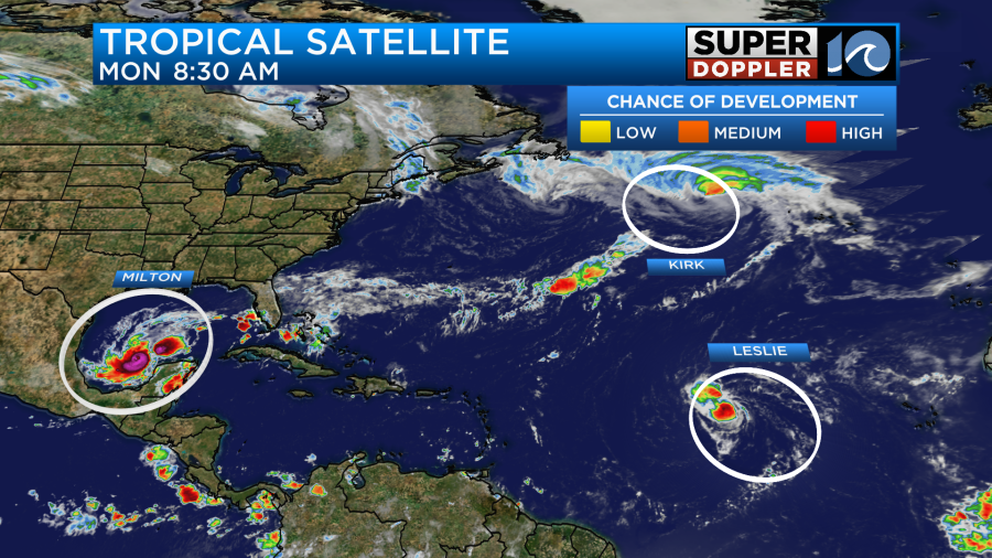
Both of these systems will stay well out to sea.
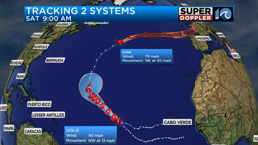
However, we are getting some waves along our oceanfront from hurricane Kirk. These waves have been impressive so far, but not completely clean.
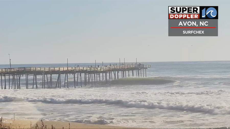
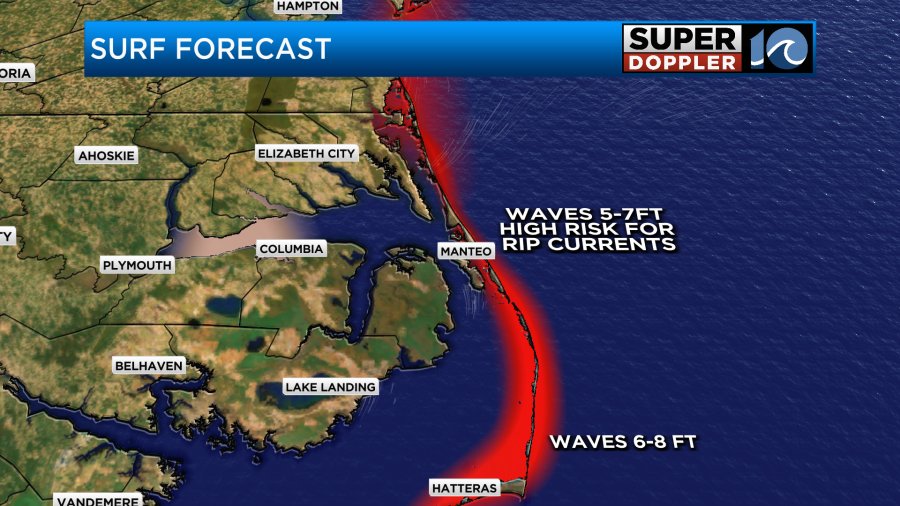
Waves will run at 3-4 feet today in Virginia Beach and 5-7 feet along the Outer Banks with a few 8 footers possible.
Outside of the tropics we have some very nice Fall weather on the way. A cold front is slowly sliding into the area.
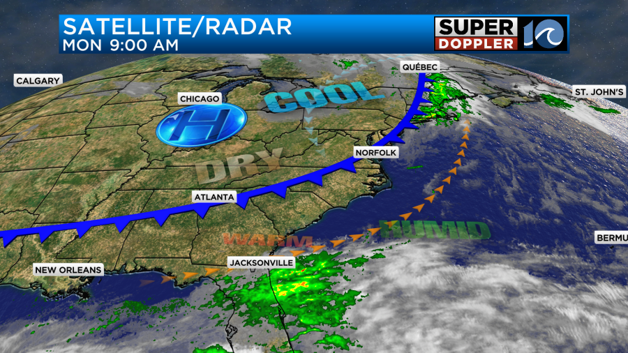
This will slowly sink to our south through the day. We’ll probably hit upper 70s to low 80s around the midday and the early afternoon. Then temps will drop to the low 70s by the end of the day.
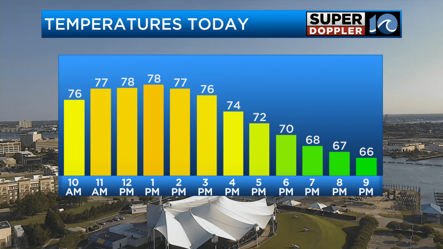
We’ll be mostly sunny with a brief increase in clouds. There may be a stray shower or sprinkle as the front passes, but most of the area will remain dry. Winds will turn from southwest this morning to out of the north.
After that we are REALLY going to dry out. Dry/Fall air will move into the region, and it will stick around for days.

Temps will be wonderful. Low temps will be in the 50s for a while. Highs will be in the low 70s tomorrow and Wednesday, near 70 on Thursday, and then in the upper 60s probably by Friday.
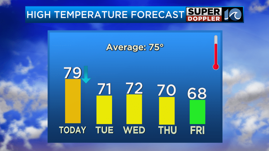
We should stay that way as we head into the weekend. The only rain that we may get are some scattered rain showers across the southern Outer Banks on Thursday. This will be the outer edges of Milton as it becomes post-tropical. It may be a bit breezy with high pressure just to our north.
There’s a lot of info here. The tropical information will likely change a bit. So stay tuned for updates.
Meteorologist: Jeremy Wheeler
