Last night then-hurricane Helene made landfall around 11:10pm EDT over the Big Bend region of Florida.
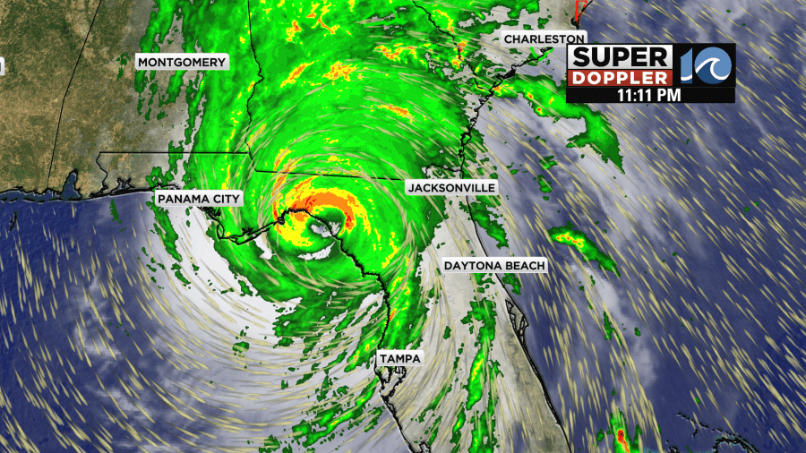
It made landfall near Perry, FL as a category 4 hurricane. Around that time our equipment recorded a wind gust to 120mph around Cedar Key, FL. The storm did produce a lot of damage and flooding along the Florida coast.
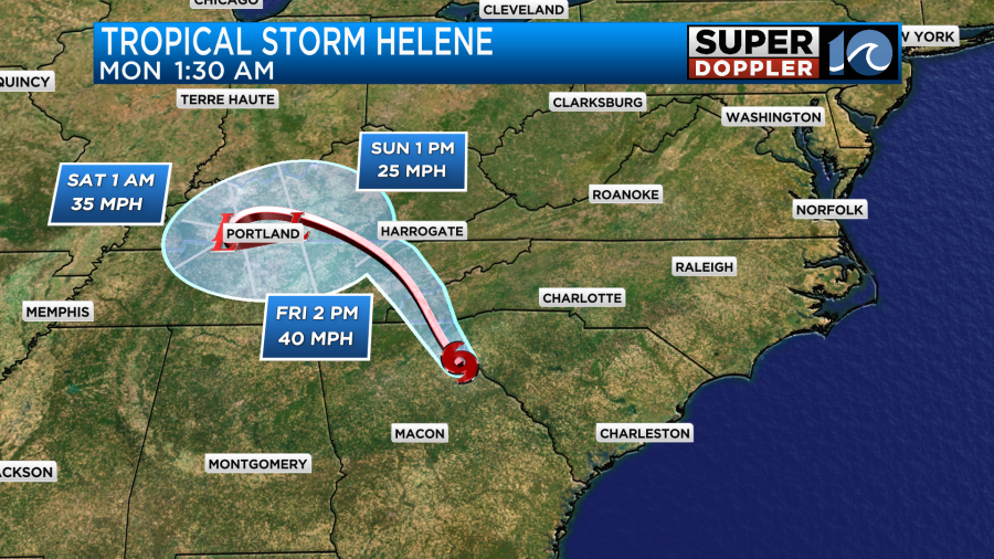
Since then the storm has moved quickly into northeast Georgia. It weakened to a tropical storm earlier this morning.
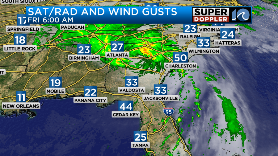
The tropical storm force winds will cover a large region this morning despite the weakening storm.

However, flooding from rain is becoming the main problem. There are many flood and flash flood warnings happening over that way. There will be some heavy rain and possible flooding across western North Carolina. It could reach up into western Virginia.

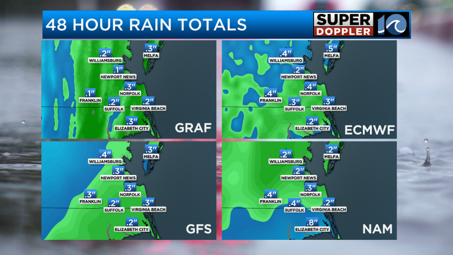
The heaviest rain will definitely be to our west. Locally, we are looking at a quarter to a half an inch. However, some spots could get up to an inch.
Helene will continue to weaken and move north/northwest today into tonight.
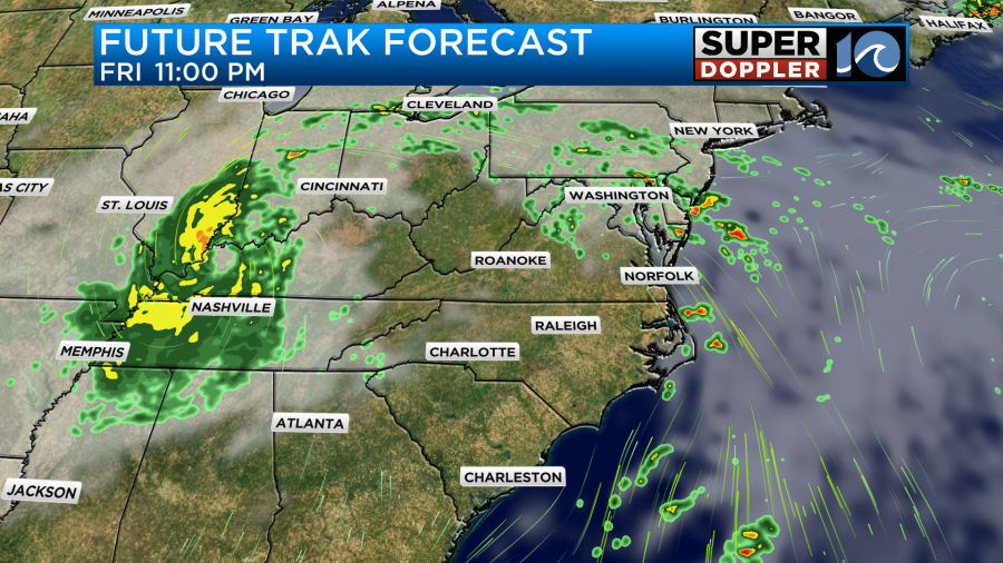
It will become a post-tropical low tonight into tomorrow as it wraps up into an upper level low.
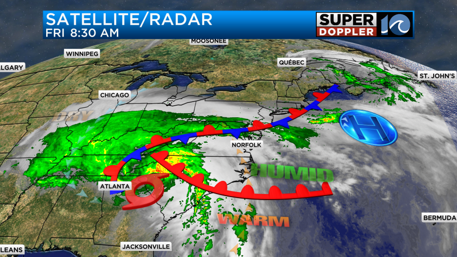
Locally today we are expecting a large rain band to bubble up from the south. This will be along a warm front that will come up as well.
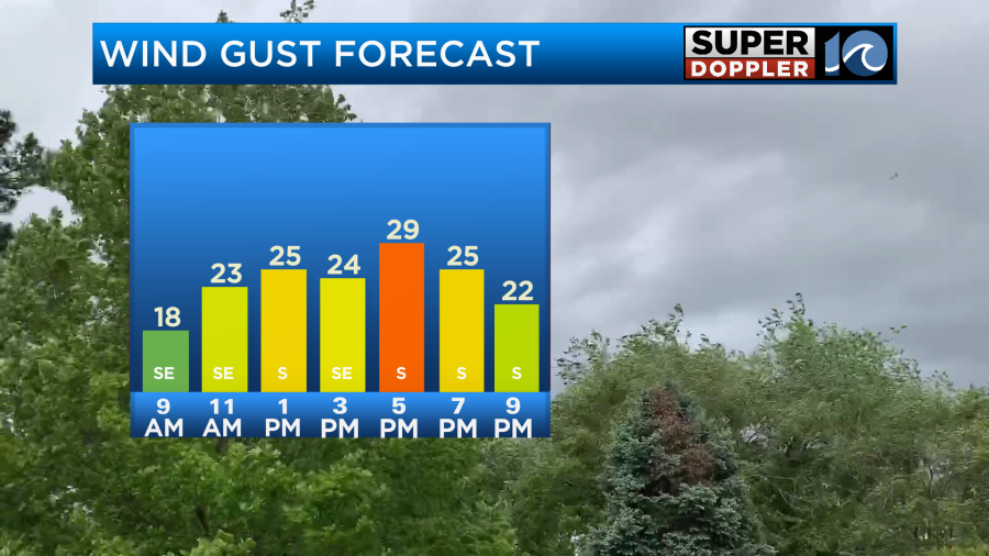
We’ll have a southeast wind increasing through the afternoon. It will run at 10-15mph with gusts to 25mph.
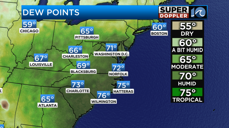
This is going to pull in some very warm and humid air from the Atlantic. High temps will make it to the low 80s this afternoon despite lots of clouds. Dew points are in the low 70s and rising.
This will all combine to be some fuel for a few strong thunderstorms later today. They could fire up as early as 1pm, and they will probably go until the early evening.
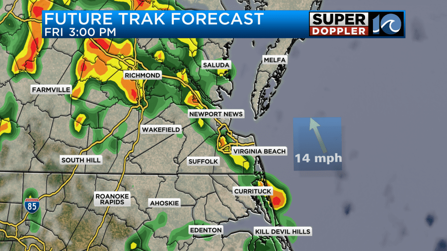
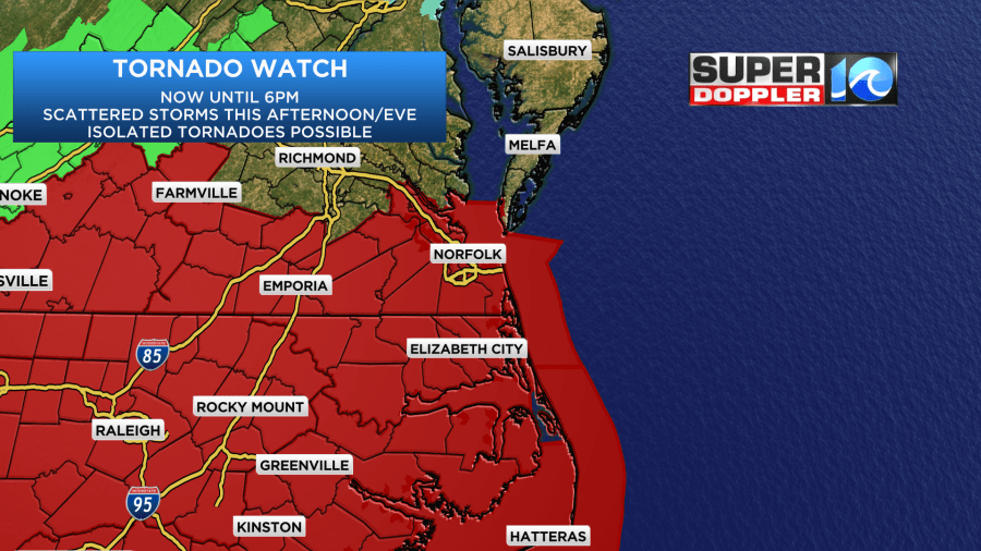
The main threats from the storms will be strong gusty winds and brief heavy rain. However, some isolated tornadoes will be possible. There is a tornado watch until 6pm for parts of the viewing area.
By tonight this will all push to our north. Then tomorrow we’ll have some quieter weather. The upper level low will be spinning to our west.
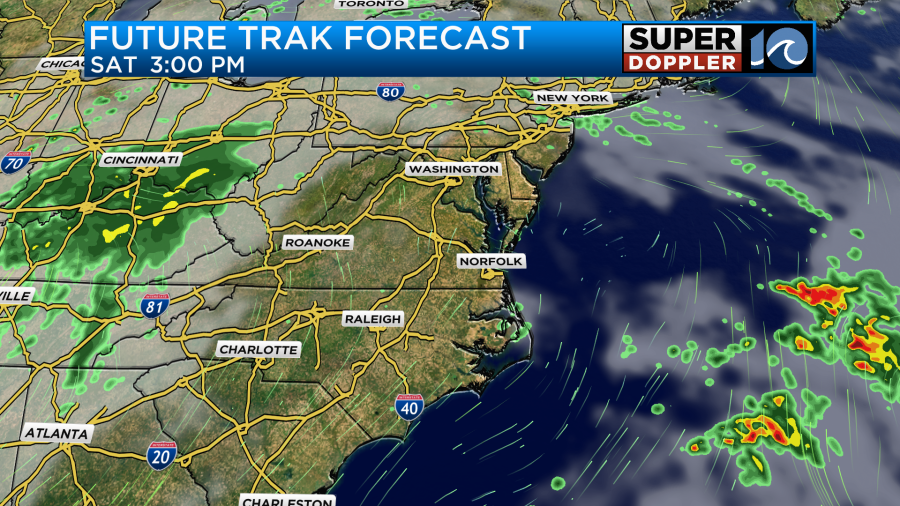
We’ll be partly cloudy with only a stray shower or two. We’ll have a light south wind as well. This is going to set us up for a fairly hot and humid day for this time of year. High temps will aim for the mid 80s.
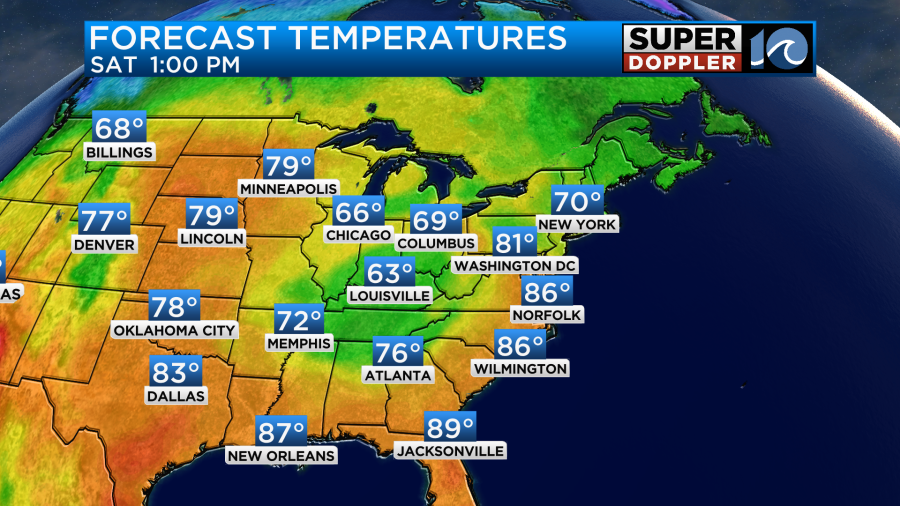
However, it will feel like it’s about 90 degrees with the heat index. By Sunday the upper level low will drift east into our area. We’ll have increasing clouds with scattered showers in the afternoon.
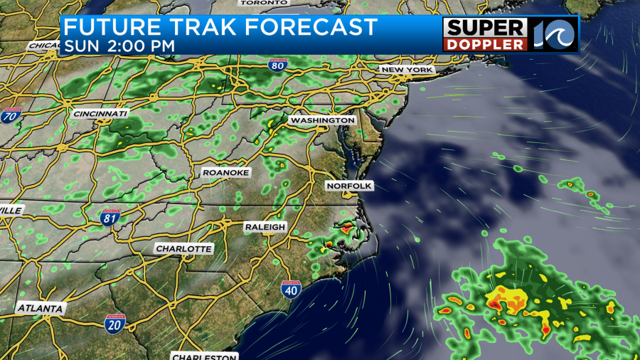
High temps will be near 80, and it will still be humid. The upper level low will continue to roll over our region through Monday. So we’ll have some more scattered showers that day. We should finally start to dry out by the middle of next week. High temps will return to the 70s.
There is another thing that we are tracking in the Atlantic basin. Isaac has become a hurricane over the north/central Atlantic ocean. The good news is that it is moving east and away from the United States.
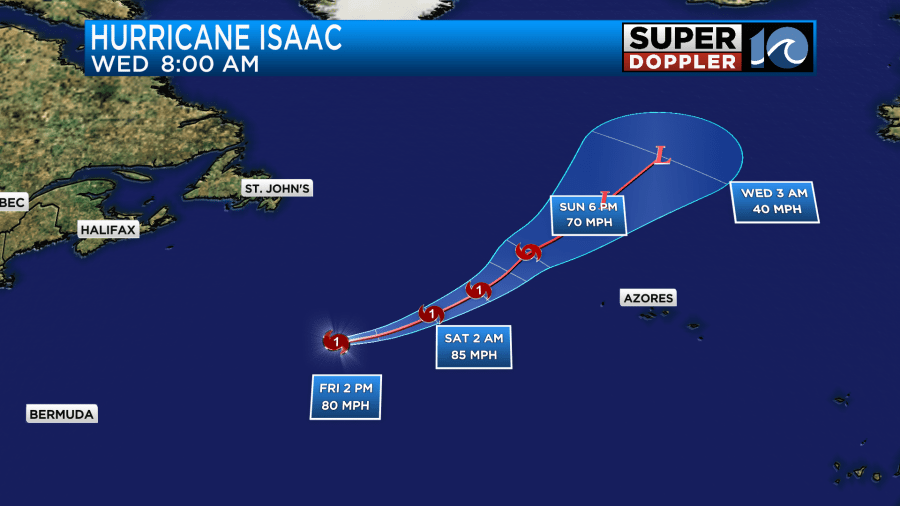
It may bring some wind and surge to the Azores islands, but they will likely miss the worst of the storm. It might send some more waves back towards our coast. We already have a high threat for rip currents and 5-6ft waves along our ocean front today. So they may only go down briefly.
There is also a tropical disturbance in the eastern Atlantic. It has a high chance of formation, but it should stay out to sea.
Stay tuned for updates.
Meteorologist: Jeremy Wheeler


