Yesterday we had some more isolated flooding in the region. This time is was over some inland locations in Virginia.
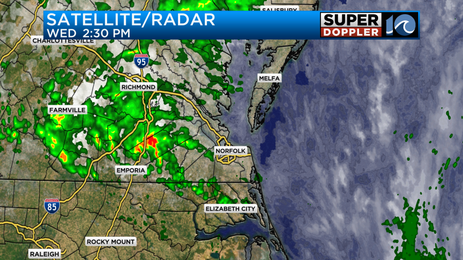
Through the day a weak upper level low sat overhead with a weak surface low and cool front nearby. A high amount of moisture combine to create a few downpours out towards Sussex county and then into Isle of Wight and Surry Counties.
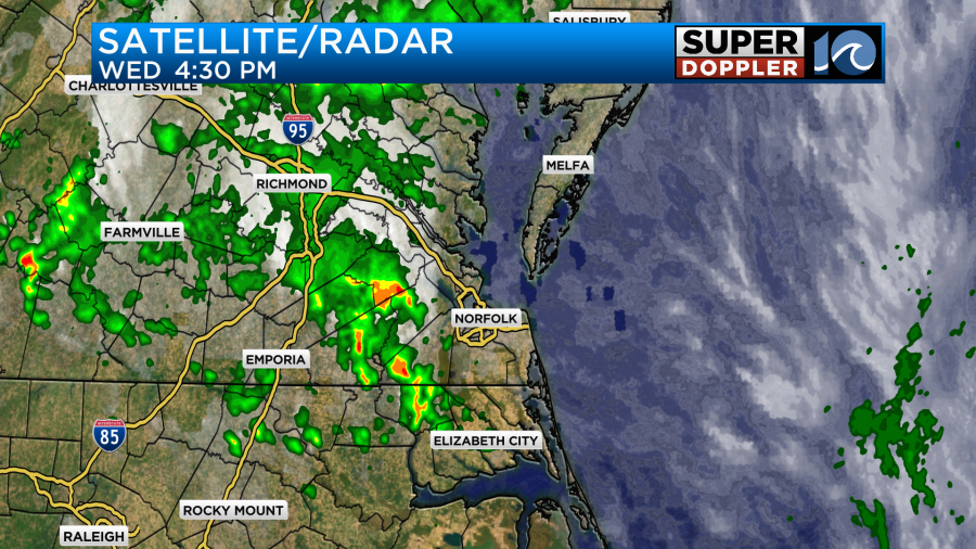
This created some flash flooding. Estimated rainfall totals were about 5-7 inches.
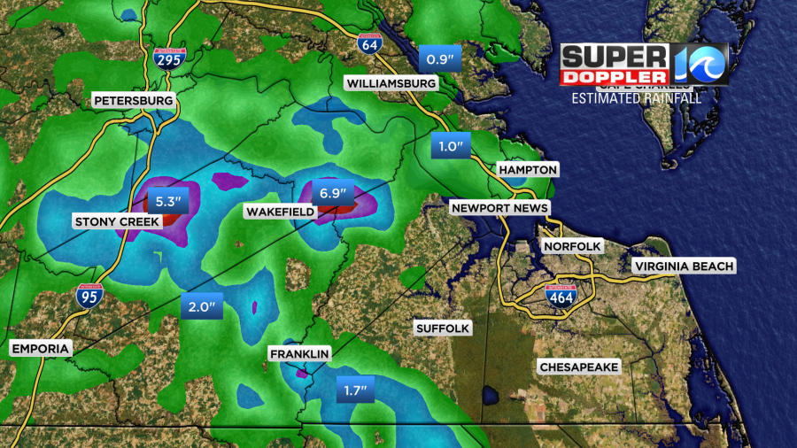
The rest of the region had a lot less rain. While the drizzle and light showers did continue for a while, it really didn’t add up to much in the rain gauges.
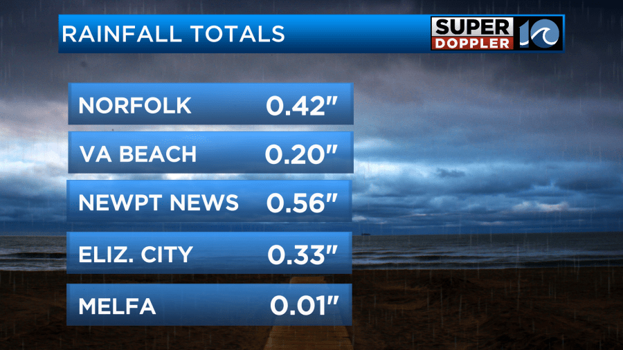
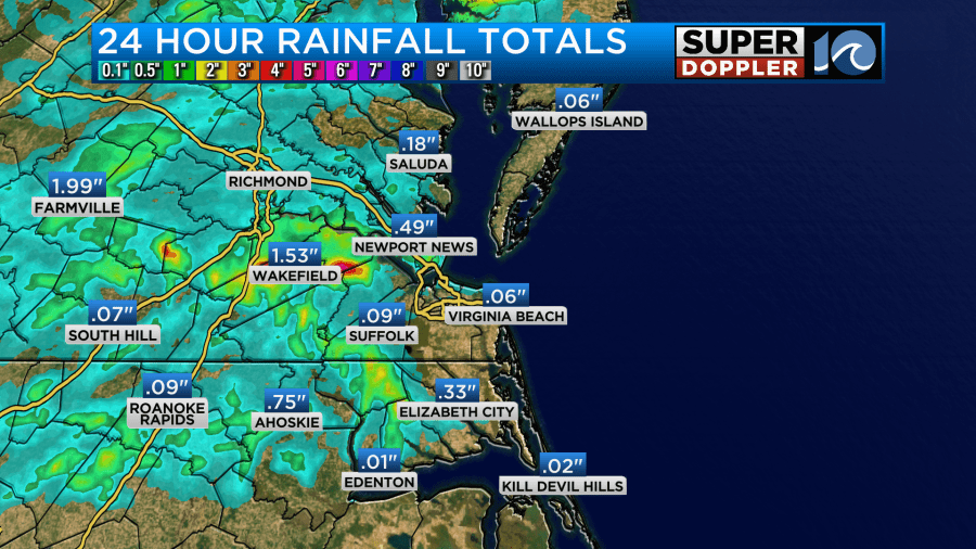
However, it was good to get some more rain. The trees and lawns should be in a lot better shape now. We got caught up for rainfall for the month. Now we are just a little below average.
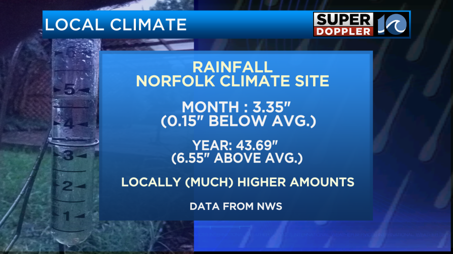
Keep in mind that some isolated locations have had MUCH higher amounts of rain recently.
Today the weak surface low is moving slowly away from our region. It is moving to the northeast.
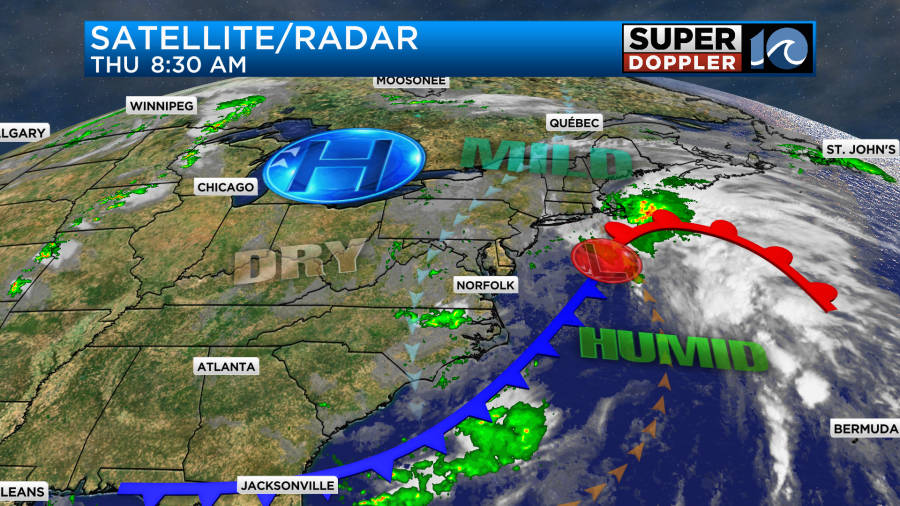
It is dragging a cool front to our south. This will eventually dry us out today. We did start with lots of clouds and some patches of drizzle. As we go through the day we’ll have a little clearing. There may be some isolated showers inland in the afternoon, but the chance is low.
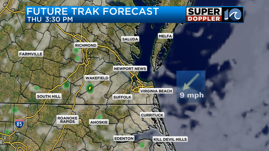
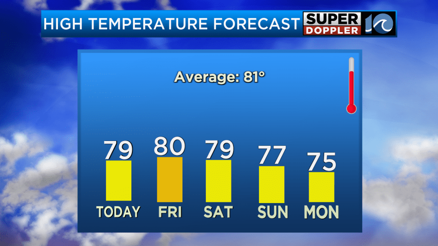
Dew points will drop from near 70 down to the low-mid 60s. We’ll have a north breeze at about 10mph. High temps will be in the upper 70s.
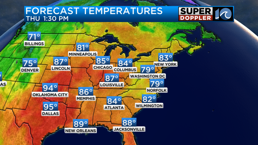
Tomorrow we’ll have drier weather with mild temps. It should be a nice day with mostly to partly sunny skies. Highs will be near 80.
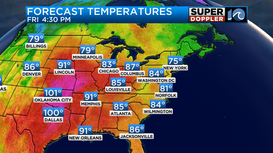
Take a look though at the temps to our west. They are aiming for some 100s out towards Texas and Oklahoma. That’s crazy for mid-late September. Luckily we won’t be that hot. We’ll be partly cloudy tomorrow with a northeast breeze. It should be nice as the humidity will be down to moderate levels.
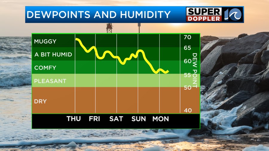
We’ll have more nice weather on Saturday. High temps will be in the upper 70s.
The models are tricky for Sunday. The GFS model has a weak upper level disturbance along with a wind shift coming through. So it has some scattered rain showers.
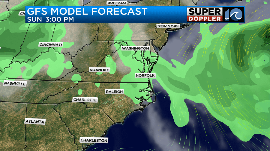
However, the European model doesn’t really have either of those features. It mainly has a light northerly flow and some moisture.
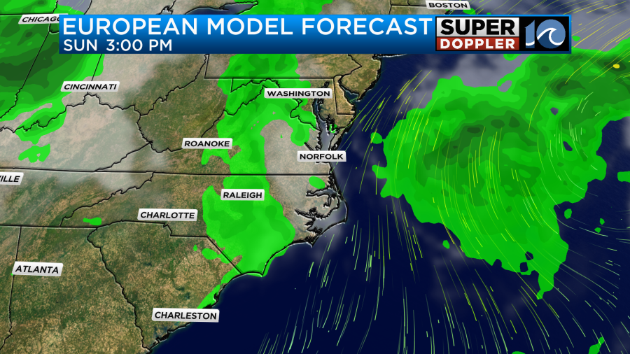
For now I have a 30% chance for a few scattered showers along with partly cloudy skies. High temps will be in the 70s either way. That will also be the first day of Fall. The second day of Fall looks pretty good. We’ll be in the mid 70s with partly cloudy skies on Monday with lower humidity.
While the chance for rainfall flooding will be much lower today, we still have a chance for some minor tidal flooding. In fact the tide forecast has increased a little since yesterday.
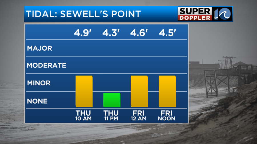
The ocean is still a little churned up but much better than the last 2 days. There won’t be much wind. So it’s mainly the natural King Tide cycle that is driving it. The tide should drop a little tomorrow. It should go down some more by the weekend.
Meanwhile, the tropics are quiet for now. The remnants of Gordon are still drifting around the central Atlantic. They have a low chance of re-forming.
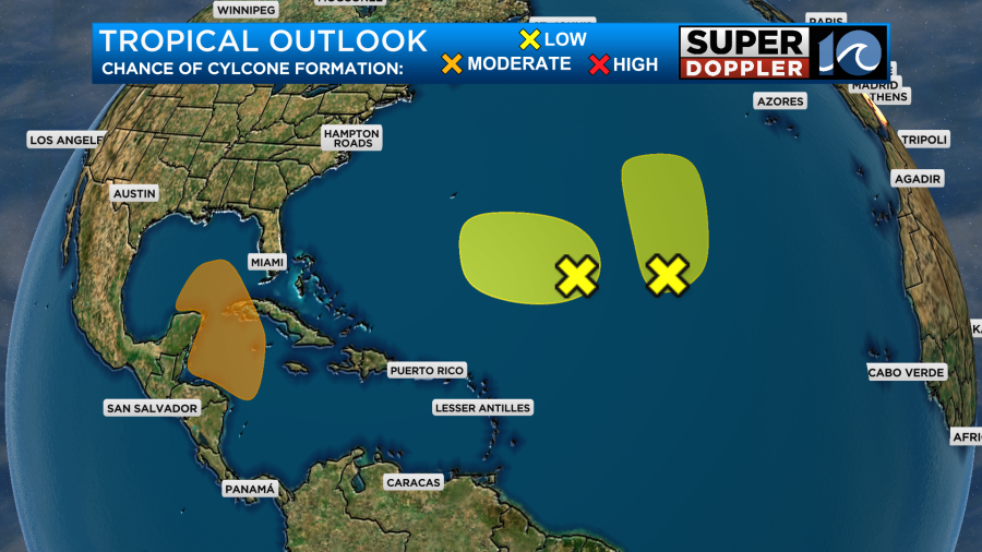
However, the more interesting feature that we are watching is over the western Caribbean Sea. The models keep forming a low down there, and they have it moving into the warm Gulf of Mexico in a few days. Some of them have a strong hurricane over the Gulf in about 5-8 days. So we’ll be watching that zone closely.
Meteorologist: Jeremy Wheeler


