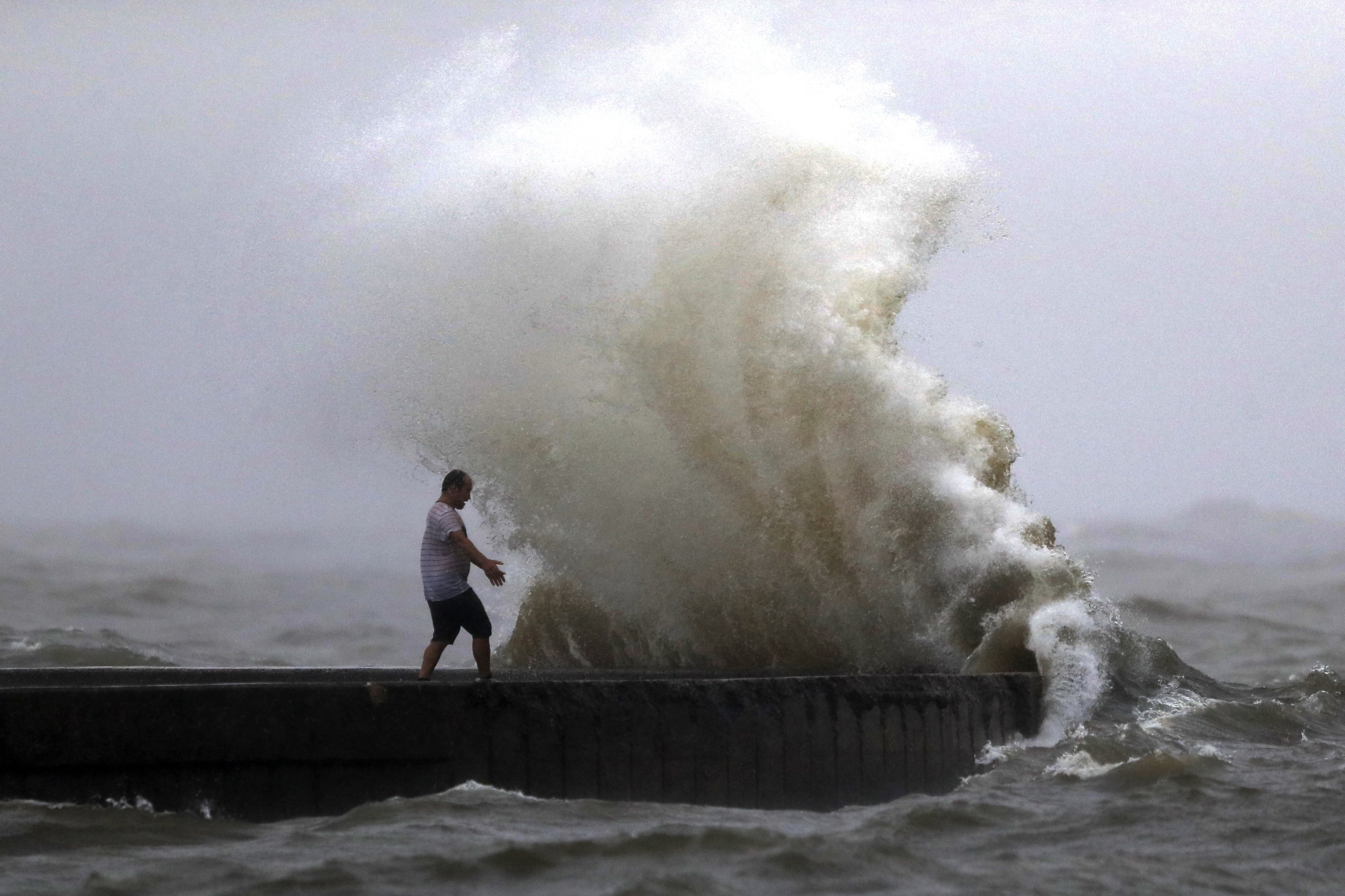
RALEIGH, N.C. (WNCN) — Weather officials said rainfall Monday from a potential tropical cyclone generated enough rainfall at the North Carolina coast to label it a 1,000-year event.
Carolina Beach was the hardest hit with nearly 21 inches of rain on Monday while across the Cape Fear River in Brunswick County, the town of Southport had 19 inches of rain. Scroll down in this story to see the rainfall totals for various areas in eastern North Carolina.
“Since much of that fell within a 12-hour period, this may have represented an event expected to occur, on average, once every 1,000 years,” the National Weather Service said.
Meanwhile, crews announced on Tuesday they had rescued nearly 120 people across 50 calls in just Carolina Beach on Monday.

Seven different agencies helped in the rescues which also included nearly 20 pets.
On Tuesday, the destruction of roads became clear. Flooding destroyed part of N.C. 211 before Generations Church headed towards Southport, Brunswick County officials said.
Also, a segment of U.S. 17 was washing out just past Randolphville Road. A section of U.S. 17 also buckled between Highway 87 and Rice Creek Parkway.

N.C. 133 was also still flooded and a section had collapsed, the Brunswick County Sheriff’s Office reported.
Rainfall totals from the National Weather Service
...Bladen County...
Elizabethtown 4.5 ENE        7.32 in   0600 AM 09/17   34.65N/78.54W
Turnbull Creek               6.34 in   0918 AM 09/17   34.68N/78.58W
Elizabethtown                5.19 in   0930 AM 09/17   34.60N/78.58W

...Brunswick County...
Southport 6.9 W             19.13 in   0800 AM 09/17   33.94N/78.14W
St James - Harborwalk       18.65 in   0900 AM 09/17   33.93N/78.12N
Bolivia 7.6 SW              17.85 in   0700 AM 09/17   33.99N/78.23W
Southport - Abbington Oaks  16.97 in   0900 AM 09/17   33.96N/78.06W
Boiling Springs Lakes       16.34 in   0900 AM 09/17   34.03N/78.04W
Long Beach                  16.61 in   0900 AM 09/17   33.91N/78.14W
Sunny Point                 15.42 in   0918 AM 09/17   34.00N/78.00W
Southport 5.7 W             14.96 in   0821 AM 09/17   33.93N/78.12W
Green Swamp                 14.57 in   0853 AM 09/17   34.08N/78.30W
Southport - Ruark Dr SE     11.13 in   0900 AM 09/17   33.34N/78.04W
Green Swamp                  9.80 in   0853 AM 09/17   34.05N/78.29W
1 W Holden Beach             8.70 in   0700 AM 09/17   33.92N/78.33W
Southport                    8.50 in   0925 AM 09/17   33.93N/78.08W
Bolivia                      6.73 in   0936 AM 09/17   34.02N/78.18W
Shallotte Fire Station       6.19 in   0940 AM 09/17   33.97N/78.38W
Shallotte                    6.00 in   0935 AM 09/17   33.93N/78.37W
West End Holden Beach        5.81 in   0931 AM 09/17   33.91N/78.35W
Sunset Harbor                5.09 in   0940 AM 09/17   33.95N/78.21W
Leland                       4.73 in   0940 AM 09/17   34.24N/77.99W
Longwood                     4.55 in   0900 AM 09/17
Ocean Isle Beach             3.74 in   0930 AM 09/17   33.89N/78.48W
Sunset Beach 0.6 SW          3.35 in   0700 AM 09/17   33.87N/78.52W

...Columbus County...
Whiteville RAWS              6.31 in   0918 AM 09/17   34.34N/78.73W
Whiteville                   3.09 in   0925 AM 09/17   34.28N/78.72W

...New Hanover County...
Carolina Beach Ocean Blvd   20.81 in   0900 AM 09/17   34.02N/77.90W
Carolina Beach 1 S Bridge   16.51 in   0900 AM 09/17   34.04N/77.99W
River Rd 1 N of Snows Cut   15.85 in   0900 AM 09/17   34.06N/77.92W
1 N Kure Beach Pier         10.91 in   0900 AM 09/17   34.01N/77.90W
Monkey Junction 1 W          9.12 in   0900 AM 09/17   34.17N/77.91W
Near Ashley High School      9.04 in   0900 AM 09/17   34.10N/77.91W
Wilmington 7 SE              8.78 in   0900 AM 09/17
Myrtle Grove Sound           8.28 in   0900 AM 09/17   34.09N/77.88W
Wilmington 1.3 W             6.82 in   0700 AM 09/17   34.21N/77.91W
Wilmington 5.6 ENE           6.00 in   0700 AM 09/17   34.26N/77.85W
Wilmington Airport           4.16 in   0900 AM 09/17
2 WSW Wilmington             3.94 in   0938 AM 09/17   34.20N/77.95W
Wilmington 6.5 NE            3.78 in   0700 AM 09/17   34.27N/77.82W
Masonboro                    3.35 in   0940 AM 09/17   34.18N/77.86W

...Pender County...
Burgaw 0.3 NE                5.08 in   0700 AM 09/17   34.55N/77.92W
Hampstead 4.1 WNW            4.76 in   0700 AM 09/17   34.39N/77.78W
Burgaw 5.3 WSW               4.26 in   0730 AM 09/17   34.53N/78.02W
Saltwater Landing            3.80 in   0940 AM 09/17   34.44N/77.58W
Back Island                  3.66 in   0918 AM 09/17   34.53N/77.72W
Castle Hayne 2.5 NW          3.50 in   0700 AM 09/17   34.38N/77.93W

...Robeson County...
St. Pauls                    3.81 in   0940 AM 09/17   34.81N/78.97W
Rowland 2.4 SE               3.35 in   0630 AM 09/17   34.52N/79.26W
Lumberton Airport            2.55 in   0900 AM 09/17
Some areas were hit particularly hard as the storm took a narrow path over the region, “causing a bit of a firehose effect,” NWS meteorologist Lauren Warner said. The agency’s forecasts allowed for “locally higher” amounts, but those weren’t close to what eventually fell.
“If that had moved just a little to the left or continued l the left, that would have mitigated some of the totals that we saw or perhaps spread them out over a wider area,” said Warner. The worst flooding occurred over parts of just two counties, her colleague Tim Armstrong said.
Ocean Isle Beach, just a little over 30 miles (48 kilometers) from Carolina Beach picked up less than 4 inches (10 centimeters) of rain.
Carolina Beach Mayor Lynn Barbee said the 21 inches that fell on his town was impossible to fully prepare for even in a place accustomed to tropical downpours.
“I don’t think I’ve ever seen it rain so hard and for so long,” said Barbee, who has lived on the coast for most of his life. “Not rain bands that get harder and let up or a front moving through. It just sat on top of us.”

