Many folks on social media are requesting that we go back to “False Fall”. If only I could… Yesterday, wasn’t too bad, but it was definitely warmer and more humid than the previous few days. High temps had made it into the upper 80s to near 90.

Today the heat will be up slightly, but the humidity is up much more. Dew points have risen up to near 70 and the low 70s.
This afternoon we will heat up to the upper 80s to low 90s again, but there will likely be a few more 90s inland compared to yesterday.
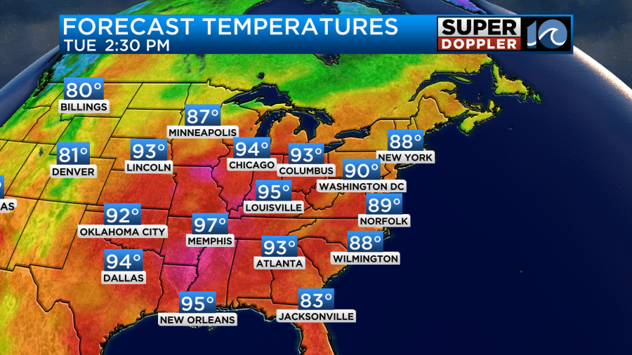
The heat index, however, will be in the low-mid 90s this afternoon.
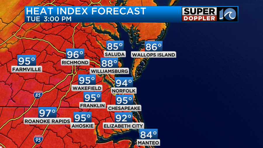
We have high pressure to our northeast. There is a subtle wind-shift boundary in the region.
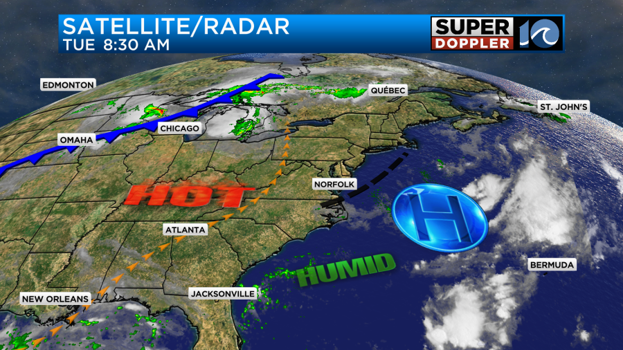
We had some spotty showers late last night and early this morning along the wind shift. They didn’t add up to anything in the rain gauge though. We do need some rain. We’ll have variable winds at 5-10mph today. Skies will be partly cloudy. There will only be a stray shower or storm this afternoon in the region.
Tomorrow the winds will resume out of the south/southwest. They won’t be strong, but they’ll help to push our high temperatures up into the mid 90s.
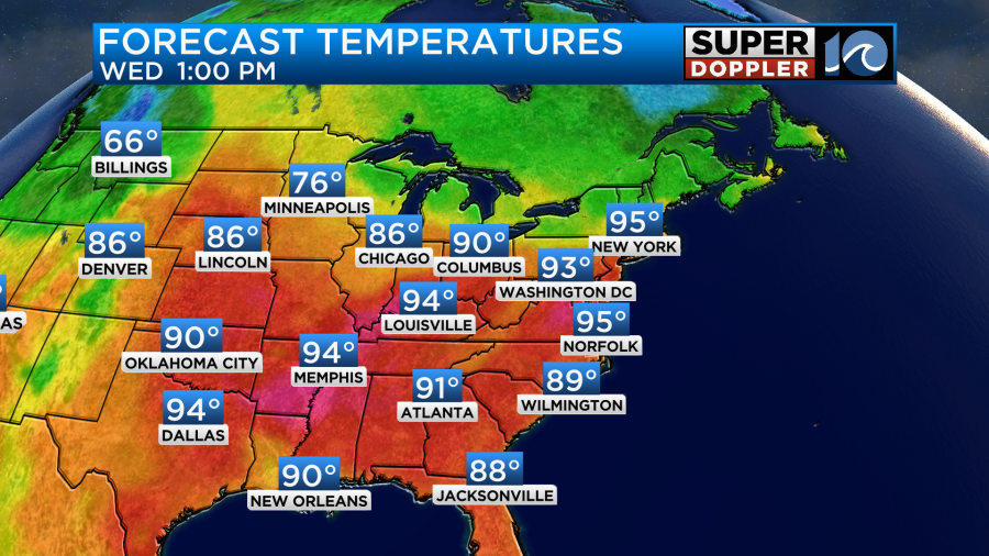
We’ll have mostly to partly sunny skies with hardly any rain in the area. The humidity will be up though. That will create a heat index over 100 degrees.
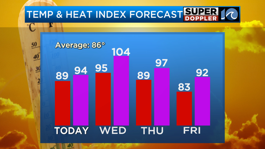
It’s possible that some Heat Advisories will be posted by the National Weather Service. Stay tuned. As you can see we won’t cool down much on Thursday. There will be some more clouds and also a few showers and storms. So hopefully, that keeps us more in the upper 80s to low 90s. The humidity will not drop though. Instead the dew points are going to rise a little more.
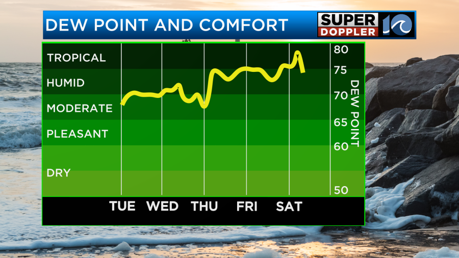
That is why the temperature on Thursday will be about the same as today, but the heat index will be higher. A cool front will settle over the region on Friday. It won’t pass to our south. Instead it will likely stall out over the area. So we’ll have more clouds with scattered showers and storms.
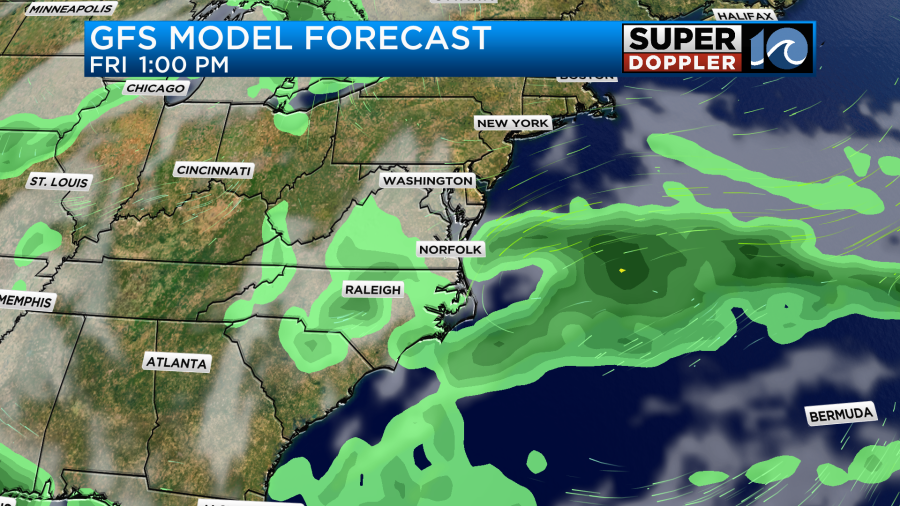
There will also be a north breeze. That should keep the high temps down in the low 80s. We’ll be in the 80s over the weekend. It doesn’t look like there will be much rain on Saturday and Sunday. Maybe a few showers and storms. However, the chance for rain does look higher next Monday for Labor Day. This as another front enters the area. I’ll have more on that in tomorrow’s weather blog.
Meanwhile, it’s still quiet in the tropics for now. However, hurricane Gilma in the Pacific will keep moving towards the Hawaiin islands over the next few days. This is after they just dealt with Hone.

Gilma should weaken before it gets there, but it could still be a tropical storm during that time. Check your travel plans if you are heading out that way for work or recreation.
Meteorologist: Jeremy Wheeler


