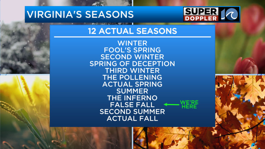
It’s that time of year again… Time for back to school (for most kids). We finally had some decent weather for the kids that returned today. It seems like the last few years there was either storms, extreme heat, or a tropical system to talk about. This morning the sun was shining brightly. We are coming off of a nice weekend. However, today we are going to transition from the nice “False Fall” conditions into the “2nd Summer” phase of the seasons.
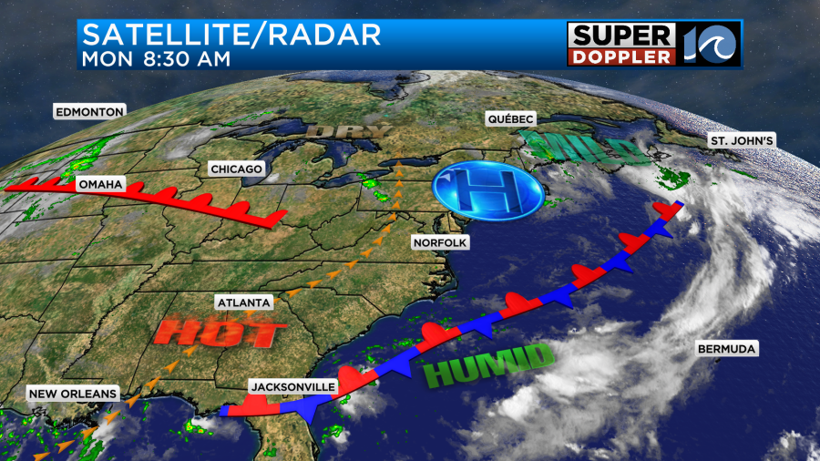
High pressure is to our north, but now it is a bit more to the northeast. This will allow the winds to start to turn more out of the south.
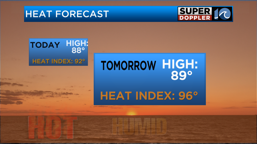
We’ll start to heat up today. Yesterday, high temps were near 80 degrees. We’ll be more in the upper 80s this afternoon.

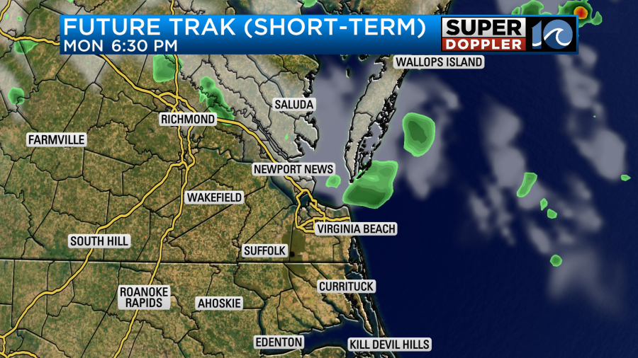
The dew points will be rising today too. They will go from the 50s and 60s to the 60s and 70s. The heat index will be near 90 or in the low 90s this afternoon. So basically, the party’s over. We won’t have much rain today. There will be some isolated showers or storms later this afternoon with a little higher chance for a few storms north of the metro. Then those few t’storms will drop south during the evening.
Tomorrow a small wind-shift boundary will be in the area. It will be very subtle, but it may kick off an isolated shower or storm. High temps will be in the upper 80s to near 90, but the heat index will be in the mid-upper 90s.
We’ll be partly cloudy through the day.
By Wednesday the real-feel of Summer will return with a vengeance. We’ll resume with the south winds, and we’ll be partly cloudy. The heat that has been residing to our west will slide east. So high temps will rise to the mid 90s.
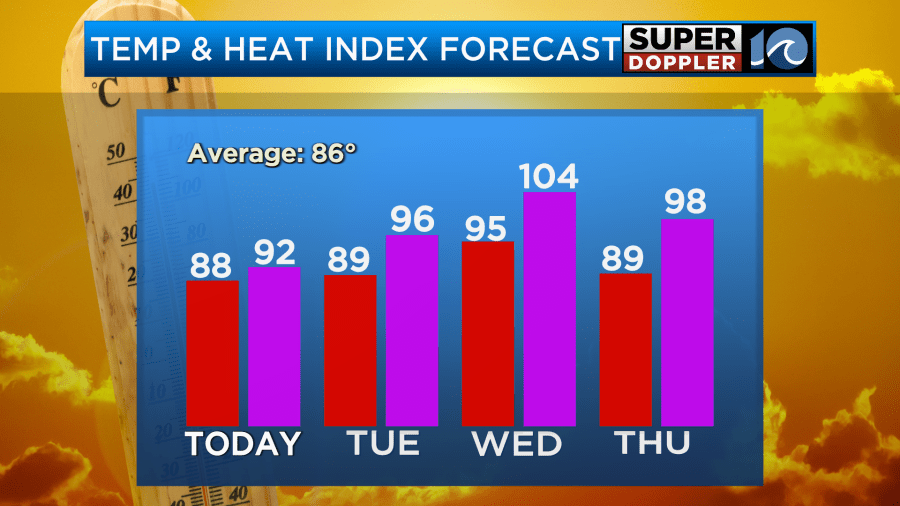
The heat index will be over 100, and it may be up close to 105. This may prompt some Heat Advisories for the region. This will impact after-school sports. For now I don’t see any rain on Wednesday. However, a cold front will be moving towards us on Thursday. That will likely prompt some scattered thunderstorms.
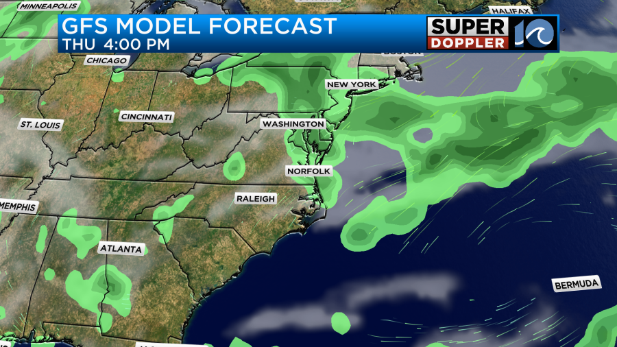
If the clouds and storms beef up enough then high temps will only be in the upper 80s. However, if the sun pops out for a while, then it may be in the 90s again. Either way, it will still be very humid.
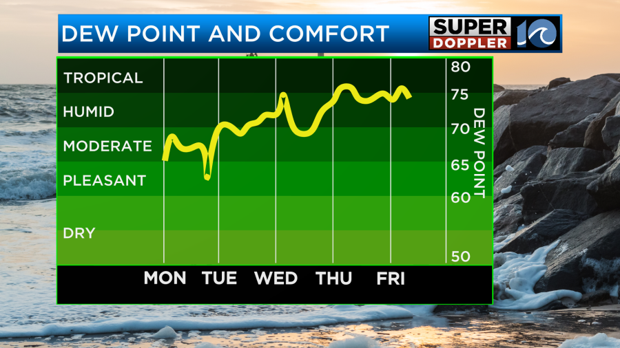
After that we should cool down quite a bit on Friday. I’ll talk more about that time-frame in tomorrow’s weather blog.
The Atlantic is still quiet. However, the big island of Hawaii just got slammed with rain and wind from hurricane Hone. Heavy rain from the storm did cause flooding on the island. Now the system is moving to the west. It is a tropical storm.
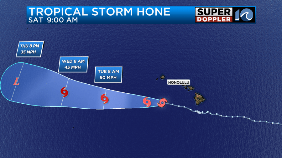
There is another system to the east (Gilma). This storm should stay north of the islands, and it should weaken too, but it may get close for a time.
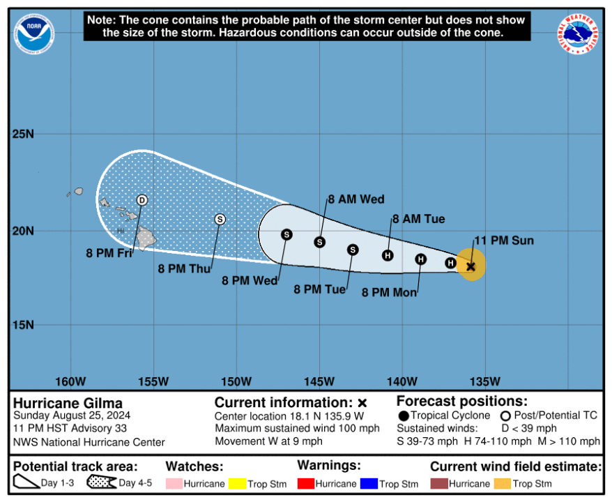
Hopefully, it doesn’t cause too many problems. We’ll monitor.
There was also some more bad weather (non-tropical flooding) recently over in the western U.S. Torrential downpours created major flooding near parts of the Grand Canyon. Unfortunately, the flooding was deadly.
In-contrast, we do really need some more rain around here. Hopefully, we get some this week.
Meteorologist: Jeremy Wheeler


