This morning hurricane Ernesto was steadily meandering its way north through the Atlantic. I could see an eye forming (or rather sharpening) on the enhanced satellite at times.
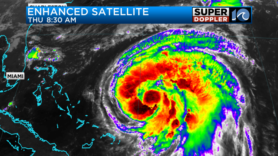
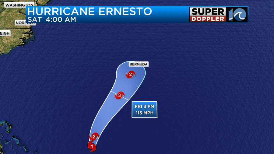
The hurricane was a high-end category 1 storm. It’s likely on the way to becoming a cat 2. Ernesto has had dry air wrapping into the southern part of the storm for a while. That has kept it from strengthening much over the last 2-3 days. however, in the last 12 hours the center of the storm has been solidifying, and it looks like that has started to block that dry air from reaching the core. The storm will keep moving over warm water in an area of low-moderate wind shear. So it is expected to become a category 3 by later tomorrow. It may weaken a bit as it moves towards the Bermuda region. It may not weaken. However, it is expected to pass very close to Bermuda late Friday into early Saturday morning.
The center of the storm may pass just a bit west of the island. However, the storm is forecast to become very large. Take a look at the European model’s wind forecast for Ernesto in a couple of days.
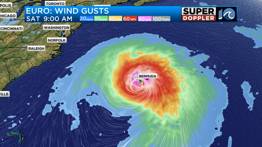
This means that Bermuda will likely get a high storm surge, strong damaging winds, and some heavy rain.
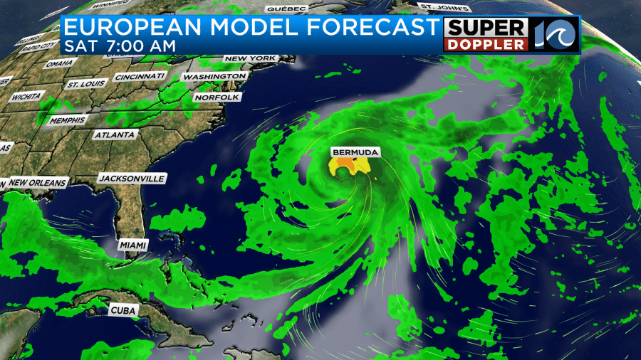
The waves out near the storm will probably run about 10-15 feet. Maybe up to 20 near the core.
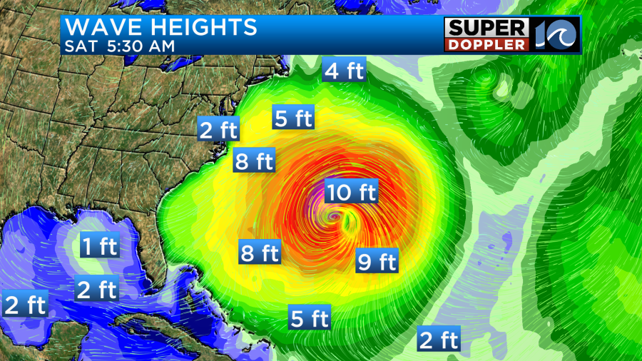
However, those waves will travel. By the time Saturday rolls around we may have waves of about 2-4 ft in Virginia Beach with some 4-6 ft waves over the Outer banks

This may be great for experienced surfers, but it probably won’t be good for swimmers. Here’s the latest rip current forecast.
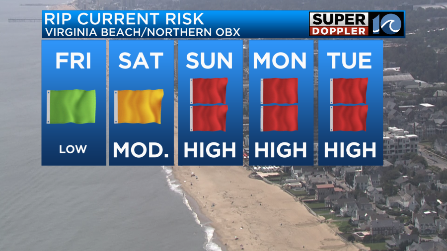
Along with the rip currents there may be some rough surf, overwash, and beach erosion. We may tweak this a bit before we get to the weekend. So check back for updates.
Locally, the weather is looking good again. We have high pressure to our north with a stationary front far to our south.
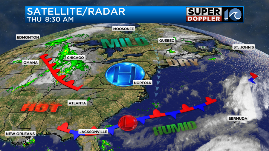
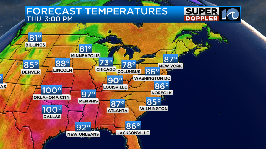
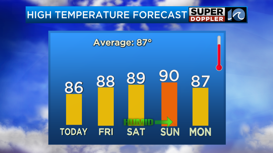
We’ll have a lot of sunshine today. High temps will run in the mid-upper 80s.
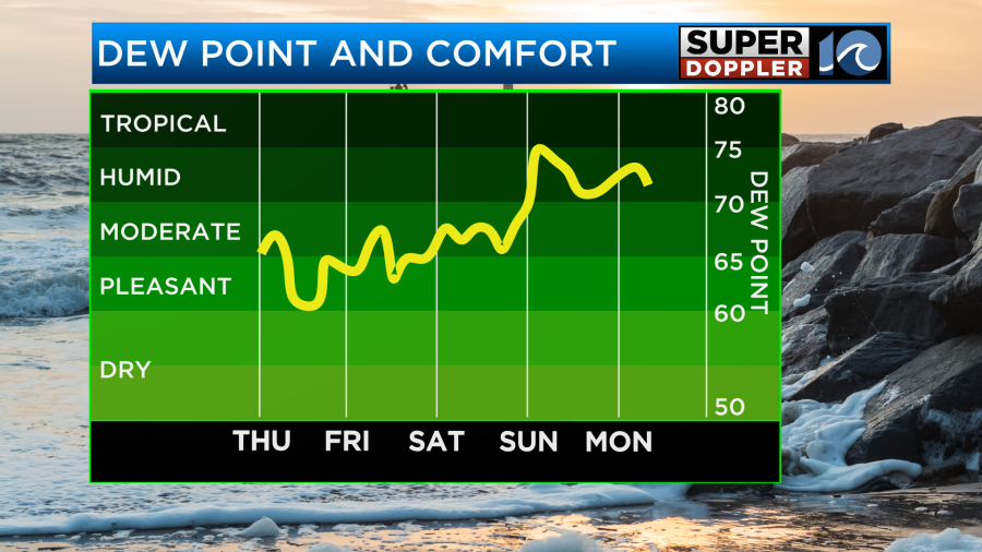
We still have moderate humidity in the region. At times the humidity has even been down to low levels. We’ll have a nice north breeze through the day.
Tomorrow we’ll be partly cloudy with highs in the upper 80s. The humidity will remain moderate. By Saturday temps and humidity will go up a bit, but not as much as it looked yesterday.
There will be a few showers Saturday morning.
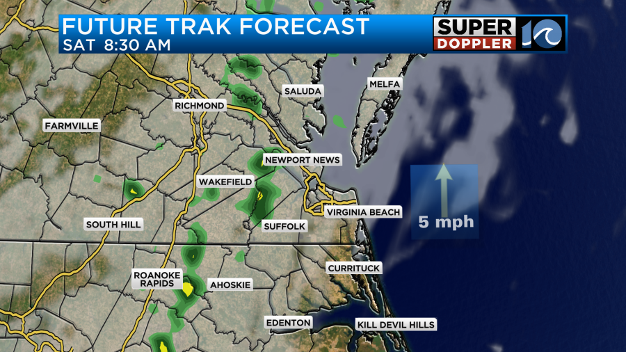
Then there should be a long stretch before a few more spotty showers try to form later in the day. By Sunday we’ll have more moisture and more clouds. So there will be a higher chance for scattered showers and a few storms. High temps will be near 90. This will be ahead of a cool front. The front will probably stall out on Monday. So we’ll only cool a couple of degrees. We’ll also have some more scattered showers. After that we should have some more milder and drier air for a couple of days.
Meteorologist: Jeremy Wheeler


